Trip Report – Blue Rocks Walk – June Long Weekend
Route – Great Dividing Range – Baal Bone Gap – Baal Bone Point – Pantoneys Crown – The Blue Rocks – Point Cameron – Wolgam/Capertee Divide – McLeans Gap – Great Dividing Range
Party – Rob, Dan, Sharon, Duncan, Disco Stu, Dave
Photos –
http://www.david-noble.net/bushwalking/BlueRocksJune2012/BlueRocks1.html
On Saturday morning we met in the Blackheath car park, and after coffee and snacks we set off for the Wolgan Road. Just past the Angus Place Colliery, we turned off and headed up the fire trail that climbs onto the divide. Just before the steep descent to Baal Bone Gap, we parked the cars and shouldered our packs. It was not too far to Baal Bone gap where we could fill up our water containers at the pressure reducing station. We were not the only ones there – a large part of 4WD’ers had turned up.
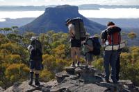
But we soon left them as we climbed up to the west and began the spectacular walk out to Baal Bone Point. Most of this walking is easy and fast – but we were slowed down by the numerous photographic opportunities. Nevertheless, we arrived at the point for lunch. Again we met a large group of people – this time day walkers – who had failed on their attempt to get to Pantoneys Crown. After lunch we descended off the point, crossed an open saddle and climbed up onto Pantoneys Crown.
We arrived at the nice southern campsite and found we had the place to ourselves. After setting up our camp, we again indulged in photographic pursuits. It had been a beautiful day which was capped off with a nice sunset. Back at camp, we kept ourselves warm next to a large fire. It was a very clear night – and before heading to bed – we did some star gazing from a nearby rock platform. It was an amazing night sky – the band of the milky way and the two Magallenic Clouds were very clear as well as a number of planets.
Some of us got up early on Sunday for the sunrise. Others slept in…. After breakfast, we packed up and headed off for the summit of the crown. There we signed the logbook and then wandered out to the northern end. The northern pass in no harder than the southern one (both easy scrambles) – but it is more convoluted. You nee to wander around a bit to find the linking ledges. Once down, we followed a fairly open ridge down to the creek near the Blue Rocks limestone outcrop. This ridge had an amazing forest of Cypress Pines. All the trees had very red coloured bark. Perhaps due to a fungus?
After lunch we headed up an open ridge to Point Cameron. As we walked it started raining. The rain was to continue throughout the afternoon and most of the night. A pass right on the point provides easy access to the plateau. Once on the plateau – we headed a short distance to a campsite and used a small cave nearby as a sheltered cooking spot. It was cosy and very convenient.
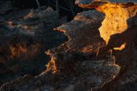
Monday started off a little wet – but most of the day was rain free. We headed off from camp and climbed up onto a series of large impressive domes. These are really interesting features. Then we dropped down a bit and explored a miniature canyon. After this was a nice walk through open woodlands to reach the Wolgan/Capertee divide. The section back to the cars is surely some of the most spectacular walking to be found anywhere in the Greater Blue Mountains. The views in all directions are impressive, but so are the closer things – the amazing twisted and contorted rock formations, the chasms that need to be crossed, the flanking cliffs, the many small cracks and canyons. A truly fascinating place.
We had lunch in a dry sheltered cave at McLeans Gap and signed the logbook. From there is was a short distance back to the cars and an easy, fast walk (except for one member of the party….) Back on the fire trail we met Fritz’s party who were driving out to regain one of the cars (they had done a car shuffle trip).
Thanks to all those who came on what was a great and very enjoyable walk.
Dave


