Date: 29/9/2019
Trip leader: Bruce Stafford
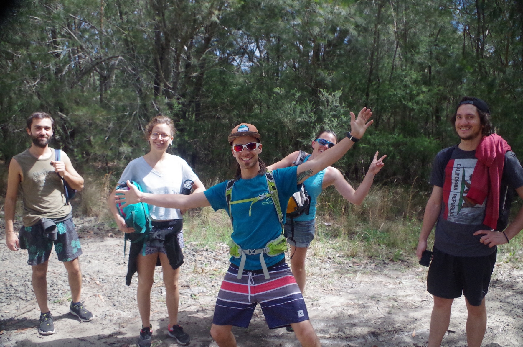
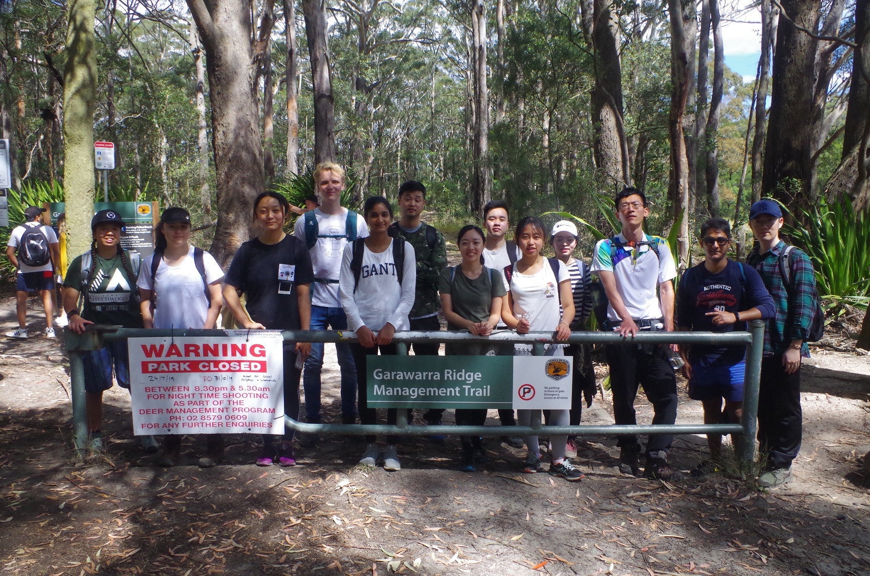
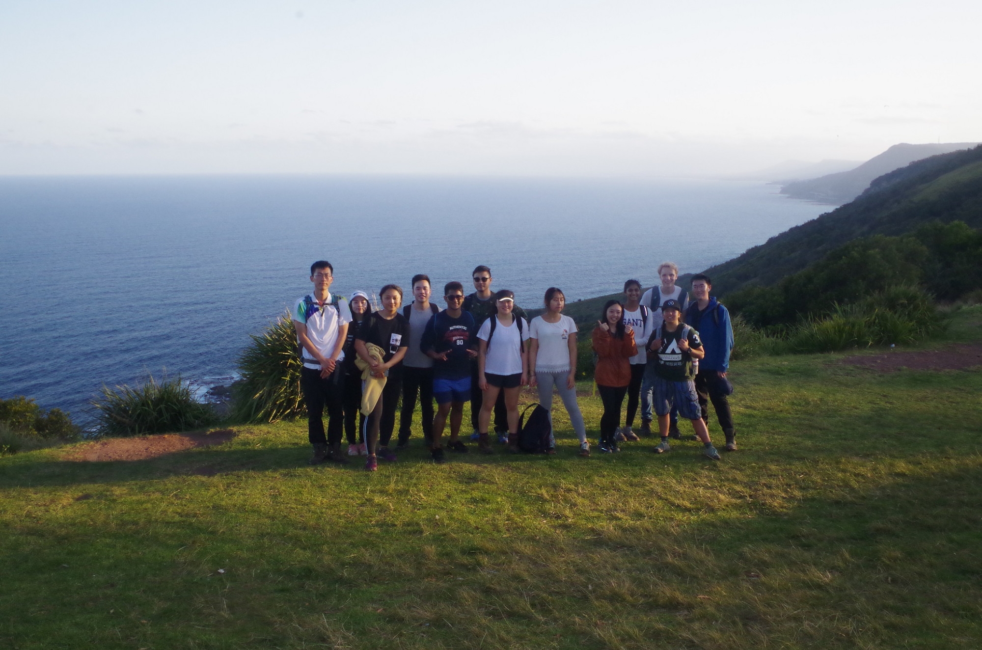
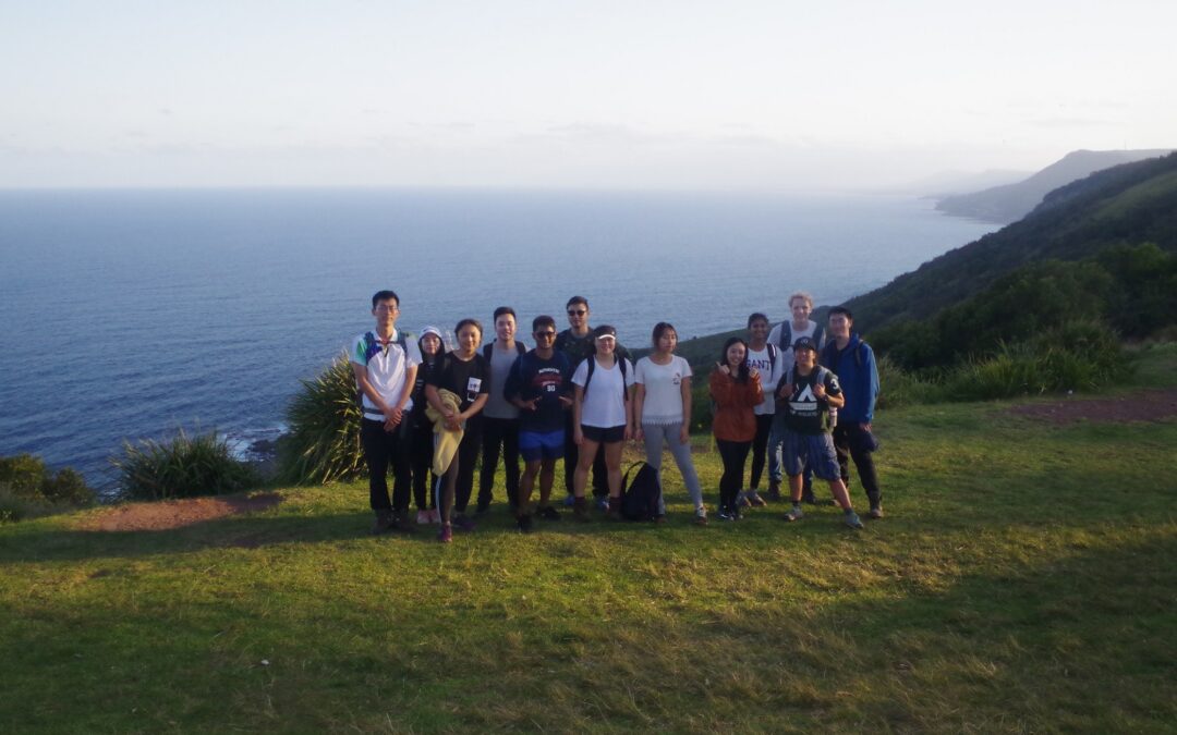
Party: Bruce (leading), Sohan Banik, Olivia Wang, Jiali Liu, Andy (Zeyu), Anna McRae, Tim Fung, Thiksana Yogaraja, Jia (Maggie) Zeng, Ricky Shi, Max Kiewiet, Ailsa Chung, Hollie Chung, Jacky Zheng.
Photos: by Bruce
After the walk set down for here on 31st August was cancelled due to rough seas, this was put on on the next available day for a low Spring tide at the right time on a weekend. Even then, it was originally set down for the previous day (28/9), but a sea swell of 2.3 metres again made it too unsafe to go to figure 8 Pool that day. The forecast for Sunday was for a sea swell of 1.3 metres, which is marginal but safe enough given the very low tide. It was also the first Sunday after the Spring Equinox,and I was reminded of the coming of summer with being “serenaded” the previous night by a Powerful Owl (Ninox strenua) calling out HOOT HOOT loudly in my yard.
16 had signed up, and on Sunday morning, most of us met up at Central station with a couple getting on at Redfern and Wolli Creek. One person missed the train due to bus issues apparently, and Bobbie mistakenly hopped on the Cronulla train by mistake (a few minutes ahead of our own train), and got out at Hurstville when he realised he was on the wrong train. He didn’t manage to get our Wollongong train so he also missed out.
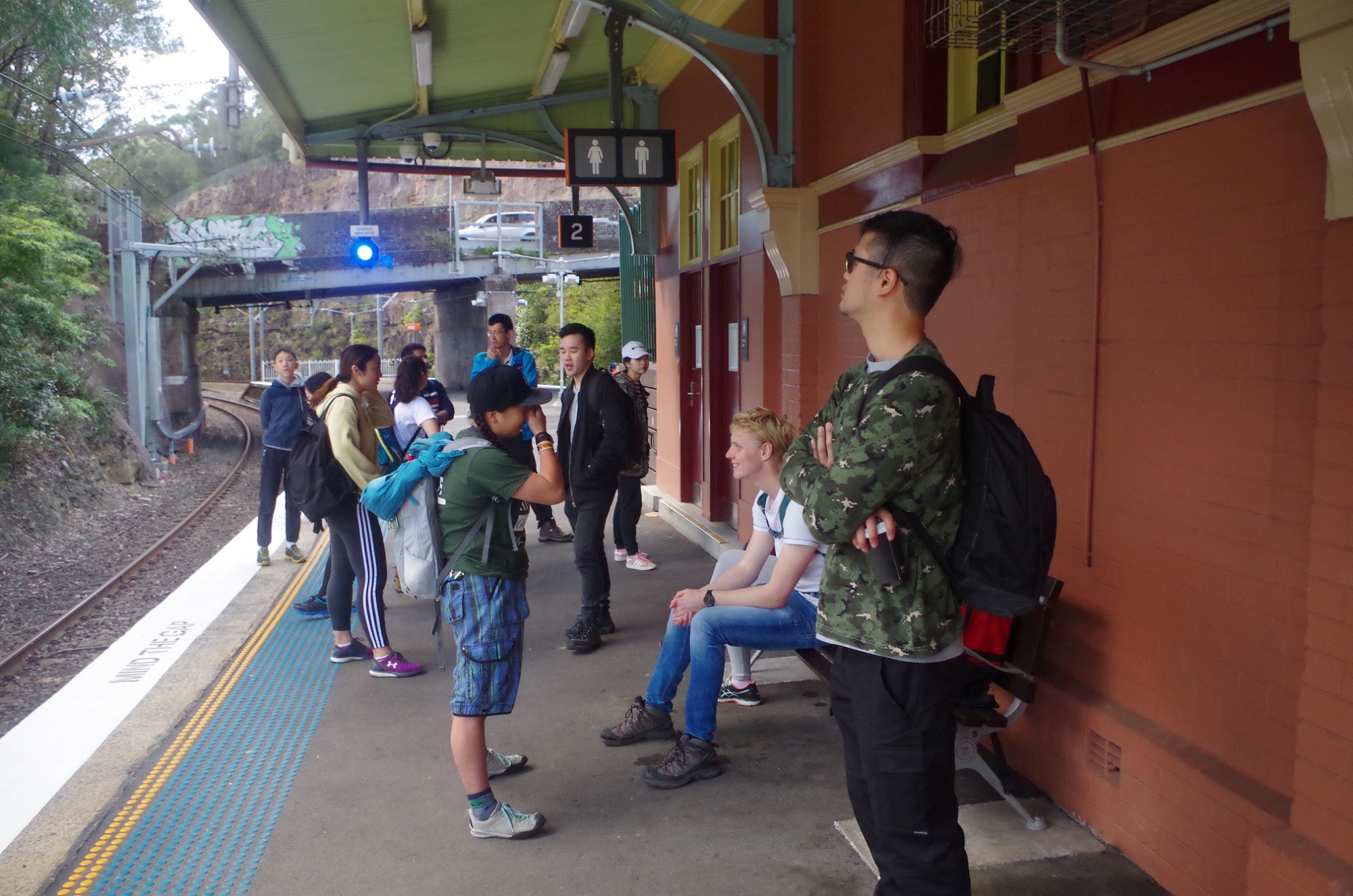
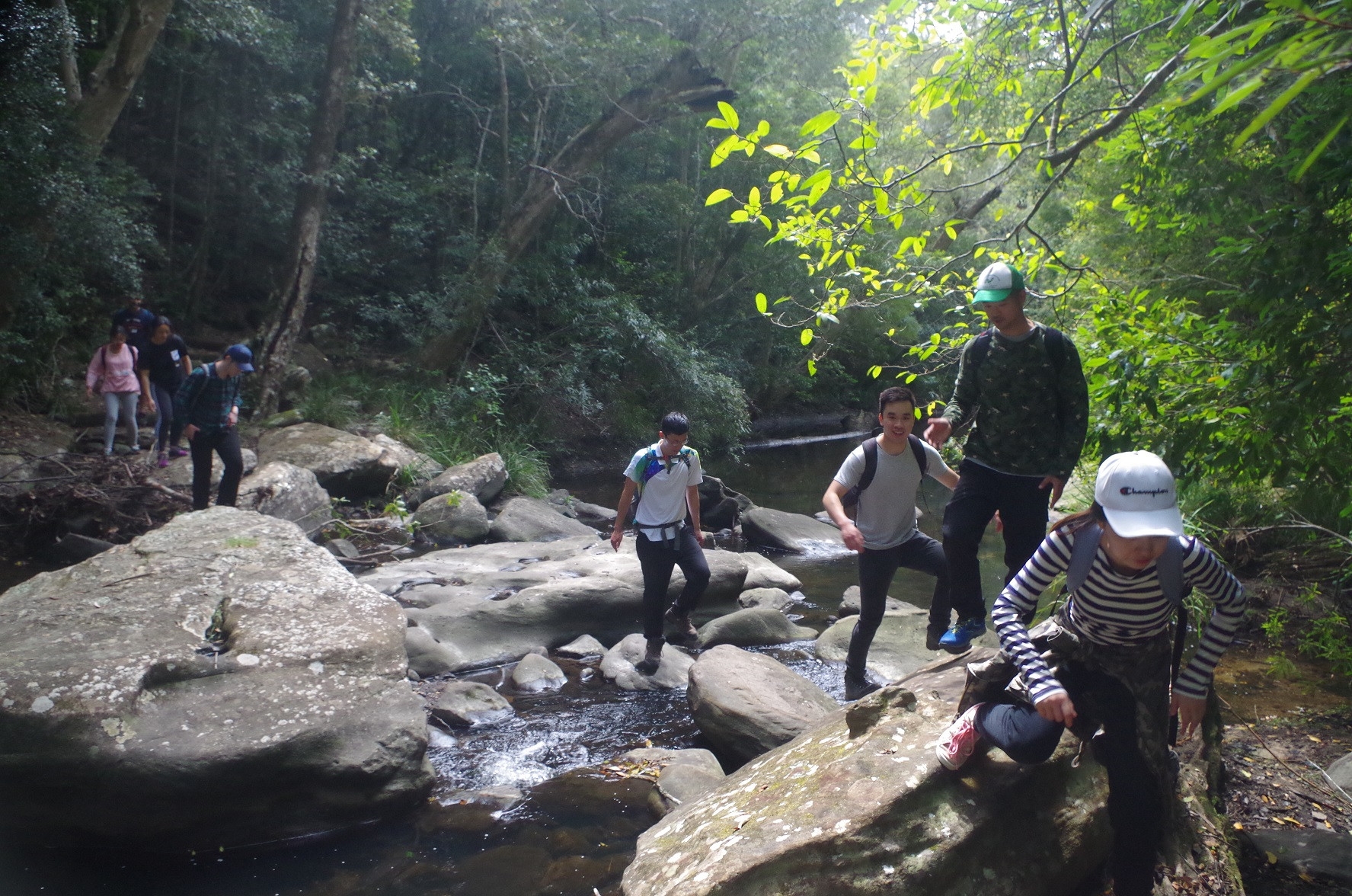
So 14 walkers all got out at Helensburgh and there was the inevitable queue for the station loos. While there I noticed a small group of six young people walking down Wilson’s Creek Road in the general direction of Cawley Tunnel and Cawley’s Creek Reserve, 2km away. I thought that a bit unusual, as those are not places noted for casual visitors. Anyway, we then headed off through the station carpark, and then up the steps to cross Wilson’s Creek Road to the start of the “track”. Just then the group of six that I had seen before came back along the road. I suspected that they were headed for Figure 8 Pool, and on talking to them that was confirmed. I’m not sure what guide map they were using but getting there from Helensburgh is not straightforward at all, as I will soon describe. They were in fact from Argentina, and I suggested that they follow along with us for a while until we can get them to the Burgh Track crossing of the Hacking River. From there on the track would be easy to follow by themselves. Back to the “track” start. It starts directly opposite the steps at Wilson’s Creek Road and is actually not part of the Burgh Track at all, but a shortcut used by locals and schoolkids to get to the station. It starts with two huge “steps” which require holding on to adjacent vegetation and the fence to get up. It rises quite steeply along the top of the railway cutting until reaching a wider track behind the houses on Gardiner Place. Ignoring a wider trail going left downhill (leads to a dead end at new Helensburgh Tunnel) we continued for a short distance until reaching a not very obvious track on the left, which after about 120 metres ends at the fence surrounding Helensburgh Tip. We followed this fence for some distance (noting repairs have been made to it recently) until reaching the “Hacking River Fire trail”. The fire trail continues level for a while until starting to go downhill as it descends into the valley of the Hacking River. It goes through woodland and Cabbage Tree palms until reaching the side track which is the real start of the Burgh Track. It is marked by just an NPWS arrow, and easily missed if you are inattentive and not looking out. On the way we were passed by two 4WD vehicles (they are legal in this trail).
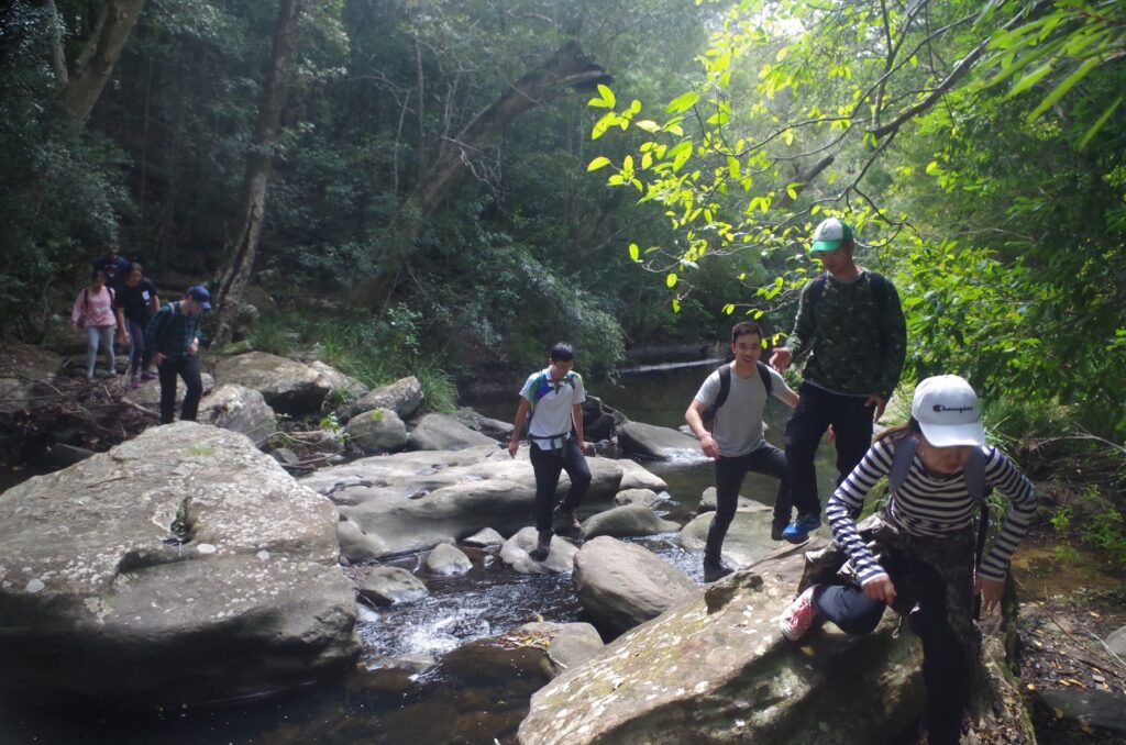
We had a water break here and also stopped the girls of the Argentine group going further along the fire trail, telling them that this was the turnoff. They waited there getting their male companions on their mobile phones to come back (they had got ahead out of sight). We then continued on down to where the track crosses the Hacking River. After the long run of dry weather, and despite recent rains here, the river was low and was easy to cross (in normal weather it can be more difficult). The track continued to Lady Wakehurst Drive, which we crossed and then the uphill slog started. The track goes uphill on a fairly steep gradient and we continued on until reaching near the top where we stopped for a needed water break and short morning tea stop. At this point the Argentine group came up the track, and after giving brief instructions to them about the rest of the track, we said “hasta la vista” to them and they continued on ahead of us.
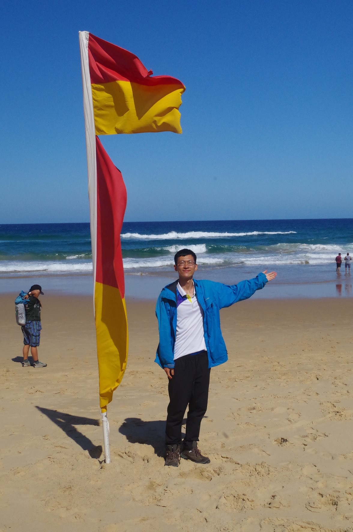
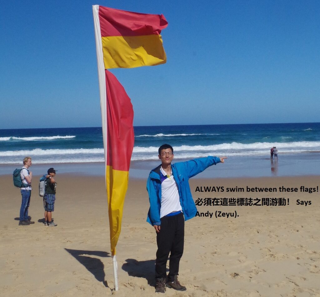
After our break we continued on and eventually reached the Garawarra Farm carpark, which was almost full. Form here the Burgh track goes steadily down the hill, and the first part is now being paved with a boardwalk to stop the accelerated erosion with all the visitors to Figure 8 Pool (more on that later). After dropping down through open woodland on a badly eroded track, it reaches the open section and boardwalk with views over Burning Palms Beach. We didn’t stop too long at the viewpoints as we were pestered by that other harbinger of summer: flies. So down to the beach were we found a spot with both some shade, and still in the breeze to blow away any annoying flies. The lifesavers were on patrol this day (as they will be on every Sunday for a while). The red and yellow flags were up, and I asked several of the international students what they were for. Many had no idea, which is a concern (what do they get told at their international student orientation sessions?). I explained that it marked the section of the beach where it is safe to swim. Andy (Zeyu) observed that today at Burning Palms it was quite a narrow section, and this is because there are three locations there where dangerous rips are common.
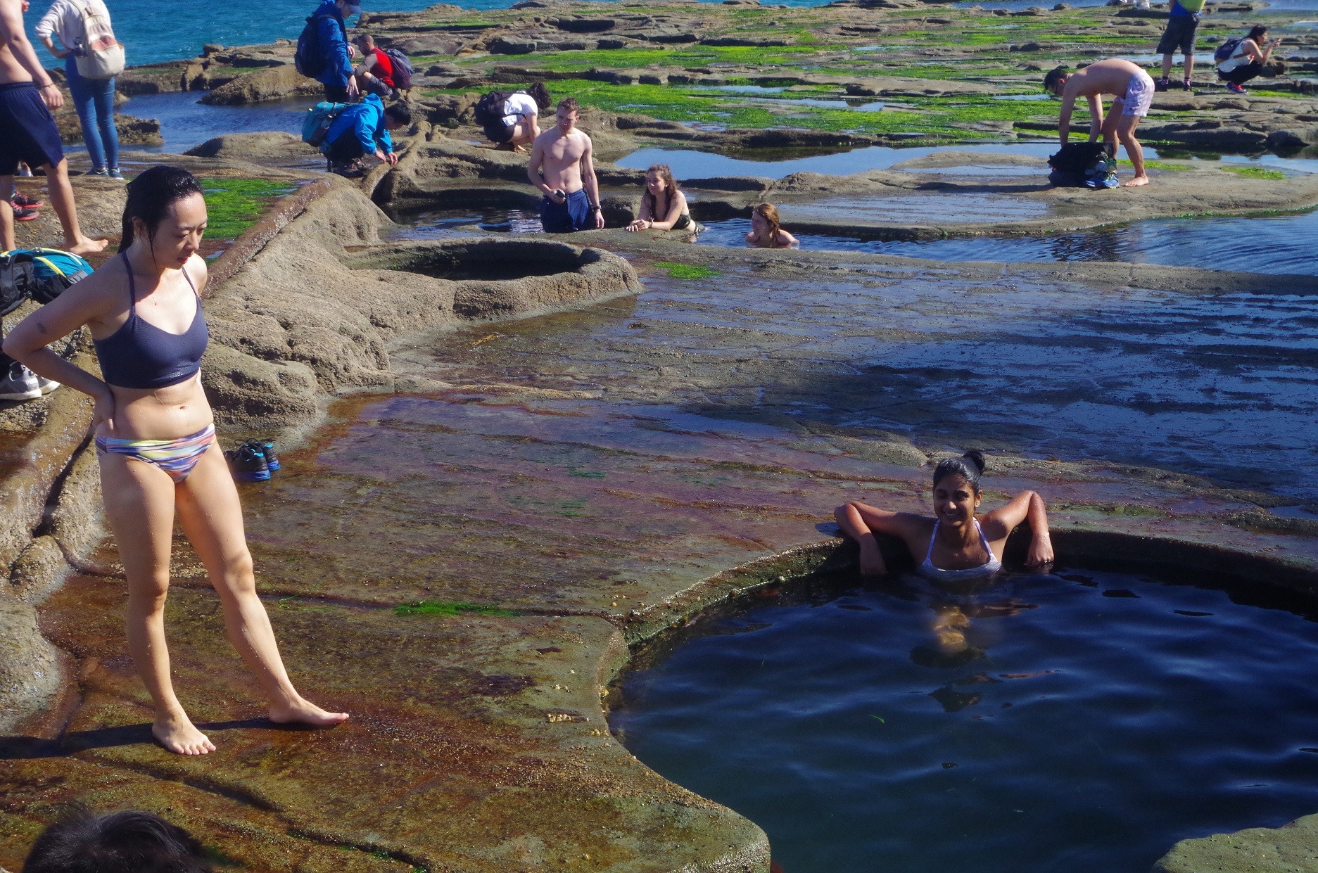
After lunch we head off for Figure 8 Pool, One and a quarter km and 30 minutes further south. There is no track there as such, you just do boulder hopping and walking along the two rock platforms. Here one person learnt why you should not carry things in your hand while on bushwalks (in this case carrying her sandwiches). She tripped and had a mild graze to a finger. This was attended to with help of her own first aid kit, and then we continued on. We passed under the first headland, which is a tricky traverse on rocks which look firm but have slippery green algae on them (rule: if a rock looks dark and damp it is probably slippery). The heavy seas and high tide of the previous day had also made this section damp as well. There is a harder by-pass just a bit higher which avoids waves, but I think that if you have to use this then it’s almost certainly going to be unsafe at Figure 8 Pool itself.

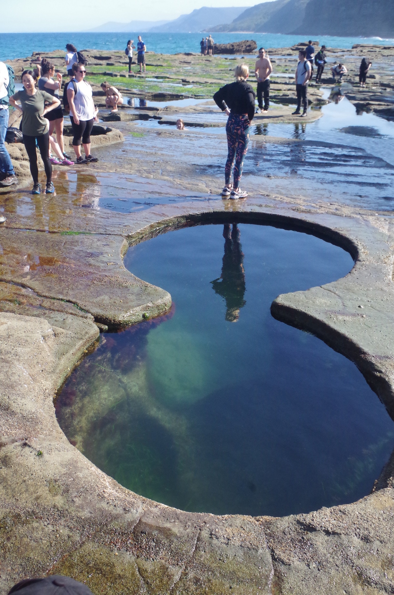
Eventually we reached Figure 8 Pool with its usual crowd of tourists, but thankfully none smoking or playing loud music. We arrived right at low tide at 2.30pm. After having a look at the Pool, two of our girls went in to get some luck. After half an our there I said we would have to go back to the beach and be on our way to Otford. This elicited complaints about why we couldn’t stay longer. There were two reasons, the first was we needed to get the 5.15pm train from Otford; miss that and the next one is 7.15pm. The other more immediate reason was that the tide was now starting to rise again, and a very low tide is always followed by a very high tide. Stay another hour and the tide height would already be halfway back to mid-tide. Already there were waves breaking over the rocks at the seaward side. More about that later.
So we returned back to the beach, with the aforementioned fall girl having another fall (she didn’t want her name mentioned) with another near-fall saved by Ailsa holding her. Also, at the pass below that tricky first headland, where the slippery rocks were, Sohan slipped and ended up with a damp behind, nothing worse fortunately. Could have been much worse though; he could have ended up in the sea below. He thought his shoes were not gripping enough, but even the best hiking boots will have no grip on such a surface. I found that my shoes also wouldn’t grip there, but I had hold of the ledge also so didn’t slip.
So we got back to the south end of the beach and went up the quite rough but short track to reach the Coast Track to continue on our way to Otford. There was a short break to have some water for the steep climb to come, and a few of our group discovered the joys of a bush toilet (there are no facilities – dunnies [U.S. English: “bathrooms”] at Burning Palms). I also got a text from Ricky asking where we were, which I thought was odd as I could see him right there. It turned out that he had sent it 2 hours earlier at the beach lunch spot when he had mislaid us, but due to no phone signal there I didn’t receive until 2 hours later! (And that reminds me, there are several places on this walk where the mobile phone signal is weak or non-existent, so be warned!).
From there we followed the Coast Track back to Otford Lookout, enjoying the coastal views along the way and the passage through Palm Jungle. After a short stop at the lookout we were on our way to Otford Station. The short path down Beaumont Road is the steepest part of the whole walk, and the endless procession of tourists to Figure 8 from there has loosened gravel on the path making it a possible slip hazard. Some of the group got worried that we would not make it to the train as it was due in 5 minutes; Otford Station is in a deep cutting and can’t be seen until you are right next to it. I was quite confident we would get there in time and we did with some minutes to spare. There were a lot of people waiting on Otford platform and we ended up crowding into the already full 4 car train when it arrived. We got back to Central 10 minutes late at 6.30pm.
This was an enjoyable day for all to a popular spot. I wanted to take the international students there under reasonably safe conditions. Because we normally go in good conditions so people might think that Figure 8 Pool is like this all the time. It most definitely is not! The NPWS has a website to check Figure 8 Pool conditions: https://www.nationalparks.nsw.gov.au/things-to-do/lookouts/figure-eight-pools
Just because you see tourists headed for Figure 8 Pool doesn’t mean it will be safe. Many tourists don’t check tide tables or sea conditions, and some don’t even know what a tide is. Also, don’t attempt walking there from Helensburgh unless you are very confident you know the correct track.
Sydney people have known about Figure 8 pool for over 120 years but considered it as just another interesting rock pool. Many of us just can’t understand the fascination it holds, and why we consider it as something to look at for maybe 30 minutes, then move on. The old track to Burning Palms from Otford was eroded down to shoulder level (now replaced by the boardwalk) but it took 120 years for that to happen! A high level of erosion on the track down from Garawarra car park has taken less than 10 years because of the sudden popularity of Figure 8 on Instagram!
A sample of photos is below, but many more on the link to my photos: https://www.flickr.com/photos/brstafford/albums/72157711112713057 The last two are by Hollie Chung.
Bruce Stafford.