Date: 1-5/5/2024
Trip leader: Jimmy
Party: Terry, Sherman
Jimmy had a few days off from uni and thought it would be a cool idea to do a weekday camping trip. In early May the bushwalking season for Jagungul is edging towards its end, about to step into snowy winter, but forecasts weeks ahead look alright and we’ve decided to give it a go. Also on the trip was Sherman, working freelance, and Terry who skipped a few uni classes, all having fairly legitimate reasons to be available for a long weekday trip. Preparation was straightforward with me spending almost $100 shopping in Coles, finishing my assignments, sending a few emails, and then starting to pack at midnight right before the trip, digging up all the camping stuff from my cupboards. It was after midnight when I finished packing and realised I hadn’t had dinner, headed down to King’s St for a halal snack pack (the kebab place opens till 4am), then trying to fall asleep with a full stomach.
On the first day, we spent almost a full day driving down to Cooma and then to Three Miles Dam Campground. Crawling through suburban streets in Bankstown before hitting the Hume Highway, stopping by the well-known airport-styled servo at Pheasants Nest, before continuing down to Canberra cruising by Lake George. It continued with a fairly scenic drive down Monaro Hwy to Cooma, across rolling fields and smooth landscapes, before slowly gaining elevation on Snowy Mtns Hwy.

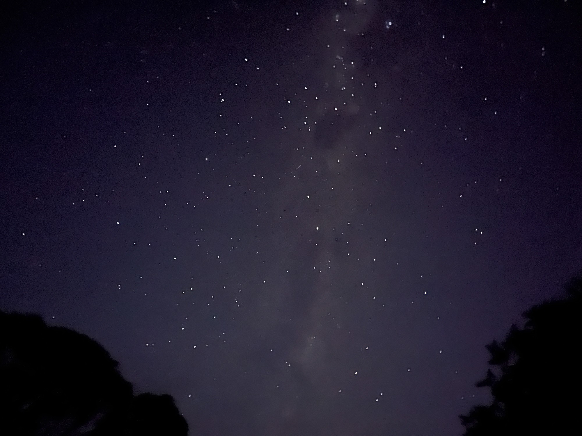
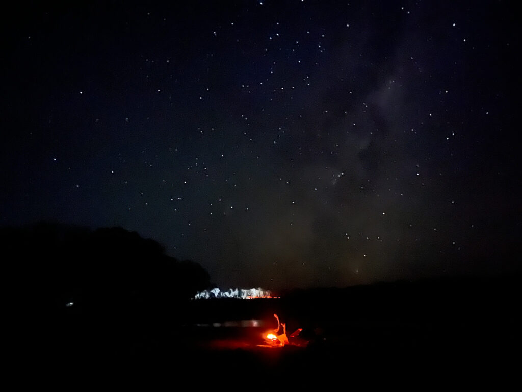
Passing Adaminaby yellow road markings soon replaced the usual white ones, being more visible in case of snow. The sun sets while we drive towards the campground, ruining plans for one with the comfort of our tents. Old tradie picks up cones at a roadwork site while instructing us to run a red light, being excited to go home after a long day of work. As we approach the campground an aerial view of the rivers and lakes emerge on the side of the highway, showcasing the unspoilt landscape of the area. Soon we turned off the highway, drove to the campground and set up our tents for the night. The steaks we got from Coles Cooma were still sitting in good condition without refrigeration. The fire pit was soon set up and steaks were grilled right on it, with the Milky Way in the backdrop. The first Milky Way of the year for me, being stuck in Sydney and its surrounds for most of the year.
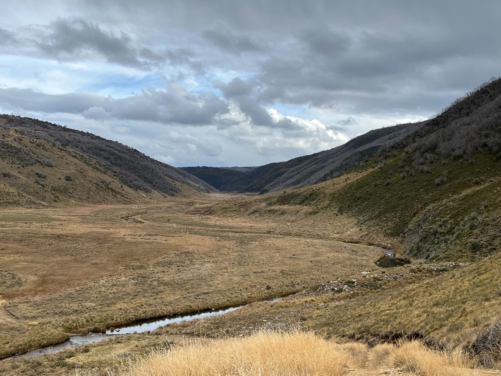
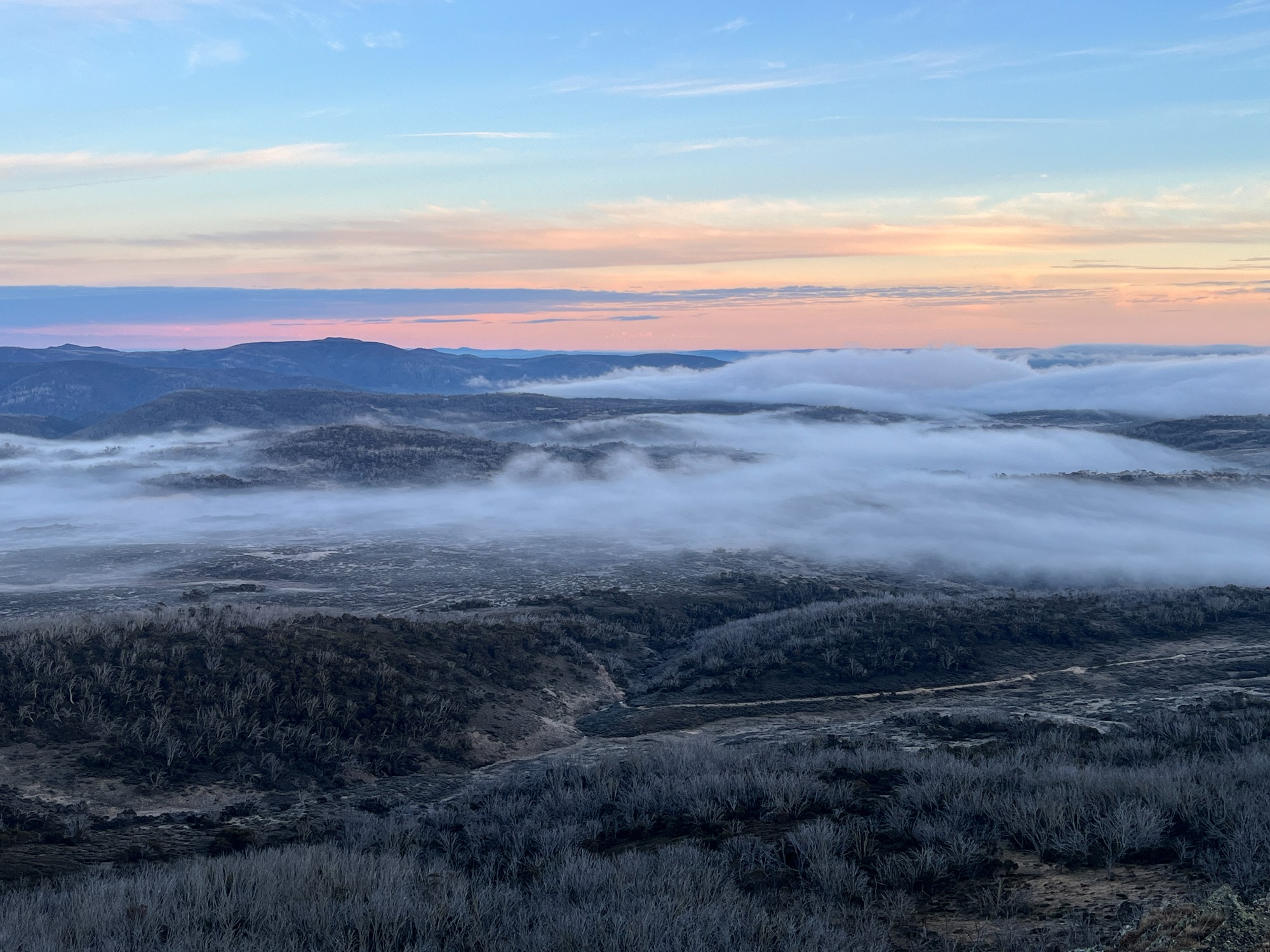
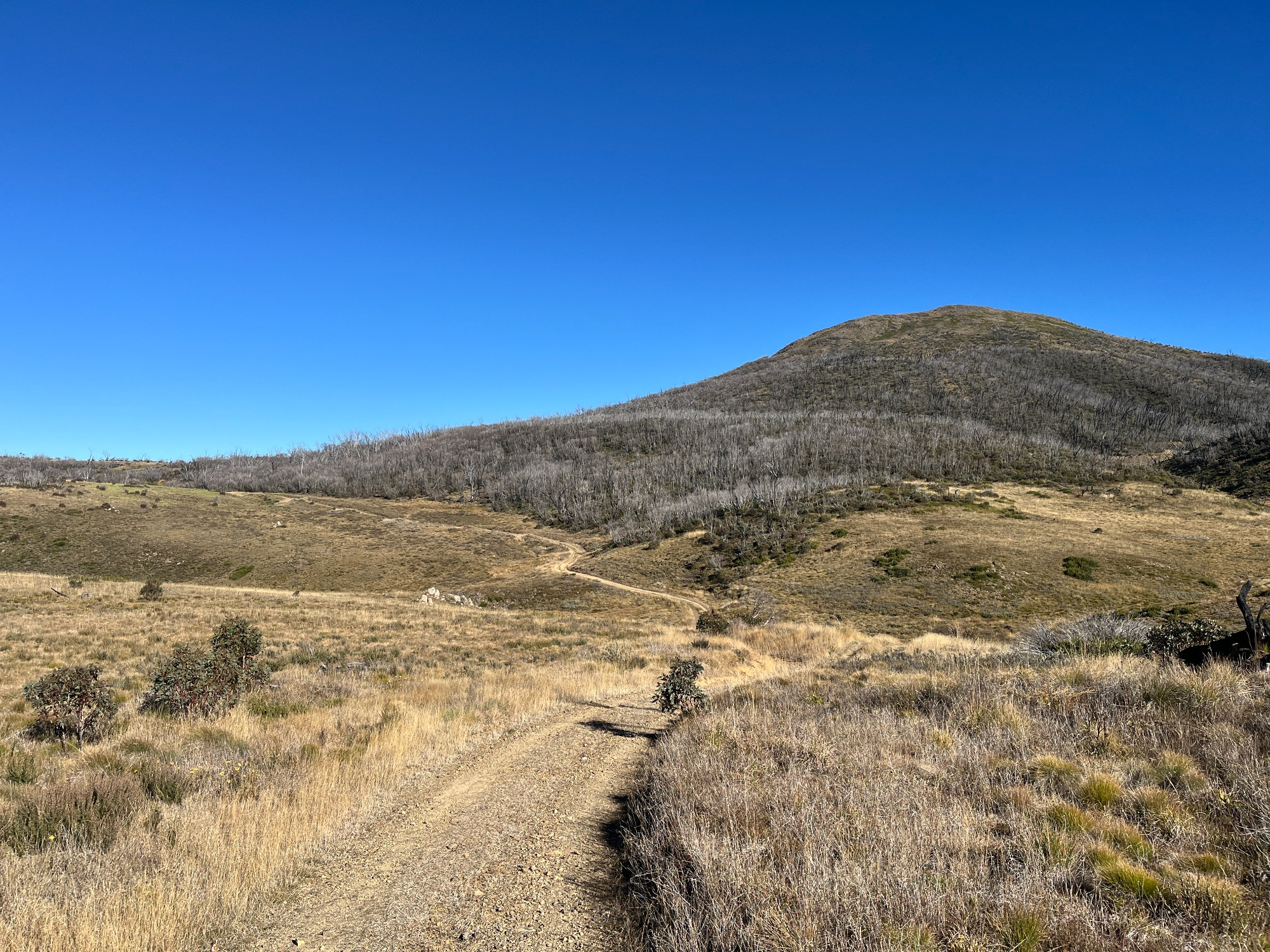
Morning fog was seen from our campground as we woke up the next day. Wasn’t too cold yet my half-empty gas canister frosted up while it burns. Simple breakfast was made before packing up the mess we made last night, seeing a few ponies across the road, and the 2-hour drive to Round Mountain trailhead started. The road passes through a few power stations built for Snowy Hydro project, and Cabramurra which sounds oddly similar to Cabramatta in Western Sydney. The road descends down to a reservoir, crosses a dam, then heads back up towards the trailhead. Sherman pops his camera out for his vlogging as we pack up in the carpark. The logbook was then filled at the start of the trail and we headed off with full camping gear for a 20km day towards Mt Jagungul. Fire trail walking was straightforward with Round Mountain on one side, and distant Mt Jagungul on the other.
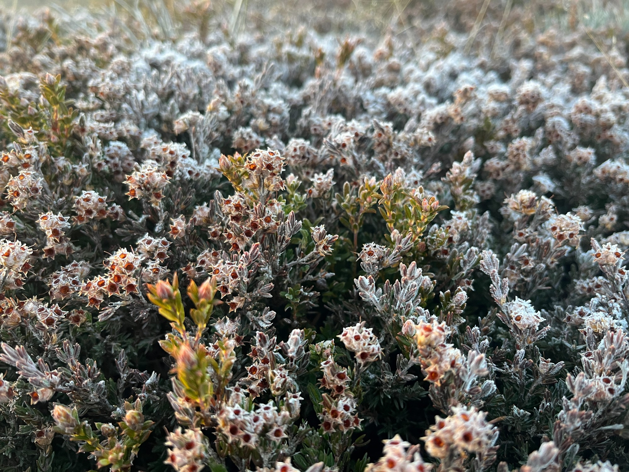
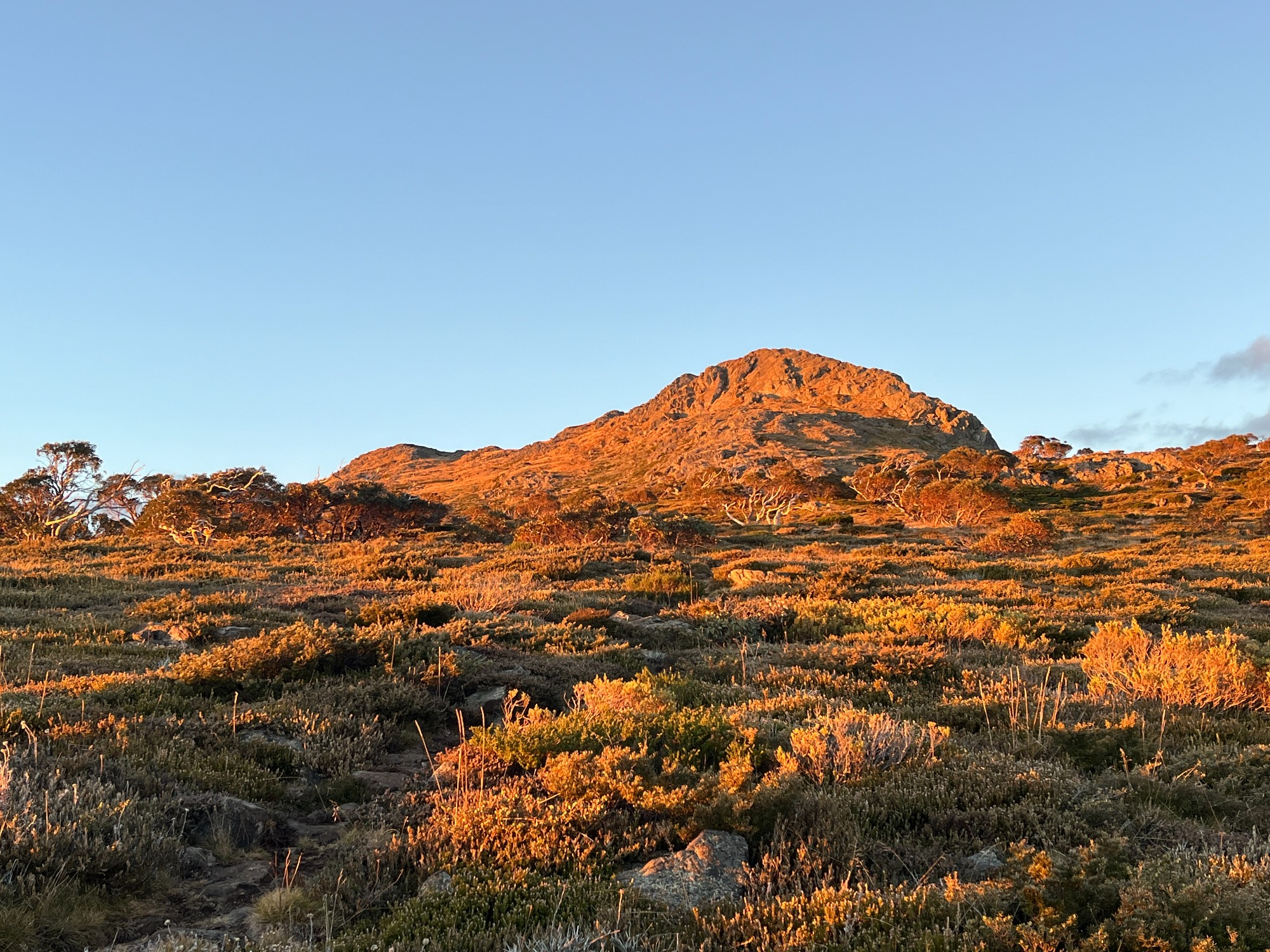
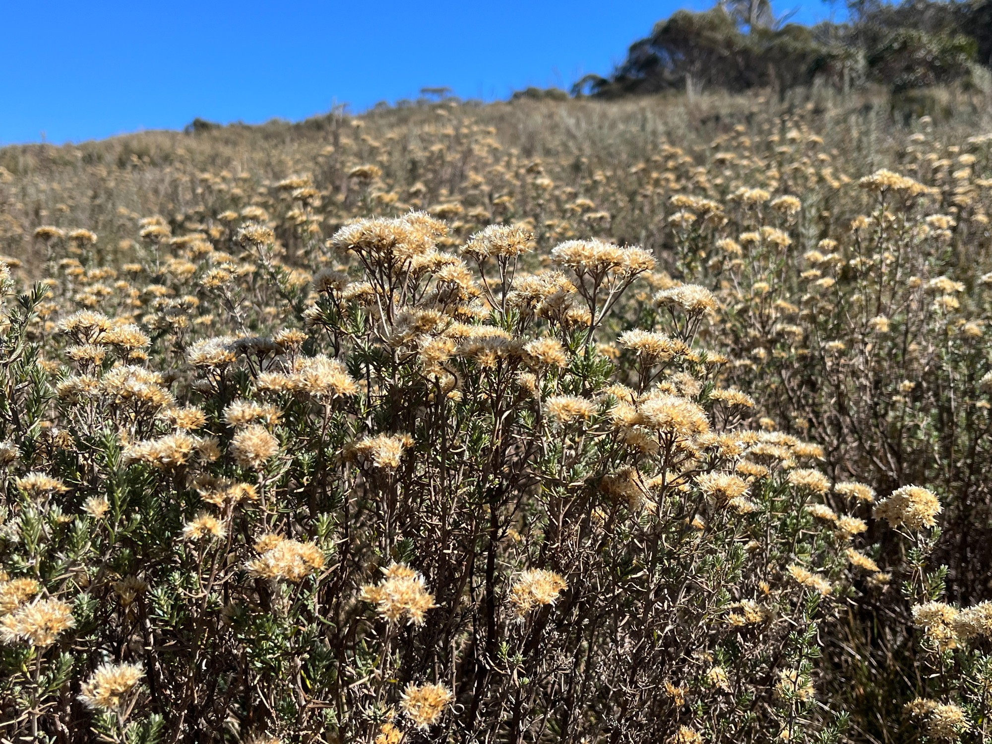
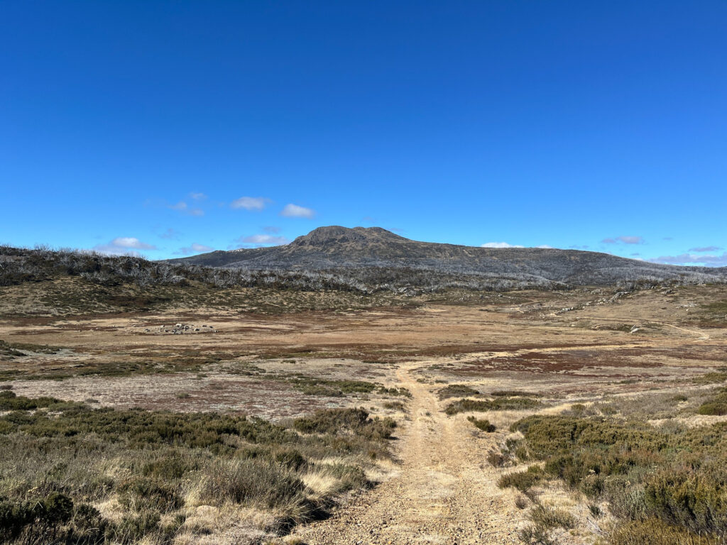
Snow gums, alpine flora, all marking their presence in the alpine region. The fire trail continues with a few uphills and downhills, followed by multiple creek crossings. Soon we reach a basin at the base of Mt Jagungul, being fairly swamp-like with waterlogged soil. The landscape feels partly like Scotland with round mountains lacking vegetation on top, looking a bit like a bald man’s hill, and moorlands all over the place. Mt Jagungul, with its irregular and rugged peak, stands out amongst all those round-shaped hills. The shape changes slightly depending on which angle you see it, in this instance slightly resembles a lion. It reminds me of Lion Rock in Hong Kong, where its name came from the lion-shaped peak, being part of the cityscape and backdrop of everyday life.
Shortly after was Derschkos hut, roughly at the base of Jagungul. A few mountain bikers were about to leave while we were ready to claim the area as our own. “This is really great…what’s the Aboriginal word for land? Ah, country”, one of them said as we chatted on the perfect weather we’ve got, much different from rainy Sydney. Inside of the hut is fairly simple with a few maps of the area and most importantly, the logbook. There tends to be a tradition of people of people writing random stories on these books and I thought it might be a good idea to come up with one. Thursday mornings are the usual time for my tutorial on the Aboriginal unit. While the tutorial is pointless and boring I still maintain a fairly consistent attendance, mostly to socialise with my classmates and having someone to share jokes with. Being 700km away from the tutorial classroom meant I couldn’t attend it that week and that’s a significant event worth documenting. And therefore I started writing:
“Skipped my HSBH3001 Indigenous tute to be here in great country. Mt Jagungul- impressive on all angles. Does look remotely similar to Lion Rock in Hong Kong (reduced version here in Aus, Lol). As a HongKonger the Lion Rock forms a part of our connection to home and I’m sure the same connection can be felt here.”
My friend in Hong Kong lives right underneath Lion Rock and seeing it every day builds a special connection. The rock changes shape every day, being high above all inhabitants, exerting dominance yet lonely on its inside. Clouds obscure it, fade away, and the cycle repeats. Perhaps that’s why bushwalking remained intriguing and an inherent part of our lives- nature itself is neutral. Interpretation evolves through various life events yet its significance remains unchanged. From a study machine to pursuing a free mind, the lion stands as a beacon and a place for comfort. Mt Jagungul continues to stand as it is, ready to take in our random thoughts and unpopular opinions.

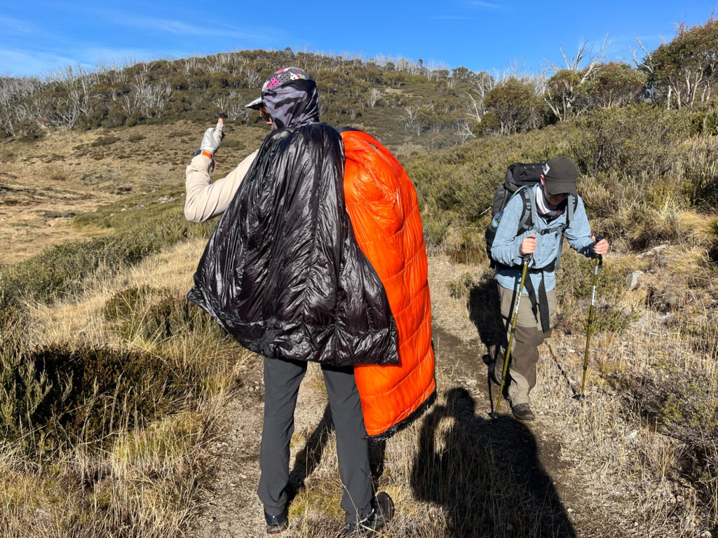
Feasting on the final water source right before our climb to Mt Jagungul. Vegetation gets dense on the way up yet a path is clearly tracable. Sherman led the way while Jimmy and I slowly followed, hauling our heavy packs uphill. With his ultralight pack and gear Sherman was fully in the cult of ultralight camping, being extra conscious of how every piece of gear weighs. My gear consists of more conventional items and full ingredients for every meal. On the way, we also had a conversation on our regular daily routine. Some have going to the gym as one while I proudly live on possibly the most unhealthy lifestyle of the entire club, feasting on KFC meals and seeing the nature as gym replacements.
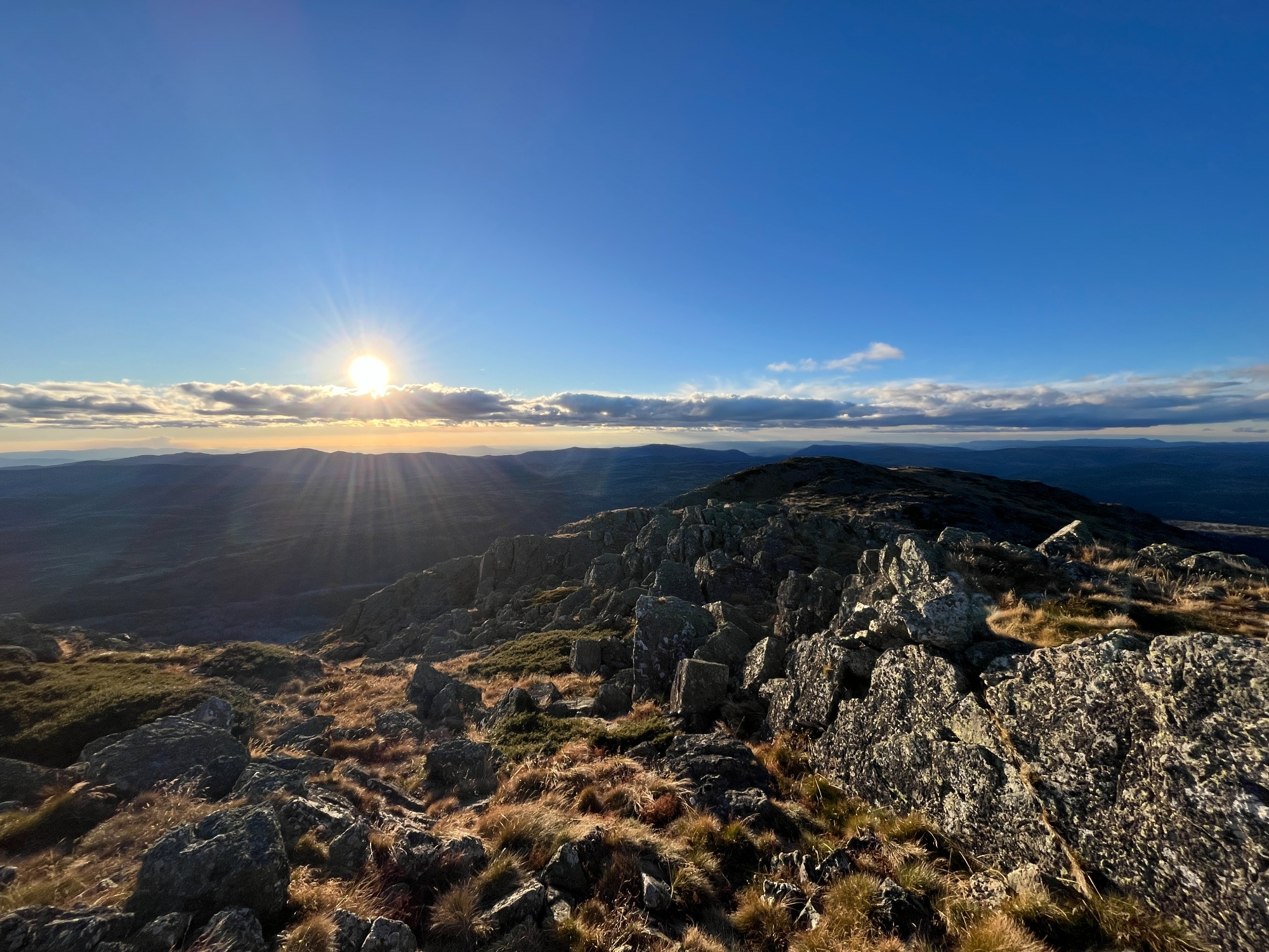
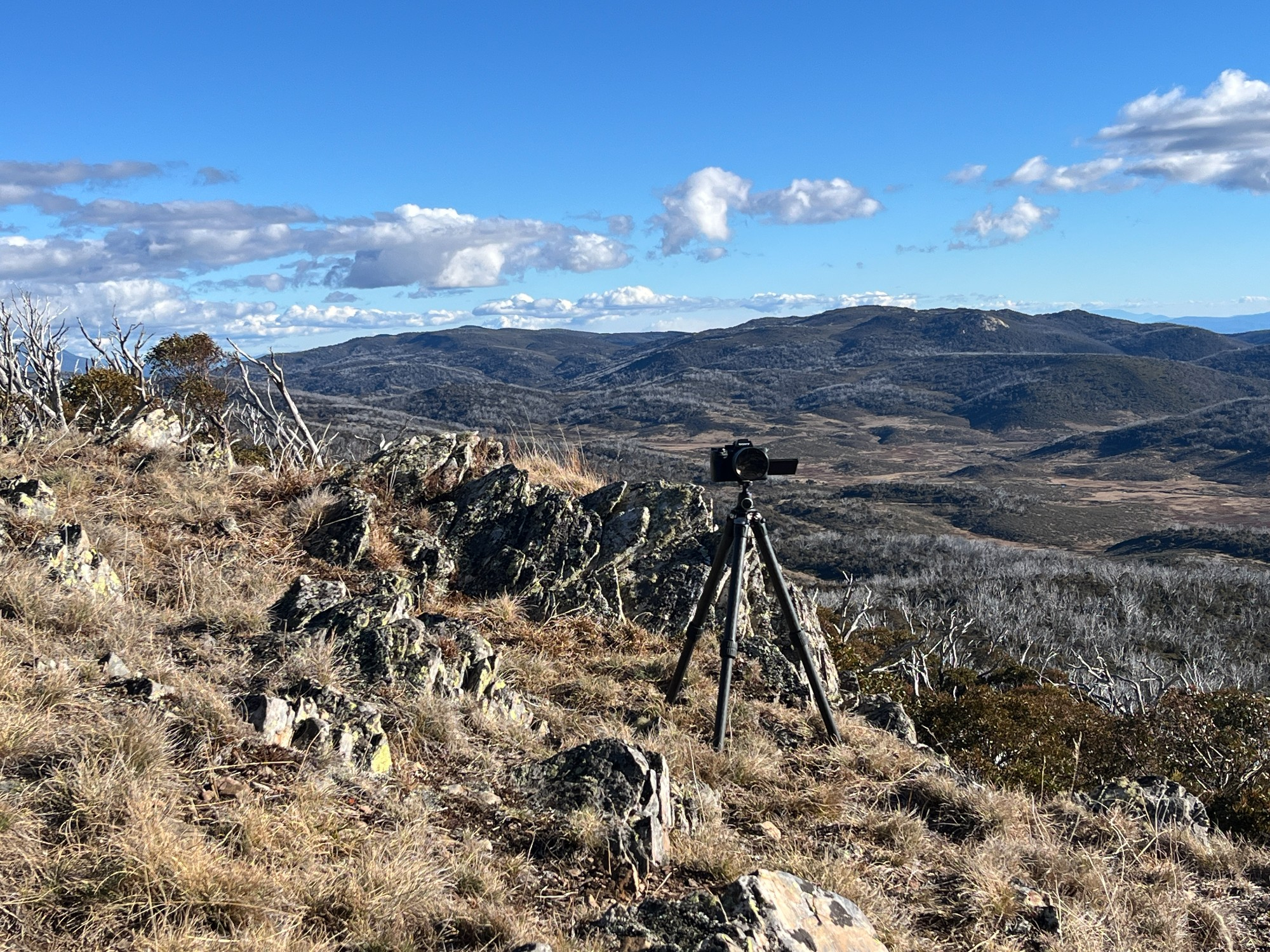
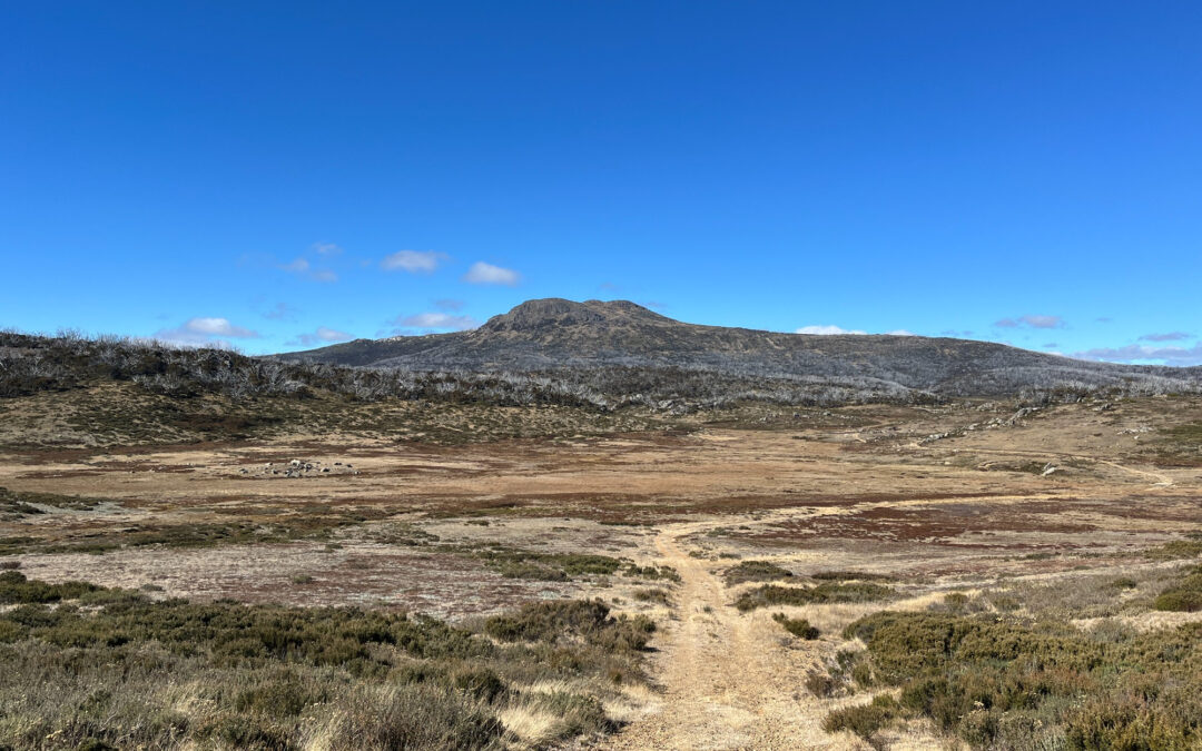
A short break as we finally reached the ridge leading to the summit. Clear views of the trail we’ve spent most of our day on. Sherman gets his tripod out ready for some vlog shots before continuing up the ridge. We picked a fairly open spot for our campsite for the night, somewhere nicely sheltered by trees yet maintaining a clear view to the nearby ranges. The summit walk continued with Kosciuszko main range in the backdrop. Mt Townsend, Mt Kosciuszko along with the main peaks all visible from a distance. Mt Kosciuszko is easily recognisable being on the edge of the main range, and also with its tomb-like appearance when seen from the east. This is possibly how it got its name from with its similarity in appearance to a Polish landmark. And that’s Mt Jagungul, 2061m above sea level. A bit of scrambling towards the end feeling much like Cradle Mountain in Tasmania. A few pictures with the sunset and we quickly made our way down, starting to get cold on top and trying to make good use of the remaining daylight.

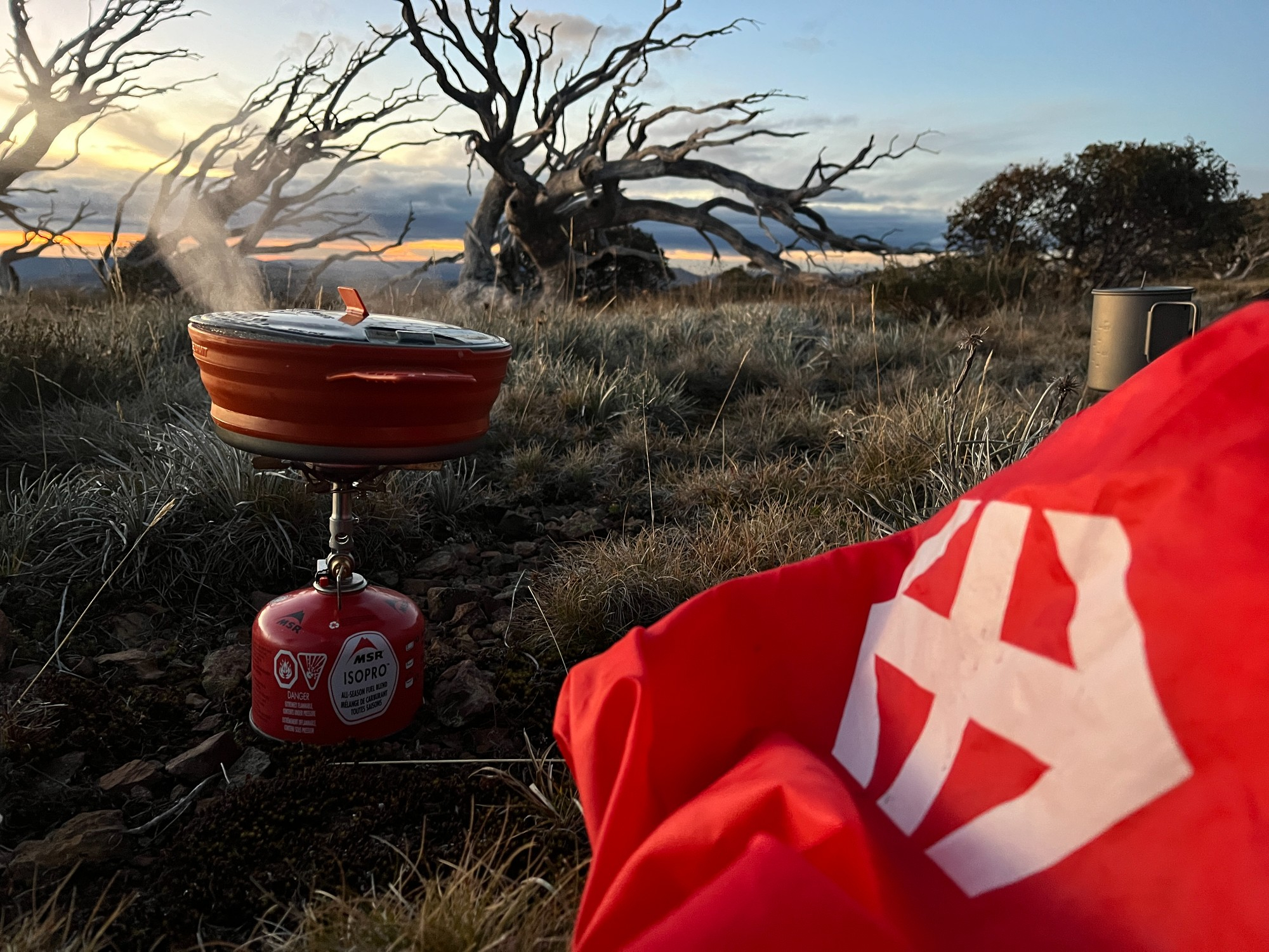
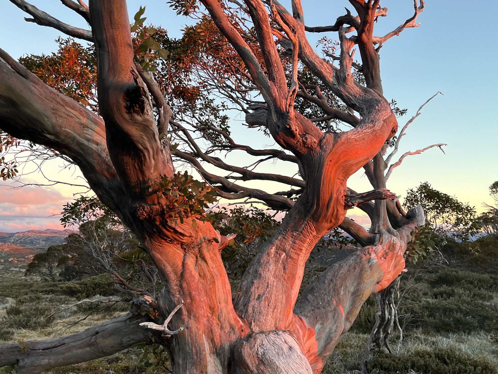
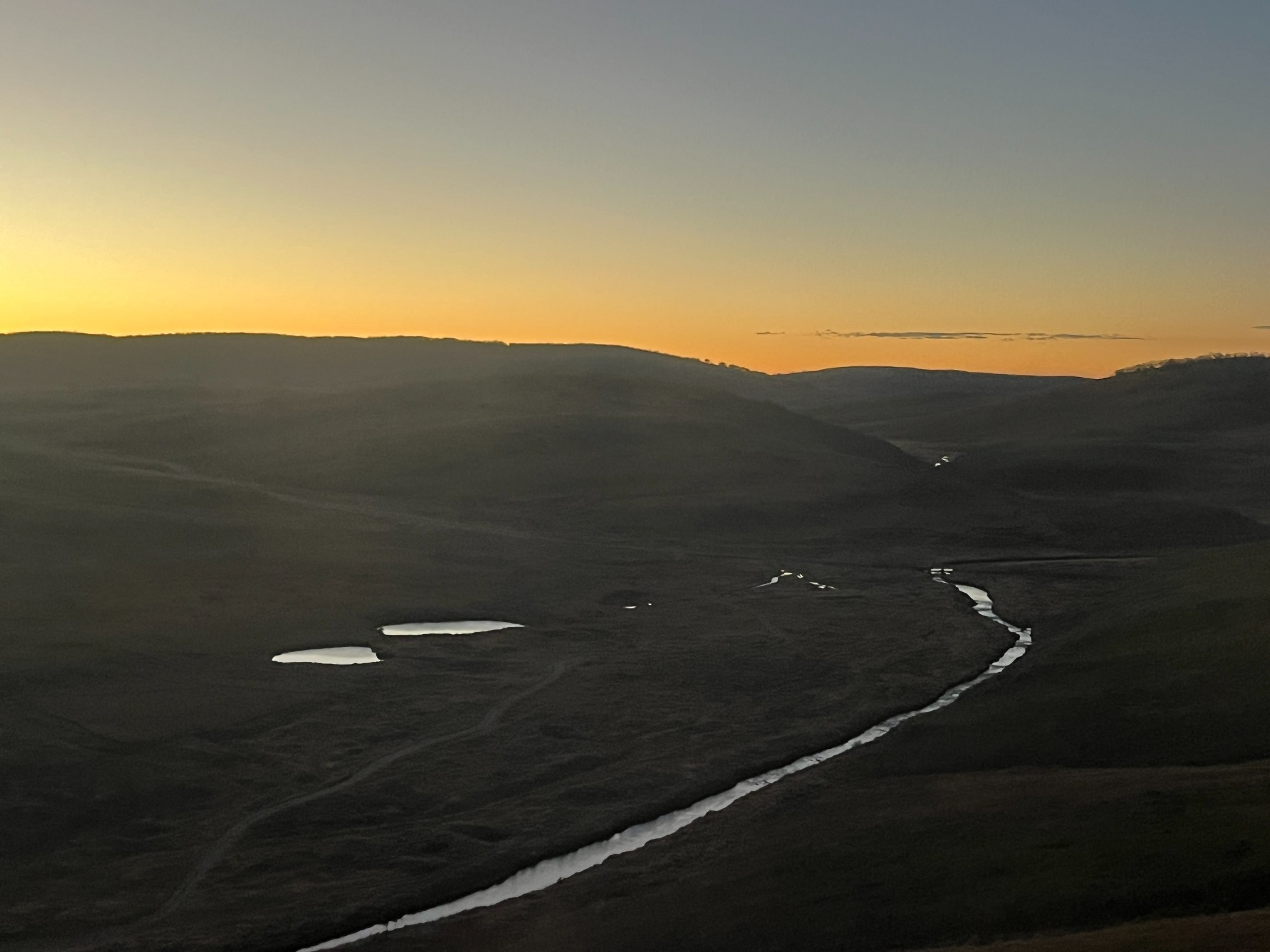
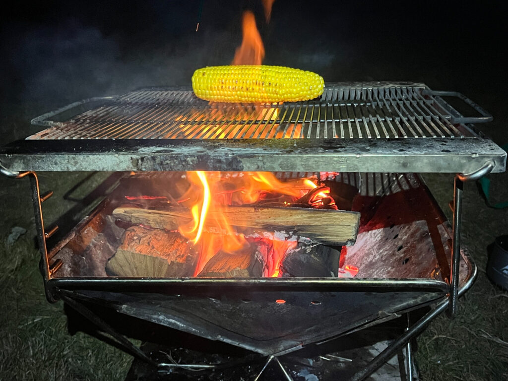
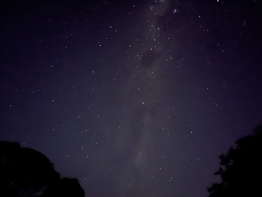
The orange light shines right on Mt Jagungul on the way down giving magnificent views. Sherman recalls that in his previous walk to Mt Jagungul, the place they camped was a bit further up the ridge, where there is a scenic snow gum. The orange light shines right on the tree giving a spot-on appearance. Near that scenic snow gum was where we started making dinner. Sherman took a shot of me lighting up the gas stove as I started cooking my indomie instant noodles. Previously a high school favourite being low-cost, accessible with great taste, it serves as great camping food with its versatility to compliment other food items. A bit of milky way skies from my tent while I tried to capture a bit of mobile reception from main range. Telstra gave me one block of reception, just enough to log onto Canvas and check my exam results, having a bit of extra peace of mind in the wilderness knowing that I’ve passed them.
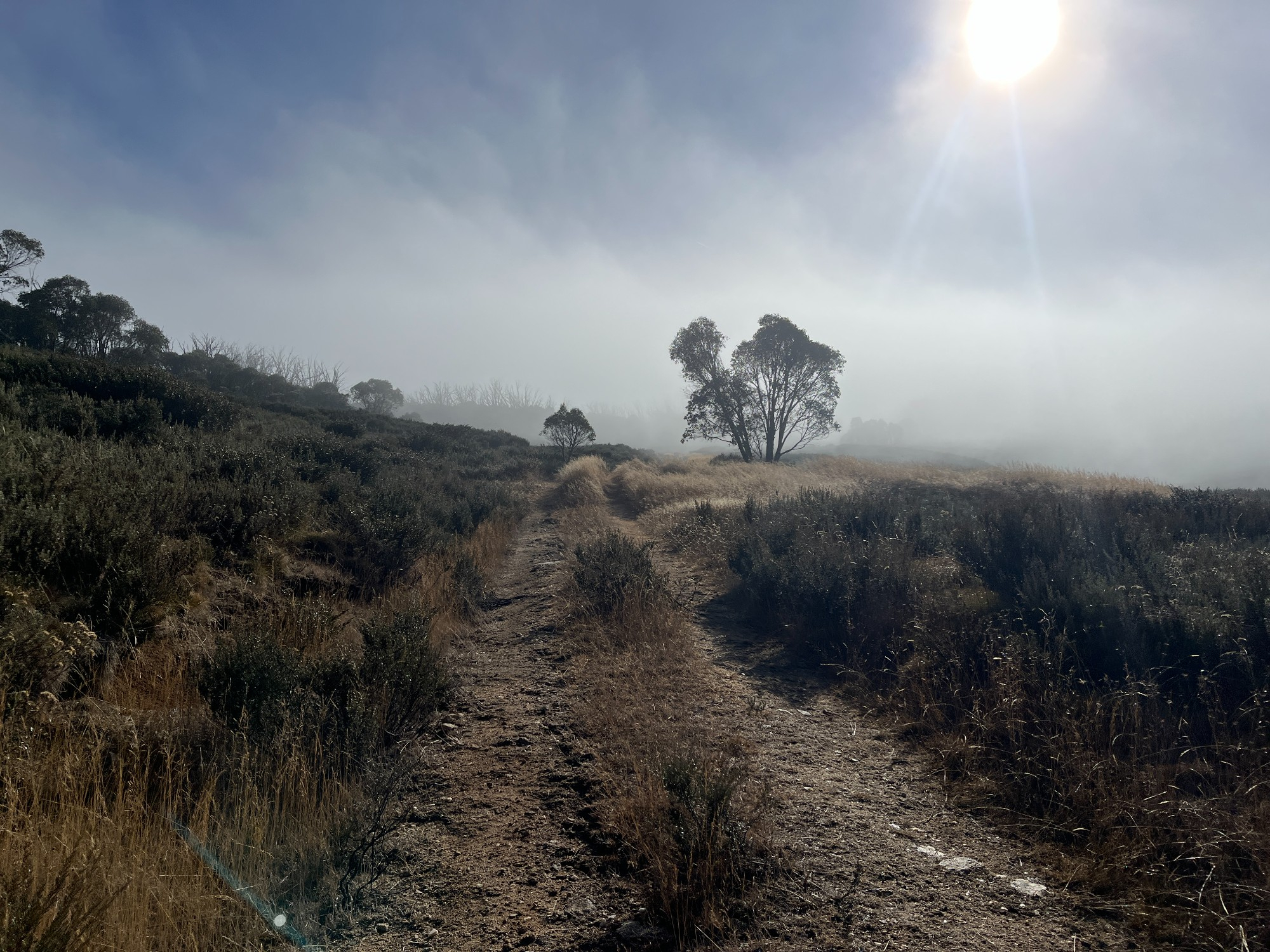
Freezing night ends with frost all over our tents as we woke up. Sherman’s portable thermometer recorded a low temperature of -4 degrees in midnight. Thick clouds cover the area we’ve walked through the day before. The water in our bottles were half frozen, and the ground frosted up quite a bit as well. Packing up our tents saw the frost fall off almost like snow. We made our way downhill escaping from the cold windy weather on top. The fog at the base gave some really cool photo opportunities, with the sunlight shining through looking like harvest season. Sherman pulls off his sleeping bag and places it at his back like a superman, hoping to dry it off as we walk on easy fire trails.
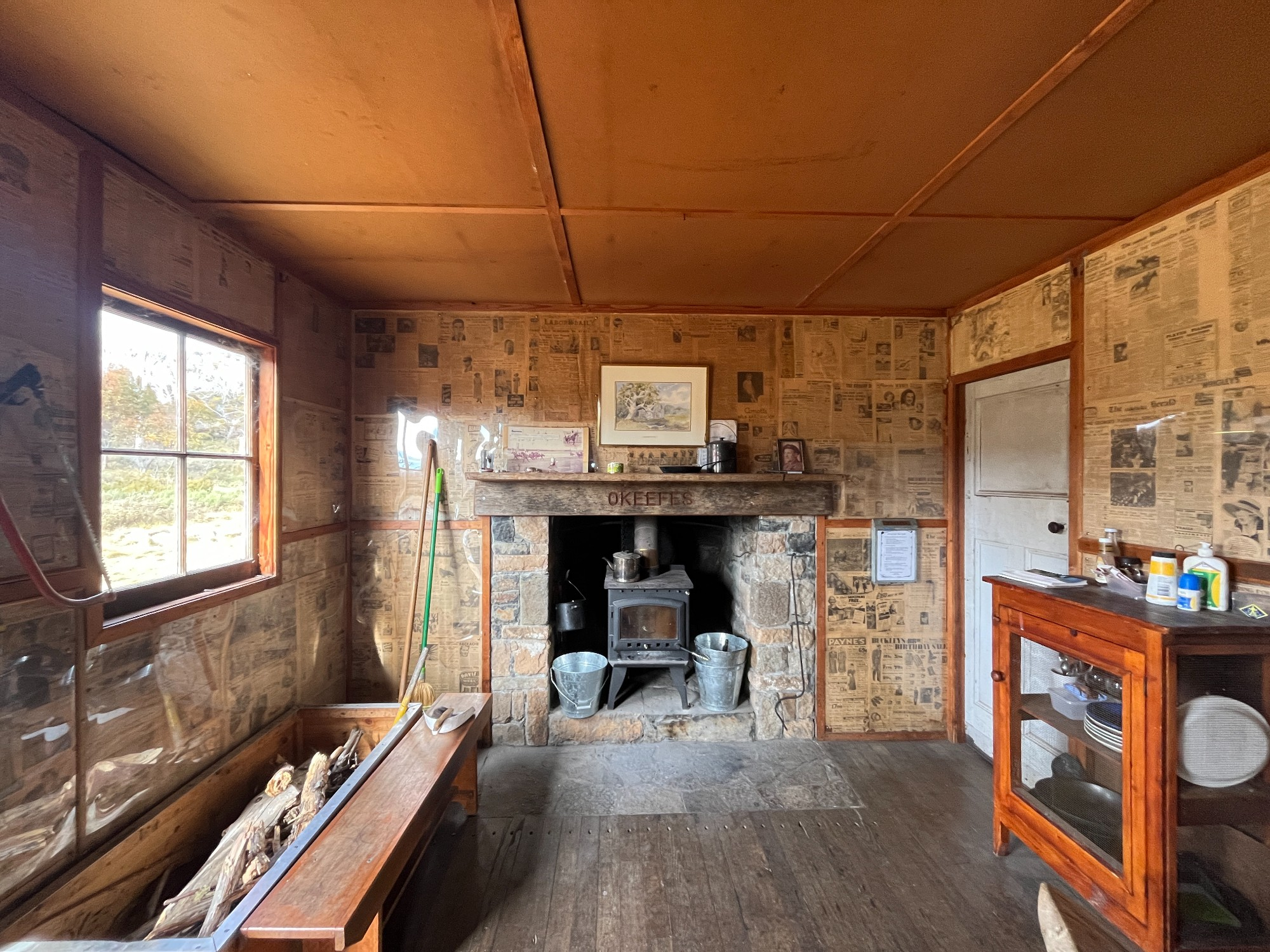
Down the fire trail was O’keefes Hut, our favourite hut of the trip. The small hut had its walls populated with old newspapers from the 1930s. There’s a living room and a fireplace at the common area offering great shelter. We took a long break, had our lunch while letting our tents dry. The newspapers were mostly from World War II amidst a global conflict. Covered in the newspapers were the Soviet front of the Germans and how the wrongful decision to attack Russia in winter reversed the course of war. The Australian government’s decision at that time was also discussed. There were talks on whether to cut train services, particularly special services run on weekends or events, to save fuel in case of a war.

Most interesting of all is the coverage of China civil war. “The traditional Chinese desire to save face is preventing the formation of a united front in South China and threatening to hand over the entire area to the Communists”, showing a slightly different perspective to what we learn today. From the perspective of people from that time it’s not hard to see why they prefer communists over the nationalists government, yet looking back from today it’s mostly just a fight between two dictators on who’s a better regime. Also interesting was the old postal romanisation used in place names. Kwangsi, Kwantung, Hangchow, Tsingtao, Kweilin, Canton etc. are all largely unused nowadays except for a few exceptions, eg. Tsingtao beer. A few systems of romanisation were developed and now the Pinyin system by the communists is most frequently adapted, based on mandarin and essentially mandating a mandarin pronunciation over all place names. The beauty of postal romanisation lies in its respect to local dialects, where the local pronunciation of a place is chosen over the national language, ie. mandarin. The old romanisation still exists around a few streets in Hong Kong, with Amoy St and Swatou St being the most notable, and in Taiwan where Tamsui likely derives from the local dialect and Taichung likely comes from Mandarin. In southern China, it’s still much more natural to pronounce places in postal romanisation, Canton over Guangzhou, Amoy over Xiamen, fitting more into how the places are pronounced every day.

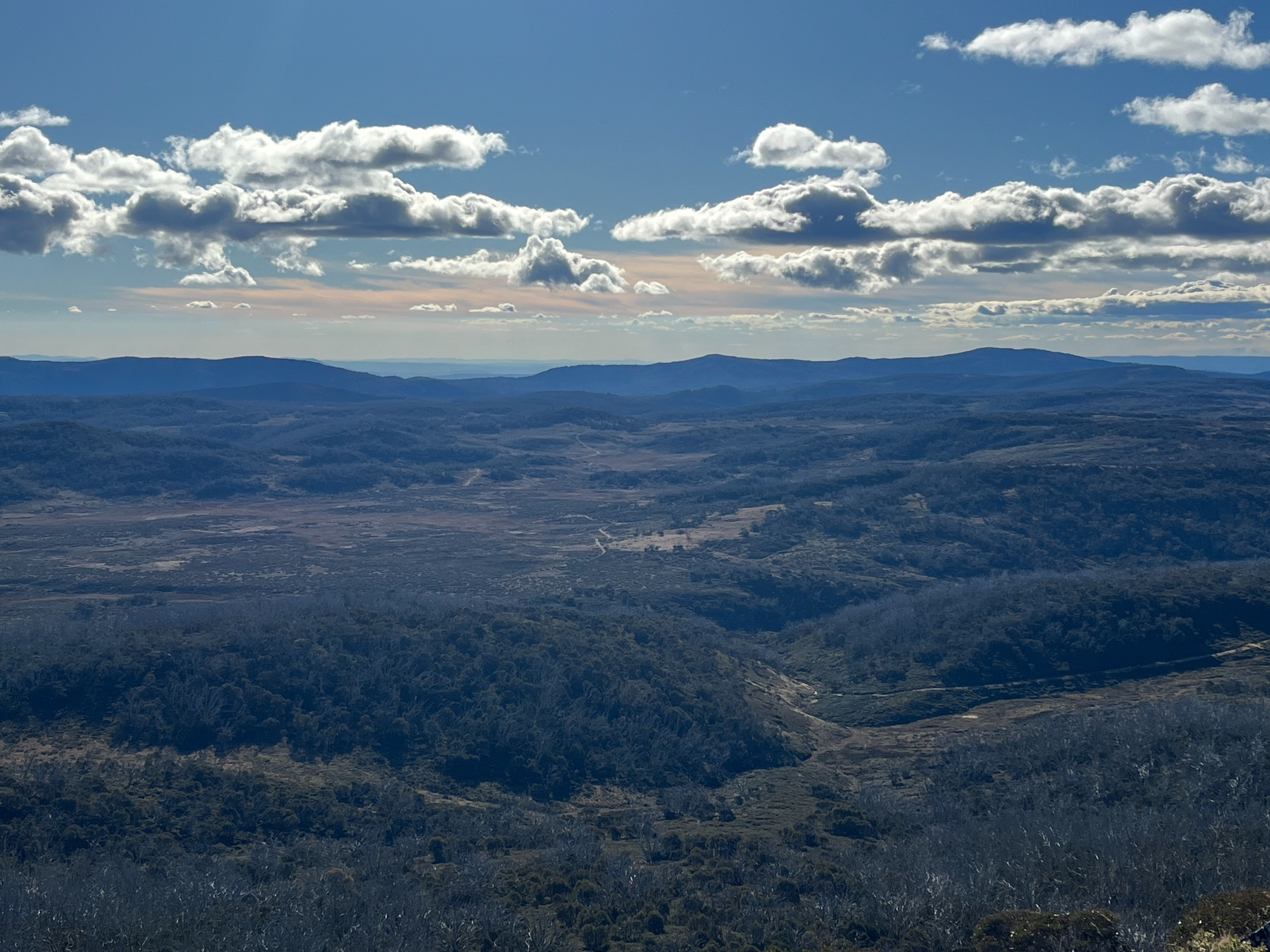
Soon we got to the river crossing with Tumut River, right before returning to our carpark. Seeing the river gorge felt like being in another country with wilderness stretching far beyond. A few fire pits along its river bank shows signs of people camping around it, which is not surprising given the scenic views. It was a fairly wide crossing- I crossed with shoes on while others crossed without. Back at the carpark we restocked ourselves with food and headed over to a nearby ridge for a scenic campsite. We trekked up the fire trail and realised the scenic spot was probably beyond reach, given how we had already done 20km on full camping packs. We settled somewhere open along the fire trail, pitched our tents and called it a day.
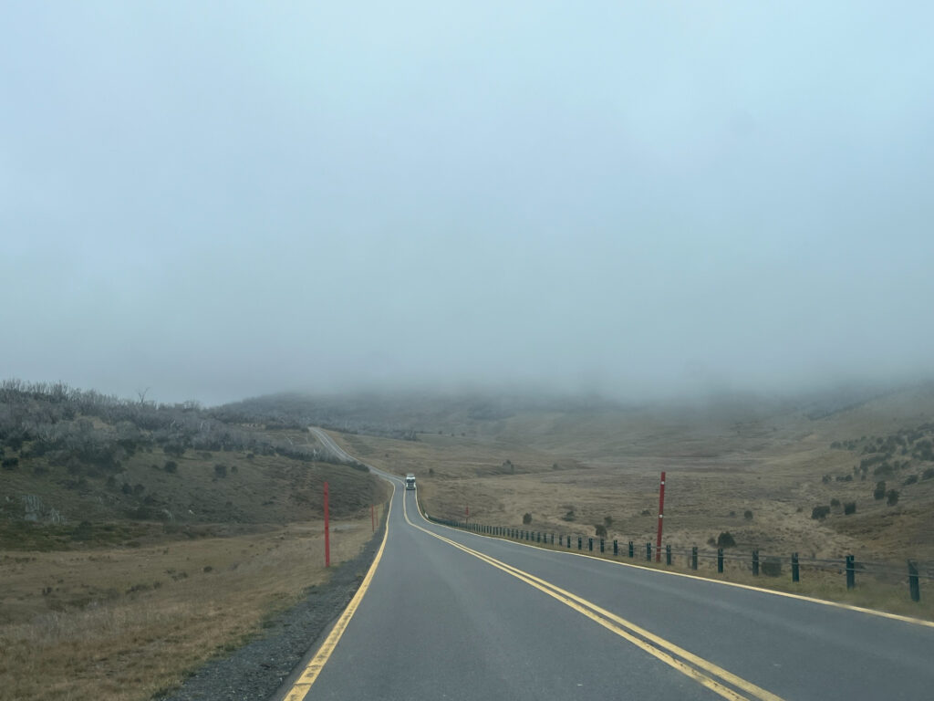
Waking up on another cold day we went back to our cars and drove out. The original plan was to do some exploration around the area but we left the plan fairly open, dependent on how everyone felt after 2 days of camping. Nevertheless, we started driving out to Cooma where we would decide our next steps from there. The fog and the open landscape brought great Scottish vibes. It took almost an hour to drive out back to Snowy Mtns Hwy, and then another hour back to Cooma. We took a short break at Adaminaby, roughly 1017m above sea level. The only attraction in this small settlement is the big trout right next to a public toilet. It’s a very small place with just several street blocks.
Our first proper meal for a few days came in the form of a full breakfast. The hash brown looks quite unconventional yet tastes really good. Being my first time in Cooma during normal business hours we visited the gallery next door, featuring photography work covering various Australian animals in snow- kangaroos, wombats, and ecidnas. The most popular one is probably a series featuring a wombat family walking along their fixed wombat trails. A range of merchandise was also sold which is where I got my birthday cards sorted for the whole year. One of the cards was taken back to Hong Kong and given to my friend where Instagram reels converted him into a massive wombat fan. Seeing the word Kosciuszko at the back he instantly recognises its Polish origin, and makes fun of the bastardised pronunciation Australians have gotten used to.
A nice lady in the visitor centre gave us a bit of info in the area’s climate and plant life as a result. It’s always fun to grab a few leaflets and hand them to passenger princesses at the back so they can get a bit of readings done during the drive, and possibly write a critical reflection on any insightful insights they might come across just to kill time. I got a booklet on the local Aboriginal history, hoping it would be helpful to my group projects of the Aboriginal unit. The booklet detailed how local Aboriginals go on cultural walks as a way to retouch their heritage, where they live their old lifestyles of hunting and feeding on bush tucker. They’re not tracing back history, but writing and witnessing history, paving a path towards the future. Inside the toilet cubicle, Jimmy saw a sticker saying feral pigs should not be slaughtered as they are a part of the Australian heritage. Interesting argument we thought as we spoke about that in the car. Jimmy has stacks of reading materials which he hasn’t read but one of them explained why Monaro Hwy up to Canberra looked barren and treeless- that’s due to the dry and windy climate, not that the area is heavily logged as in Southern Highlands or Central West NSW.
Cooma carries the old regional town vibe like many Central and Far West NSW towns do. It’s possibly the influx of travellers that shaped a progressive side of town, with new cafes and shops popping out all across. The visitor centre tries to build a spending local culture promoting produces from the region. The place can feel quite rough at night but with all the changes happening recently, it shapes as a good role model for many regional towns to adapt. It’s progressive urban planning policies and community spirit that revive communities after all, bringing in new ideas and allowing the place to thrive.
Stopped by Canberra on the way back to Sydney. Jimmy went into Paddy Pallin for a new pair of trekking shoes. After that, we stayed a night in Bungonia’s luxurious campground and headed back home on Sunday.
Trip report by Terry currently on a long exile to Bundaberg, Queensland. Nothing to do in rural areas so might as well catch up with trip reports before the internet goes down under.