Date: 1/9/2024
Trip leader: Bruce Stafford
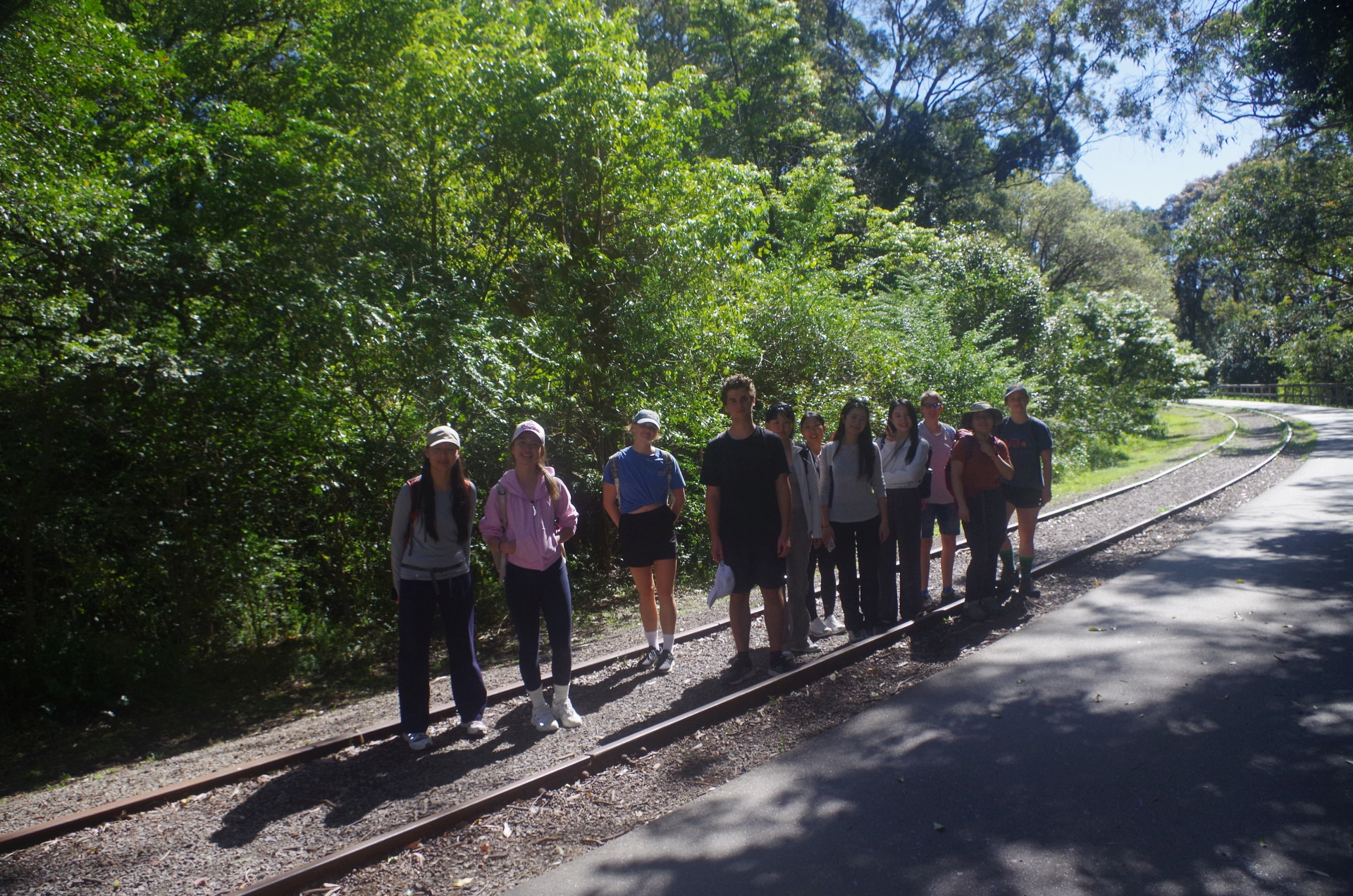
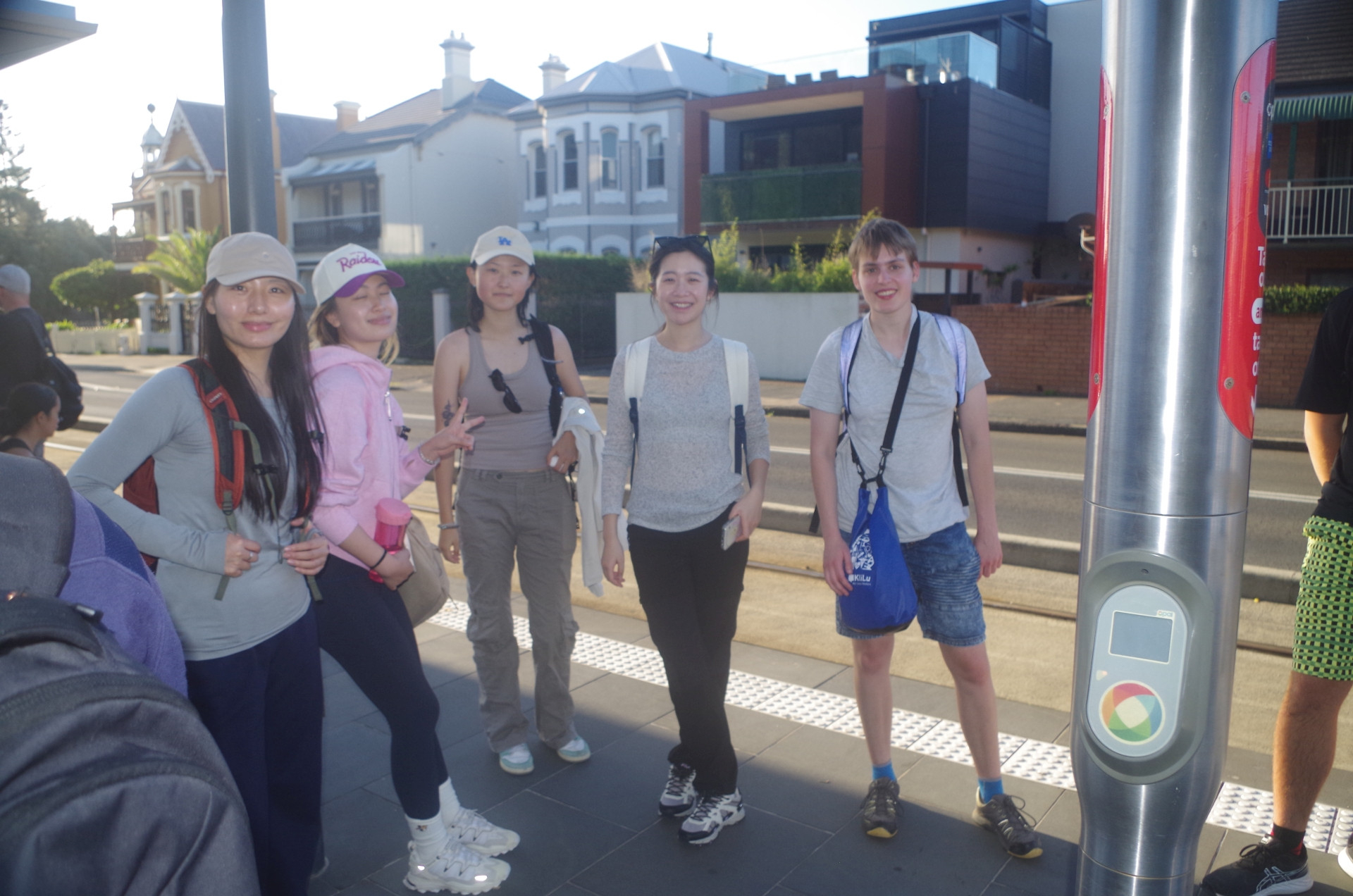
Party: Anina, Chloe, Cornelia, Doris, Ember, Fredo, Jackie, Jiaxuan (Astraea), Lei, Peiyan, Ruiqi(Rickie), Theo, Yiwen, Yuning
Fernleigh Track, Glenrock Conservation Area, & Merewether Beach, Newcastle 1/9/2024.
The rare unseasonable very warm weather this weekend gave me some concerns about this walk, because of the possibility a high fire danger, and even maybe a “Total Fire Ban” being declared because of the strong and dry NW winds. As it turned out, the Hunter region had only a “low” fire danger rating that day, compared to the “high” fire danger rating for Greater Sydney and the Illawarra that weekend. (I will add links to the RFS and other helpful sites such as tide predictions at the end of this report).
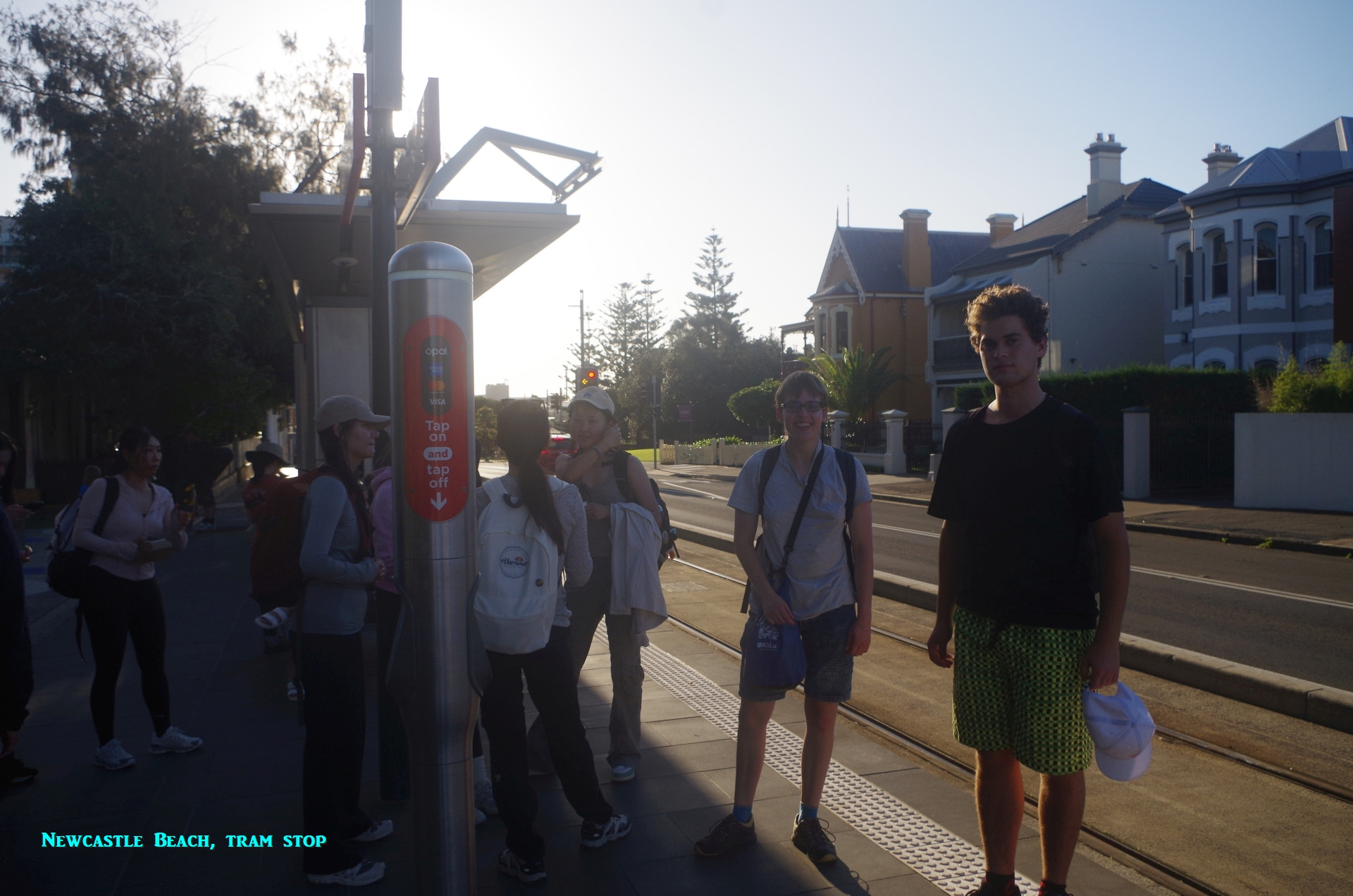
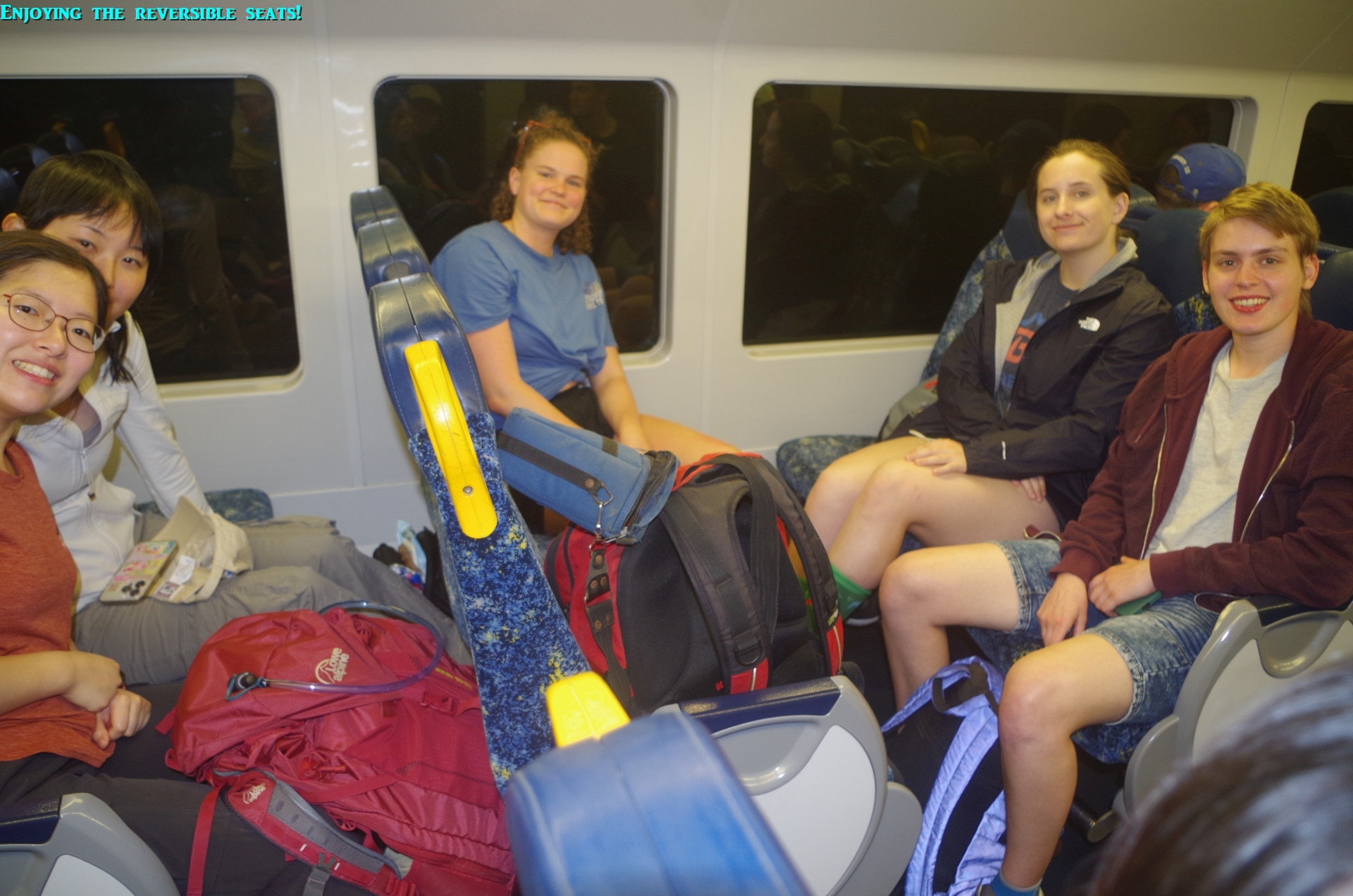
I got on the train at Gosford, changing from my local all-stops train there, and noted how very cool the winnd was, surprising given the weather forecast for 28 Degrees C. I almost needed a jumper (pullover), which I didn’t have in my pack anyway. Still, while waiting in the wind a new “modern dynamic” D set Intercity train on a “test” run pulled in on the opposite platform. This gave me a good chance to check out the non-reversible seats in this train, which look almost identical to those in London’s outer suburban Class 458/4 trains (more about that later too).
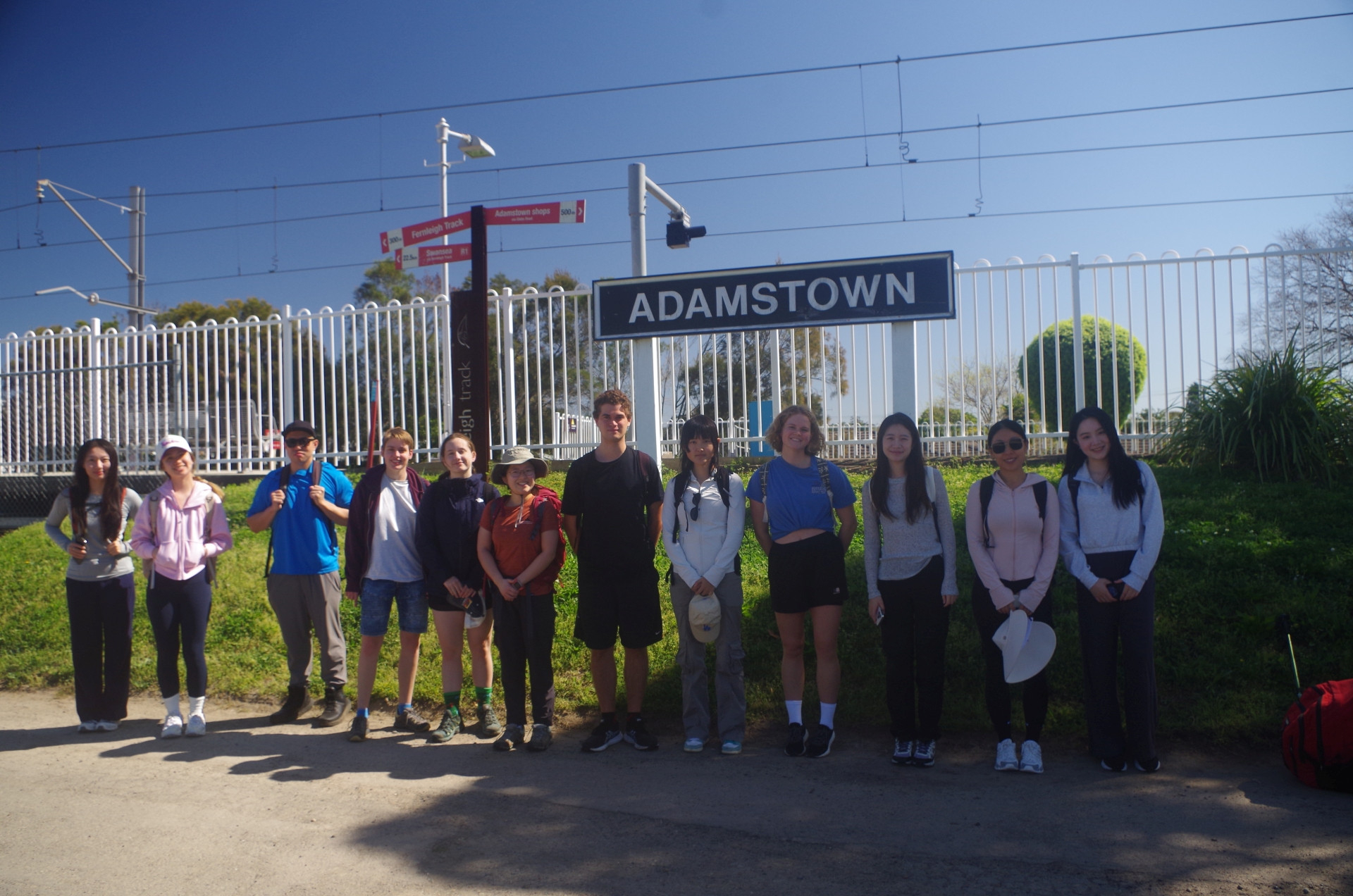
On the train, the train guard made an announcement that the toilet in the last 4 cars, i.e. the ones we were in, was out of order. That put paid for plans for people to use the train toilets on the two and a half hour trip up, as once off the train there are no toilets until Merewether Beach. So on arrival at Adamstown we quickly set off to the start of the Fernleigh Track, which is actually a rail trail going 13km to Belmont, although we went only as far as Kahibah, 3km away. It is on the trackbed of the old Belmont colliery railway, and rises in a steady 1 in 40 gradient to Kahibah.
Before then, however, some people needed a toilet stop, and we turned left off the rail trail after only 400 metres to go to the “Fernleigh Cafe” where we knew there were toilets. On arrival there was a note on their door that they had closed early for Father’s Day! Then a check of Maps on an iPhone showed that there were toilets in a small retail area another block away. This included a “Petstock” outlet as well as some smaller businesses in a building with a toilet. The day was saved! The Petstock staff kindly allowed 5 of our group to use their toilet, and others used the one at the other building. Everyone was relieved (pun intended), but we lost almost half an hour of walking time because of the lack of the train toilet (about which I will write to the Transport Minister).
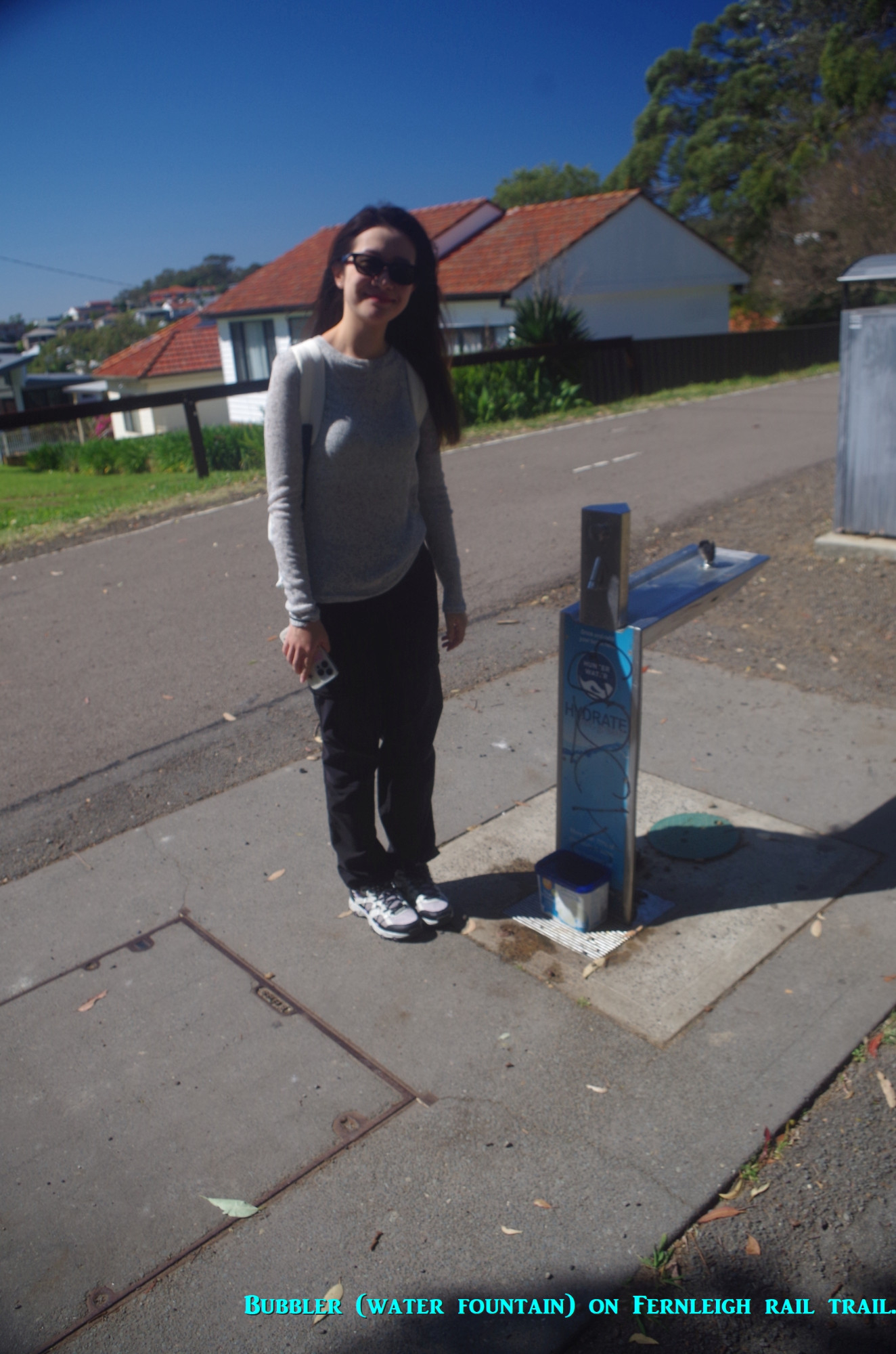
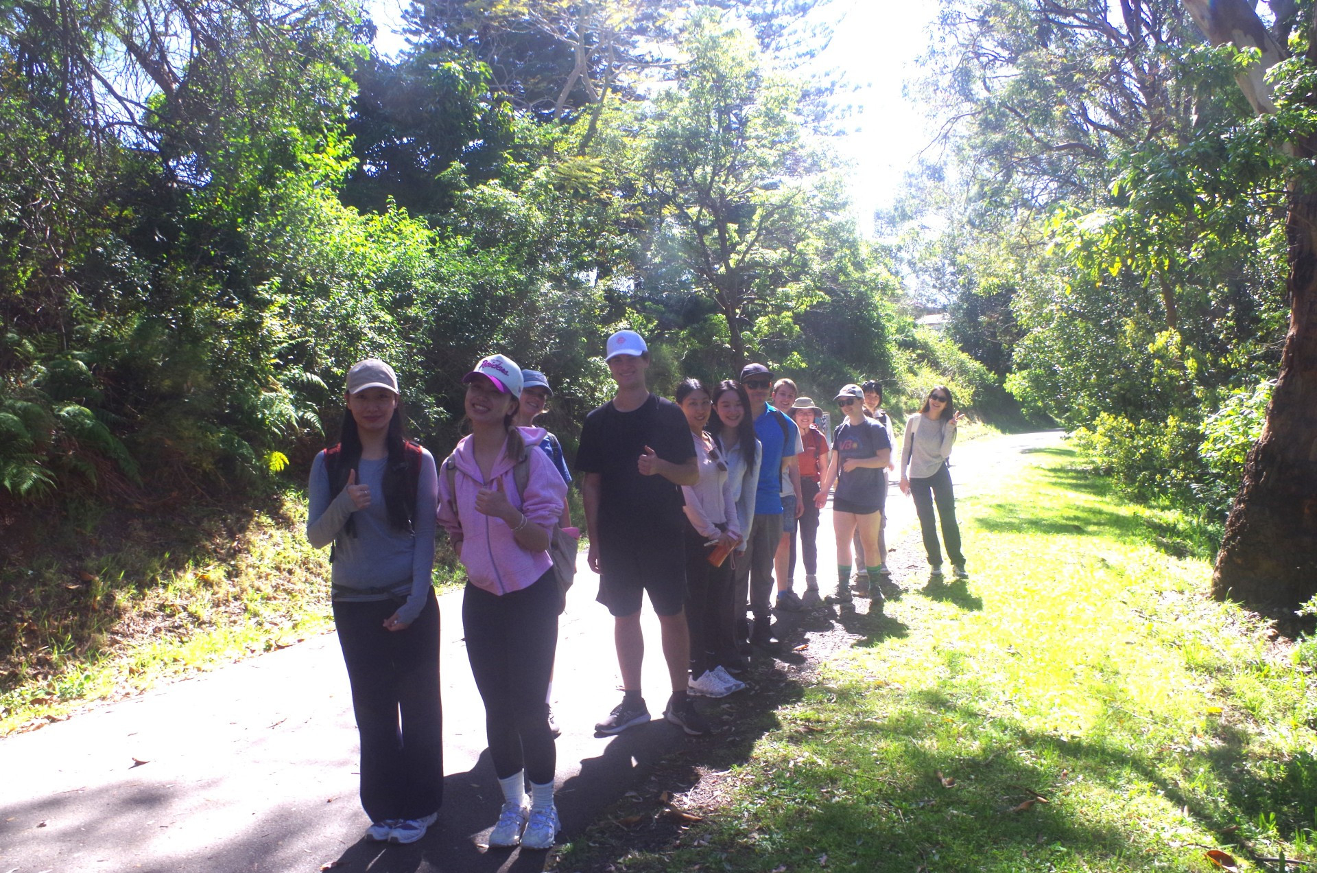
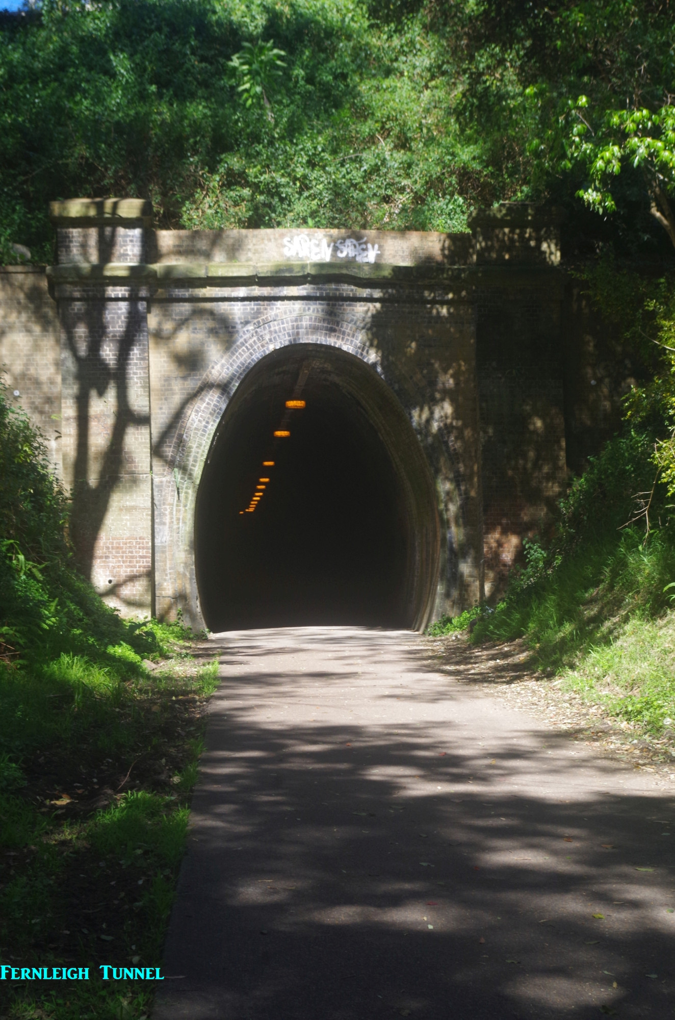
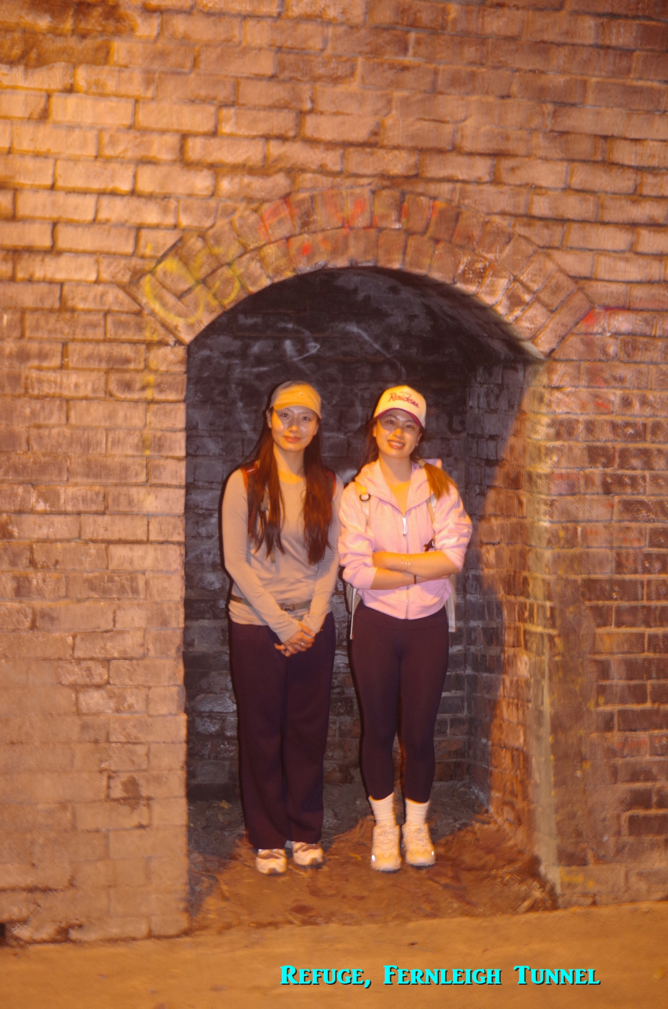
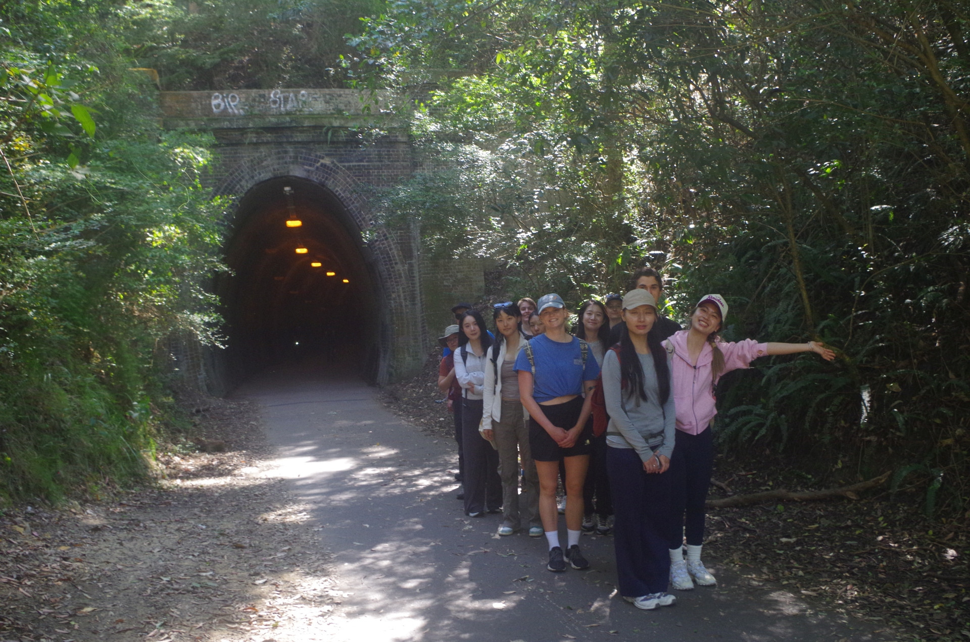
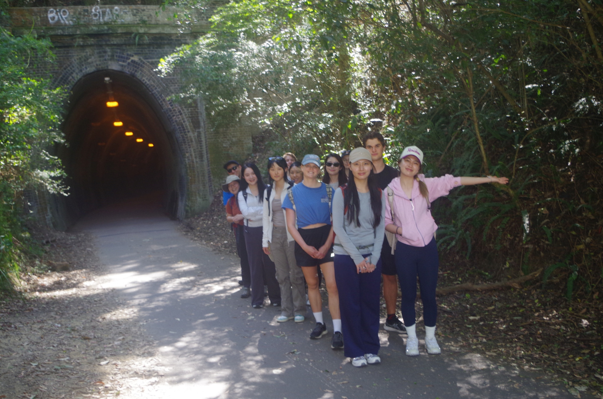
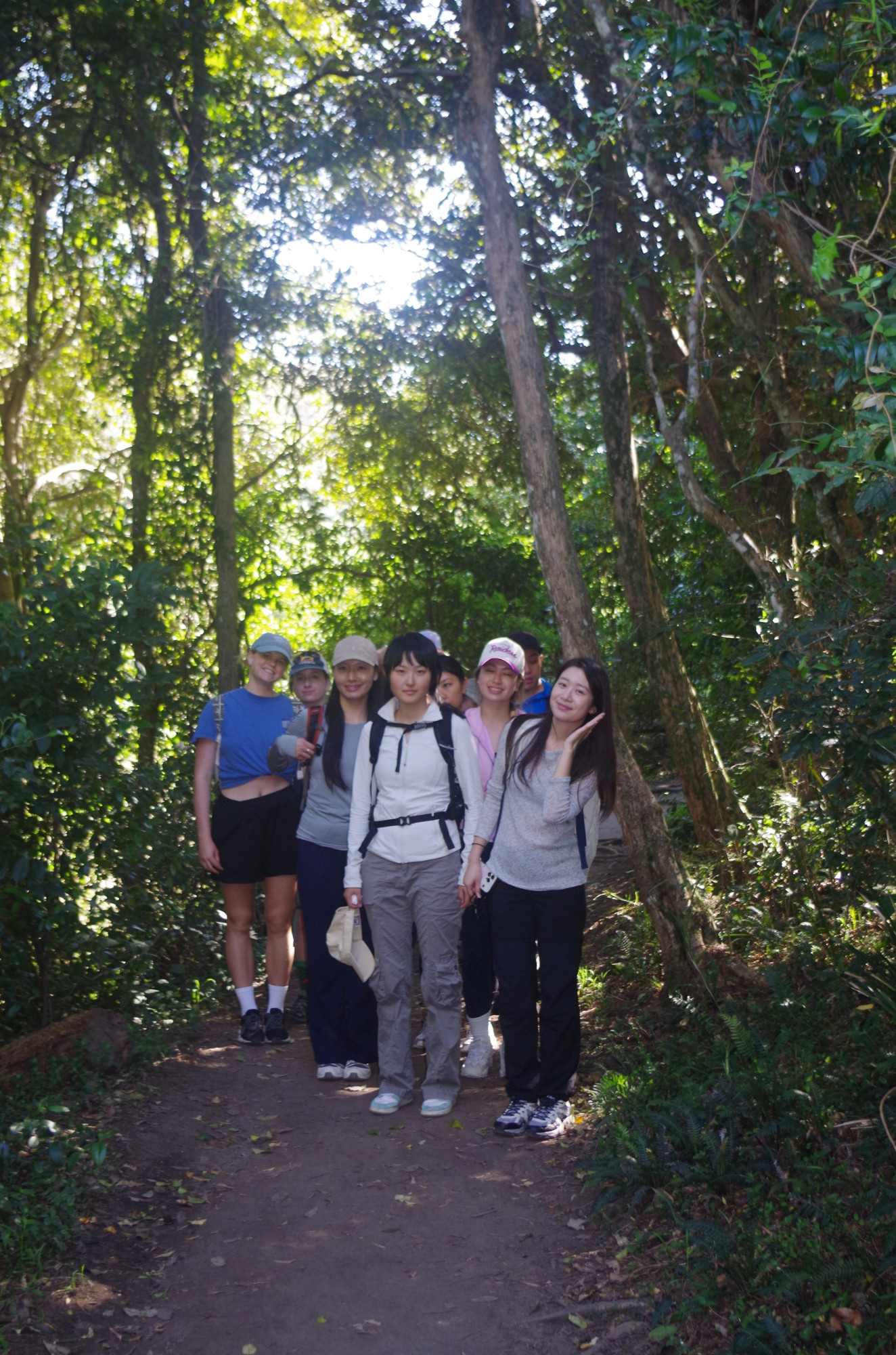
After the toilet stop we returned back to the Fernleigh Track and continued on. after another half km we came to a bubbler (water fountain) where water bottles can be topped up – and a good idea on a very warm dry day like today. Something else we noticed was that there were few people walking or bike-riding the track today, maybe because they thought it was too warm, or because it was Father’s Day and they stayed at home. Nevertheless it was still important to keep a watch out for cyclists who sometimes come down the 1 in 40 gradient at some speed in the opposite direction (there is a rule to keep left when walking here). About halfway along the track we came to the 181 metre long Fernleigh Tunnel, and a couple of people posed inside one of the refuges, which are 50 metres apart in all railway tunnels for shelter if a train comes while you are in the tunnel.

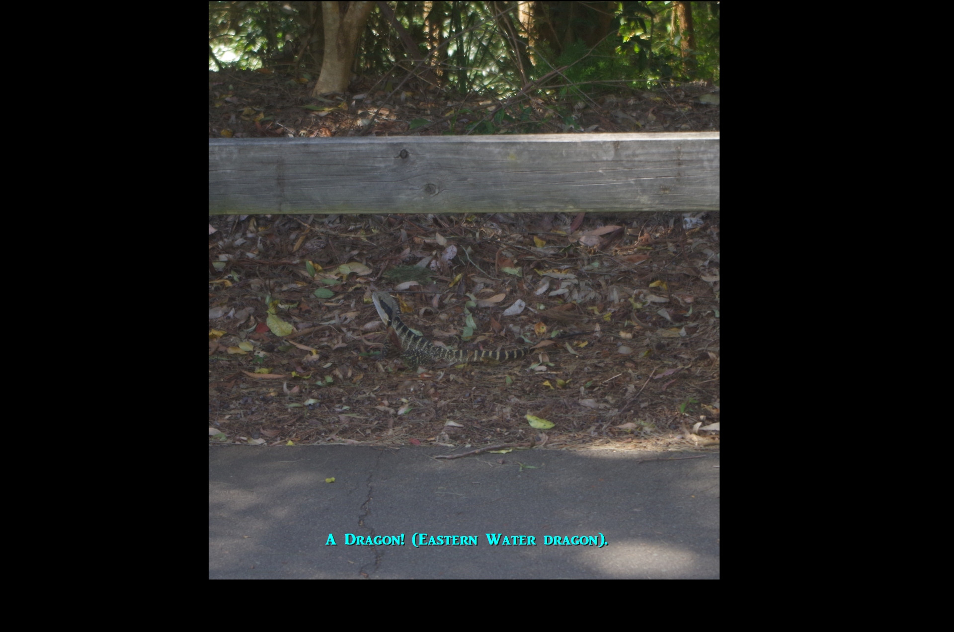
After the Tunnel the track stays on its uphill 1 in 40 gradient but becomes wider with some old rail tracks kept in place on the right hand side. I got everyone to walk along these tracks for a while, and by chance saw a Dragon (Eastern Water Dragon) in the bush just on the other side. Had we remained on the path instead of walking on the railway it would have run away. I managed to get a good enough photo of it before it partially hid in the undergrowth, still watching us warily.
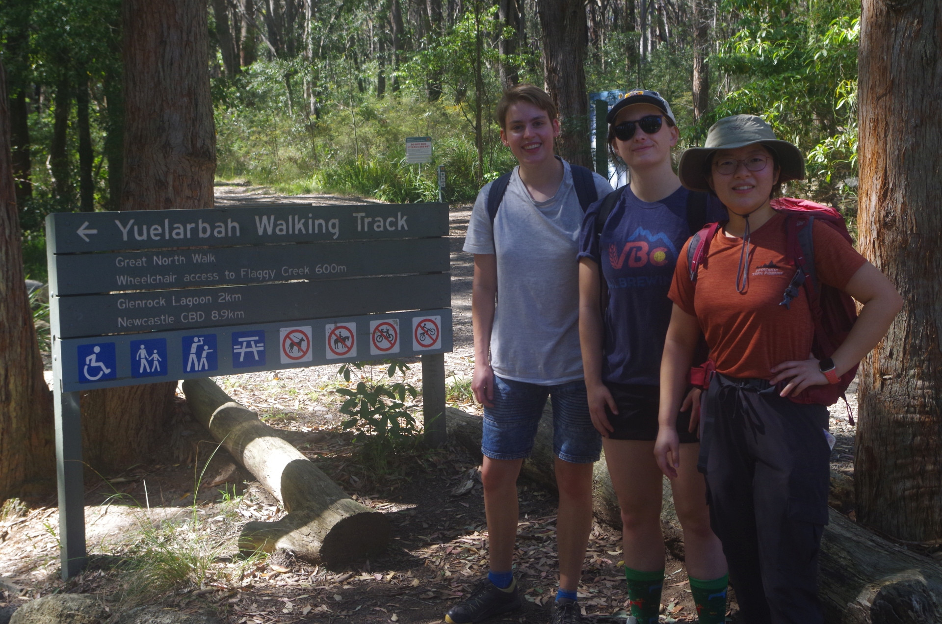
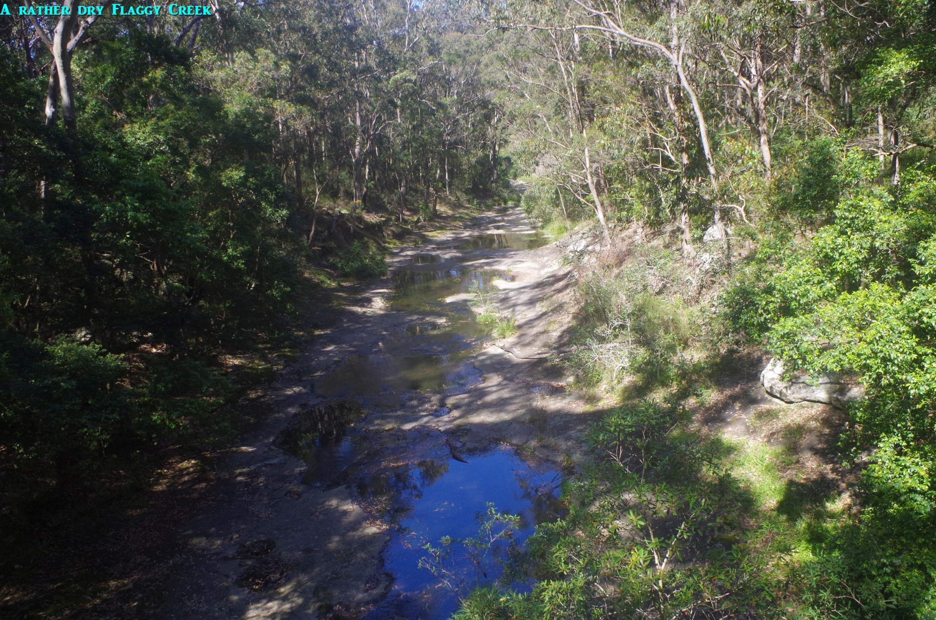
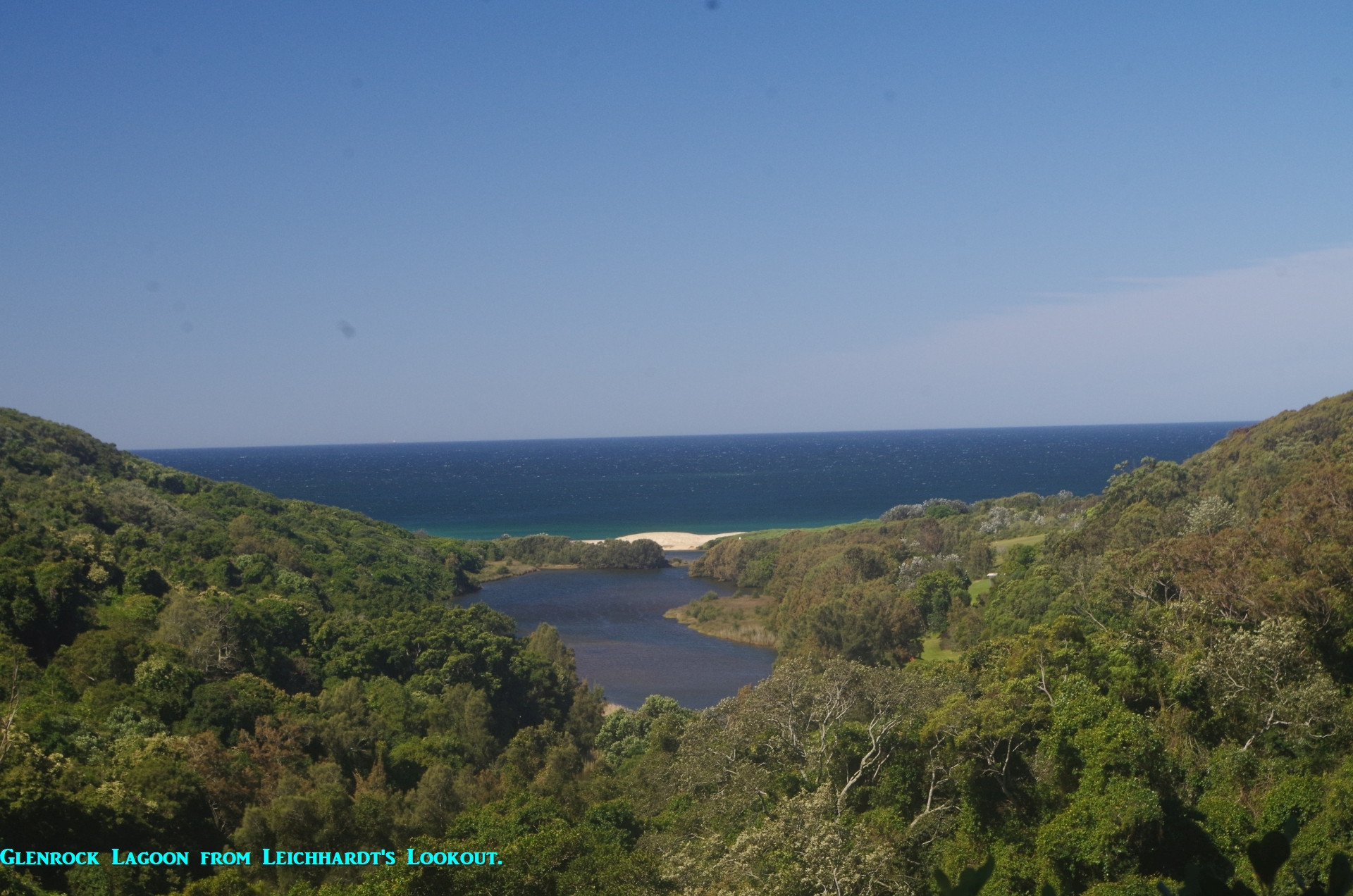
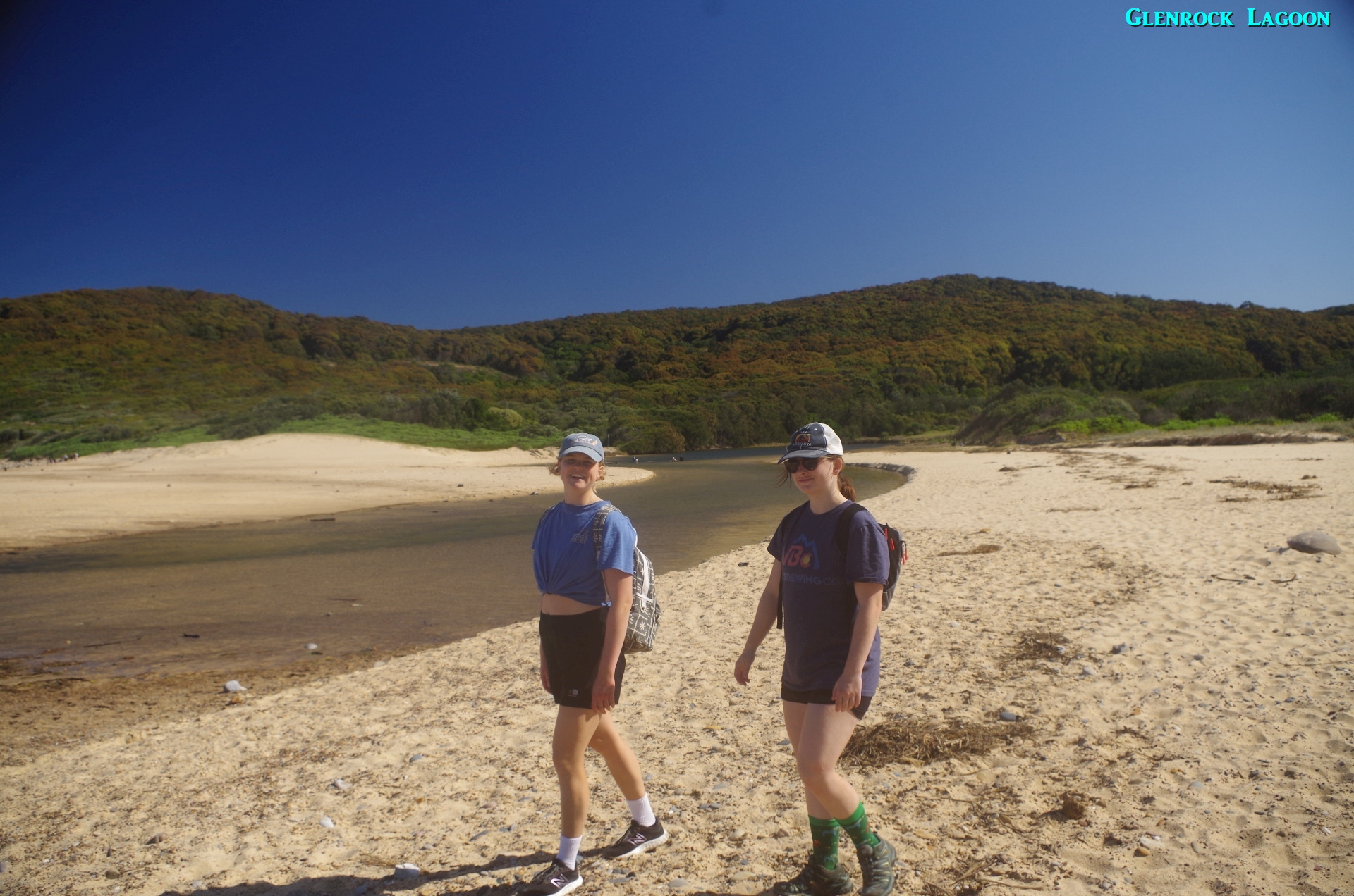
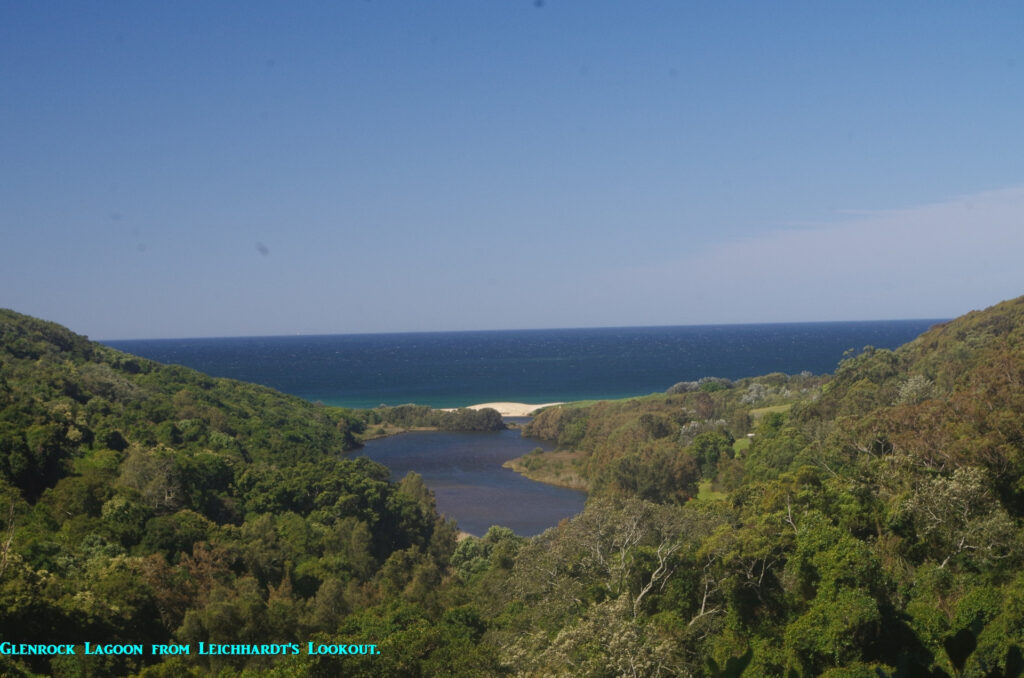
Not long after that we reached Burwood Road, where we turned left to walk about 100 metres to Glenrock Conservation Area car park, where we met an elder of the Awabakal First Nations mob (on whose land we were on) who told us to watch out for snakes now that the warm weather has come! Then we set off along a gentle gradient along the first part of the Yuelarbah Walking Track towards the first bridge over Flaggy Creek. Then a right turn until passing under power lines, from where the track gets rougher but still undulating. Then it dropped down to a bridge over Little Flaggy Creek, which appeared to have more water in it than “big” Flaggy Creek. Soon after that we arrived at Leichhardt’s Lookout. This lookout has a view east towards Glenrock Lagoon and Burwood Beach’s south end. I told the group that the next place on the other side of the ocean was South America!
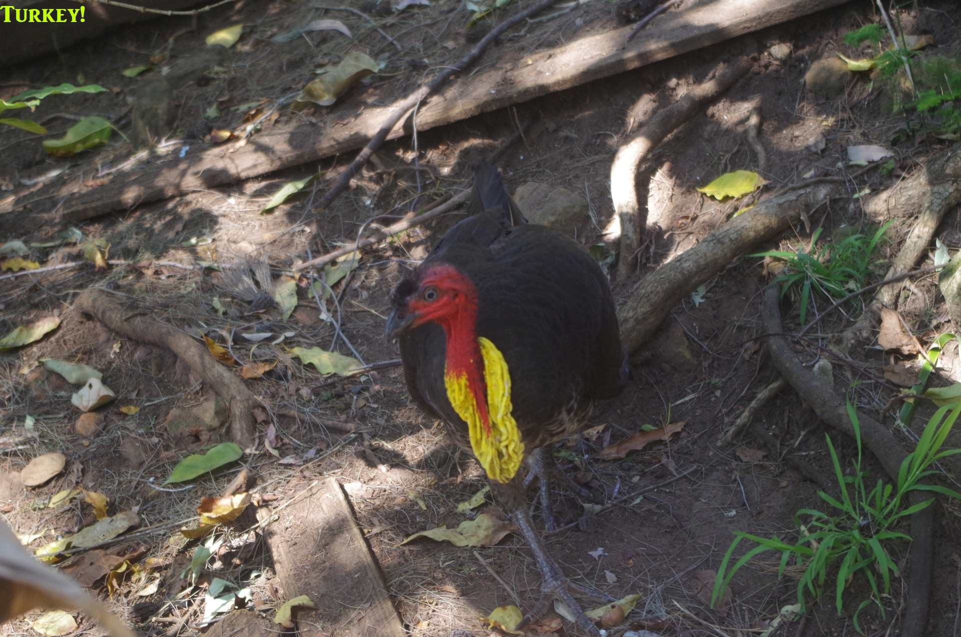
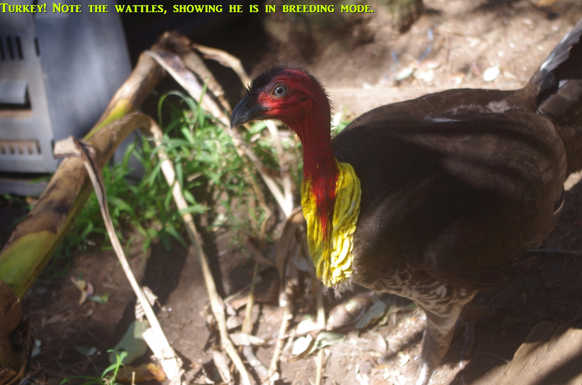
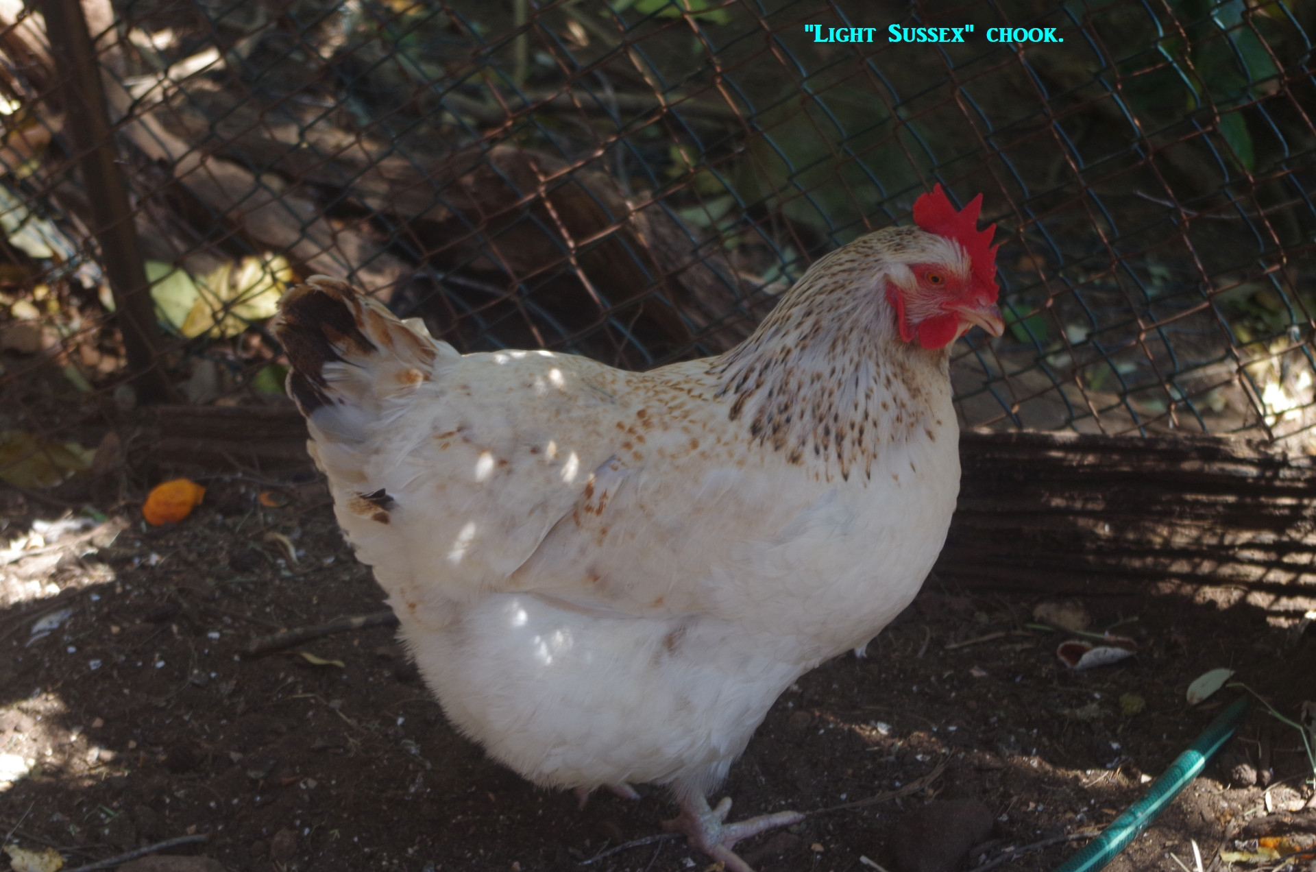
Because we had lost some time because of the search for toilets earlier, it was 12 noon now, so we decided it was now lunch time. This would also allow a good break of over an hour before reaching Merewether Beach and going for a swim. As on the previous week’s walk I brought out my “billy” and portable gas stove, and cooked two eggs in the water. I showed the group that one of the eggs bore the date “1/9” meaning that it had been laid earlier today (by the chook shown in the last photo). I also put the stove down on the floor this time to make sure there wasn’t a repeat of the spill that happened with it last week. No Yum Cha this time though, as I was aware that we needed to make up time so gave brewing tea a miss. A Raven came and perched on a tree above us and called out “Arrrgh Arrrrrrrgh”, probably hoping for handouts (which it didn’t get from us). A Bush Turkey also roamed around underneath for the same reason, but was camera-shy; so I have added photos at the end of this report of the Turkay that lives in (or rather has taken over) my yard. He has made a massive nest in my yard, and occasionally takes a certain interest in my chooks.
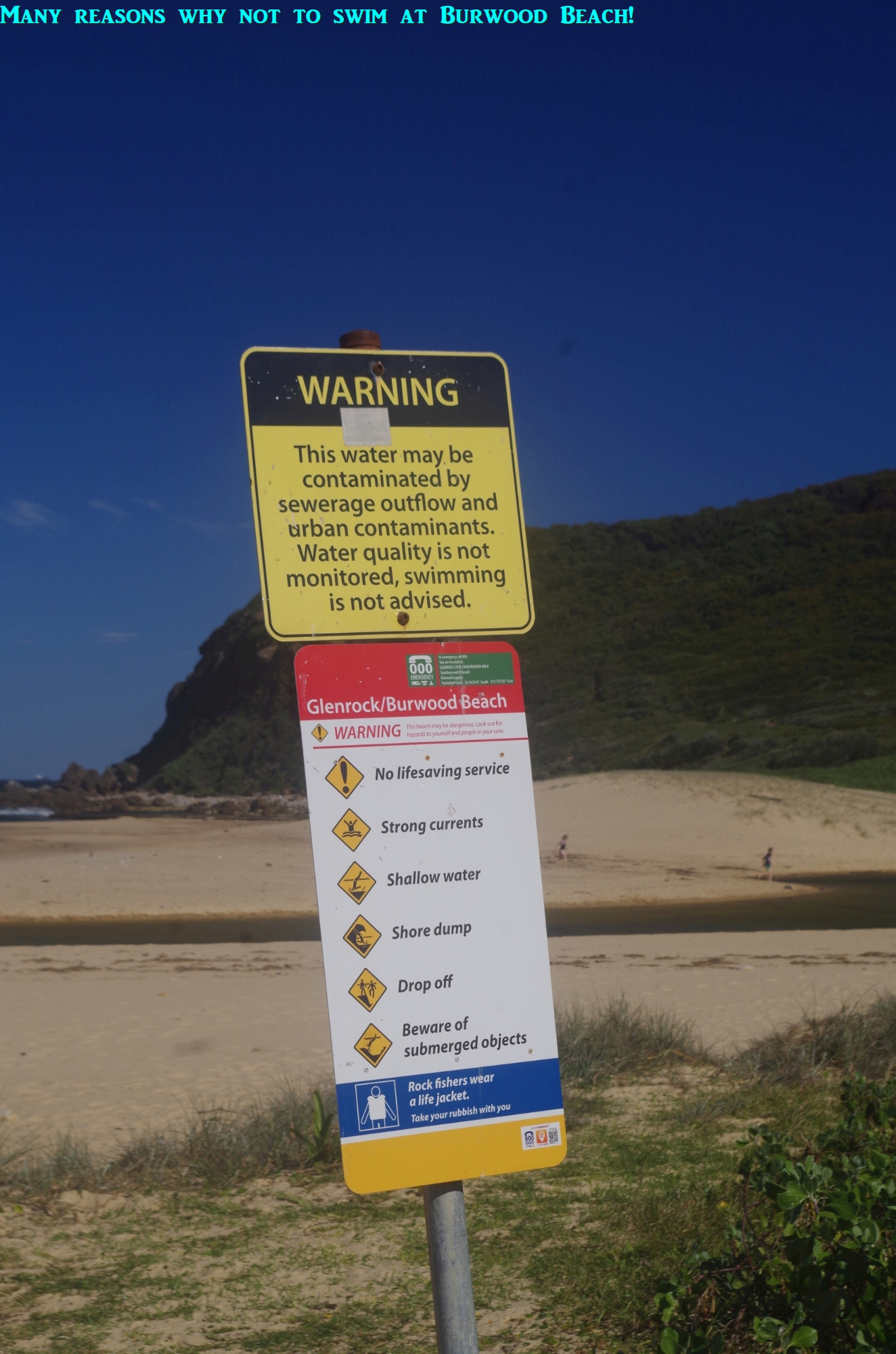
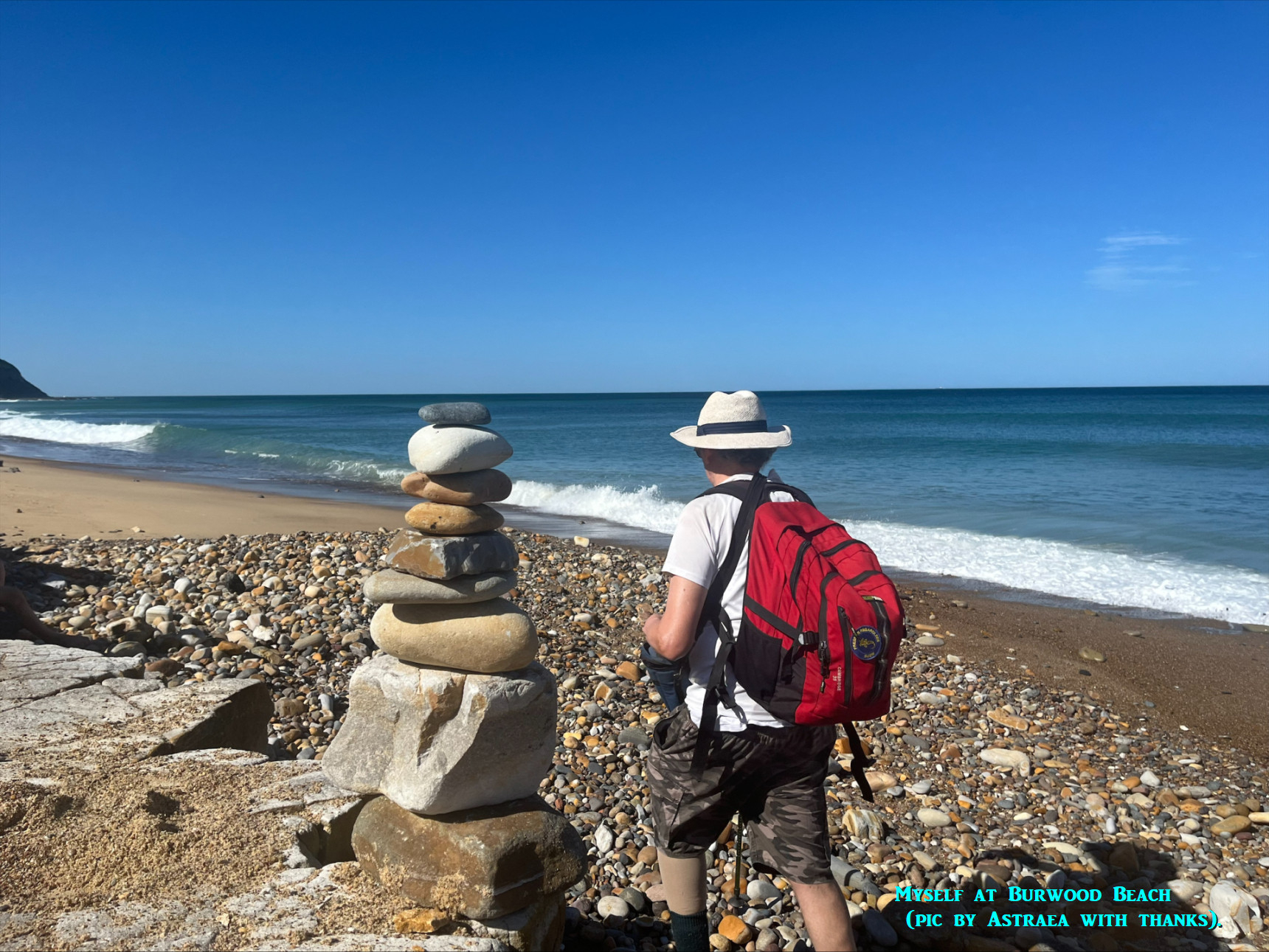
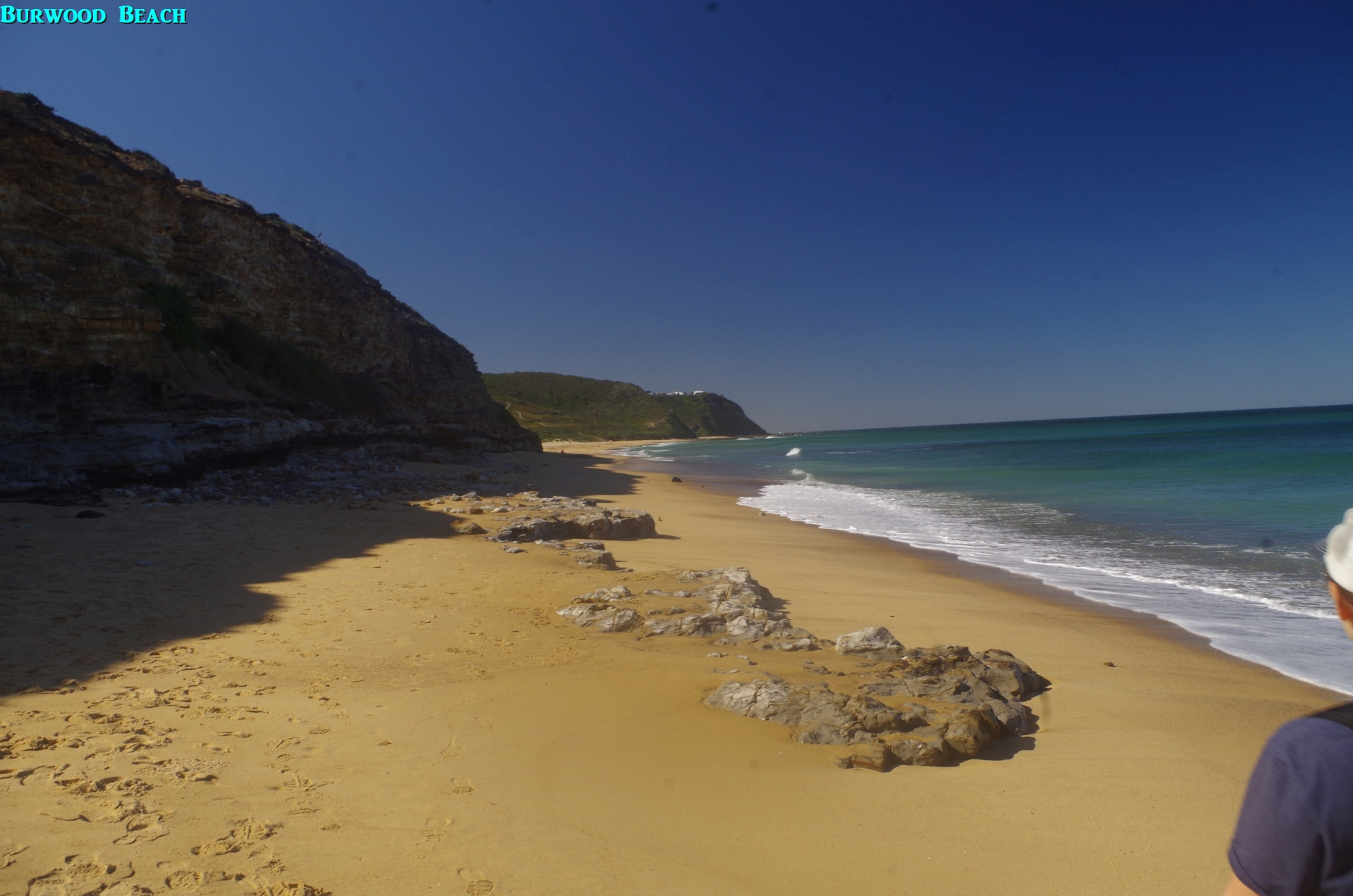
Then we headed off to Burwood Beach, continuing along the Yuelarbah Track, first going down a series of steps and then through a thickly wooded area with some slightly muddy sections and a couple of vines along the way, like a jungle. after a while we came out at the south end of Burwood Beach, and its sign warning about the dangers of swimming here, including possible waste water contamination in very wet weather. Burwood Beach has a Hazard Rating of 7/10 on https://beachsafe.org.au/ and is never patrolled, has several permanent rips, and needless to say it is dangerous to swim there. Locals almost never do. It was seen that a fair bit of sand had been eroded from the beach after some heavy seas a few weeks ago, and if it was a high tide (it was low tide this time) the area here would have been covered with water, and we would have had to detour along the Yuelarbah Management Trail and join the beach somewhat further along. (A link to tide times is also at the end of this report). As it was we were walking right on the edge of the waves in a few places as we went along this 1.3km long beach.
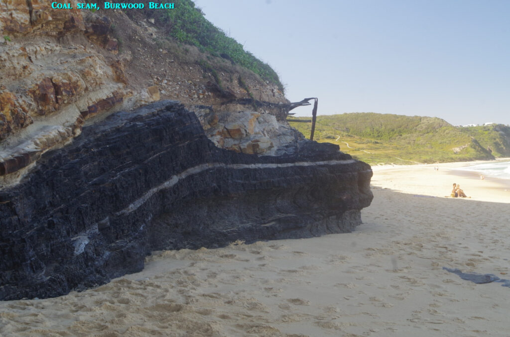
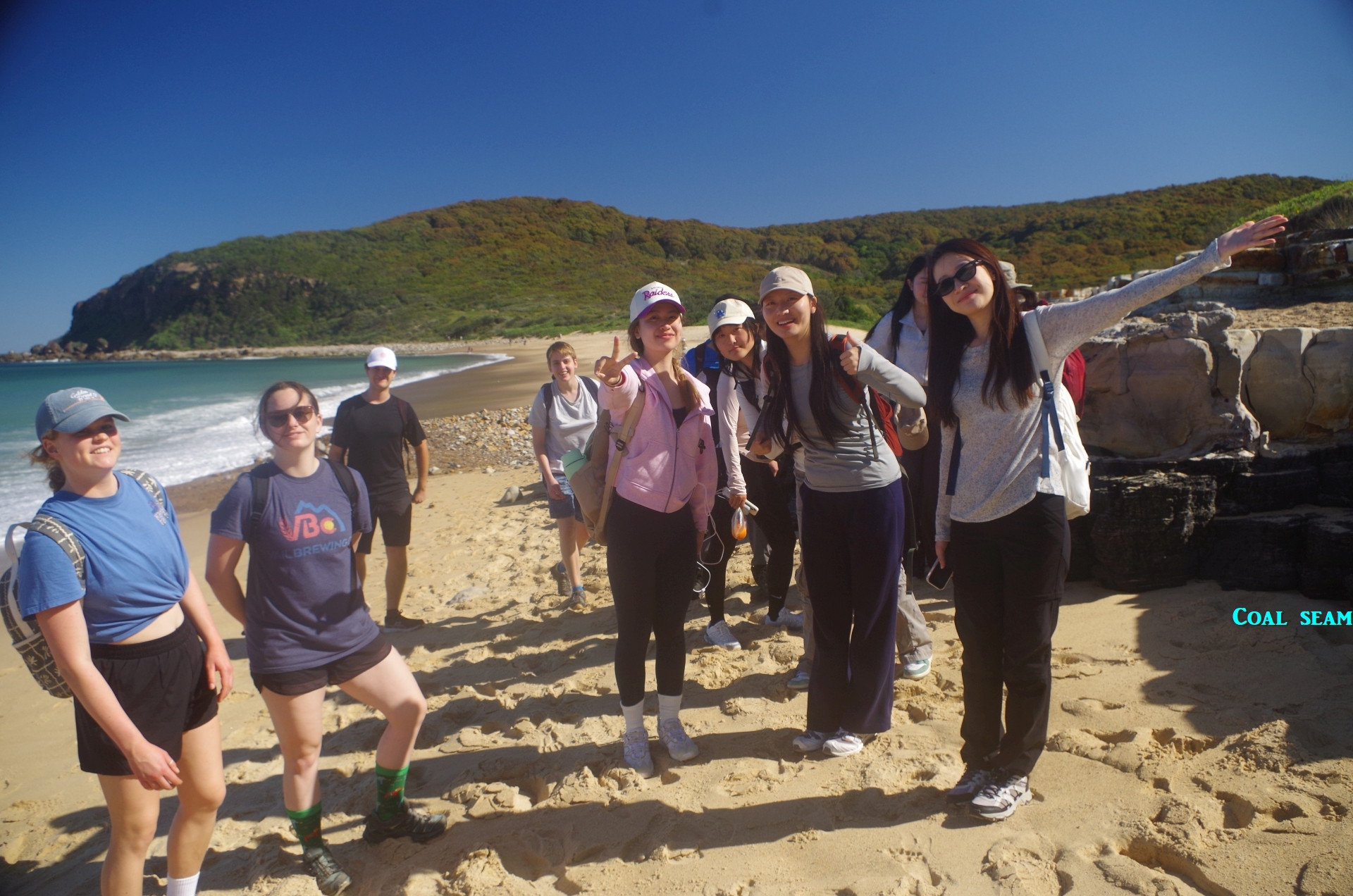
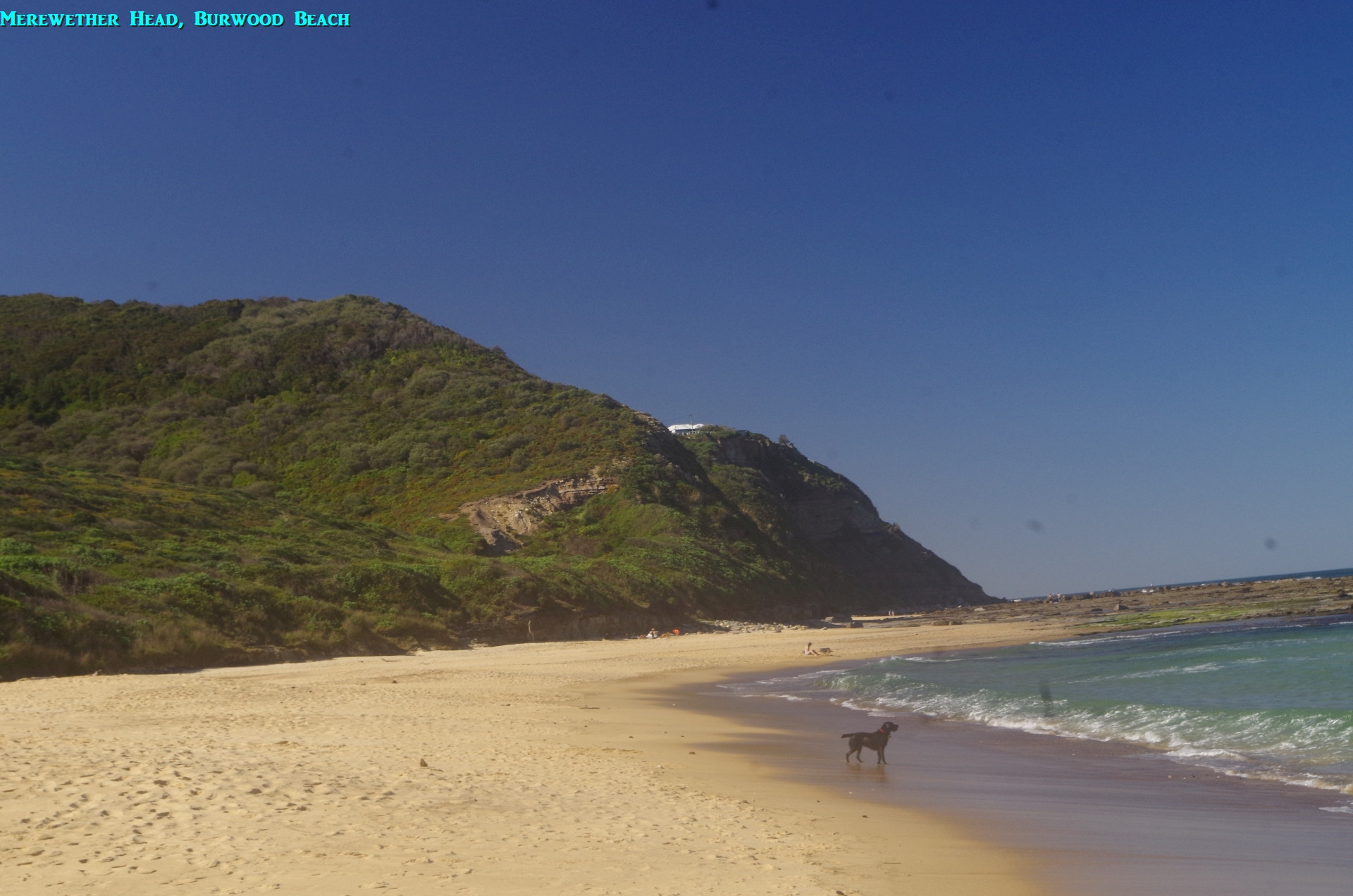
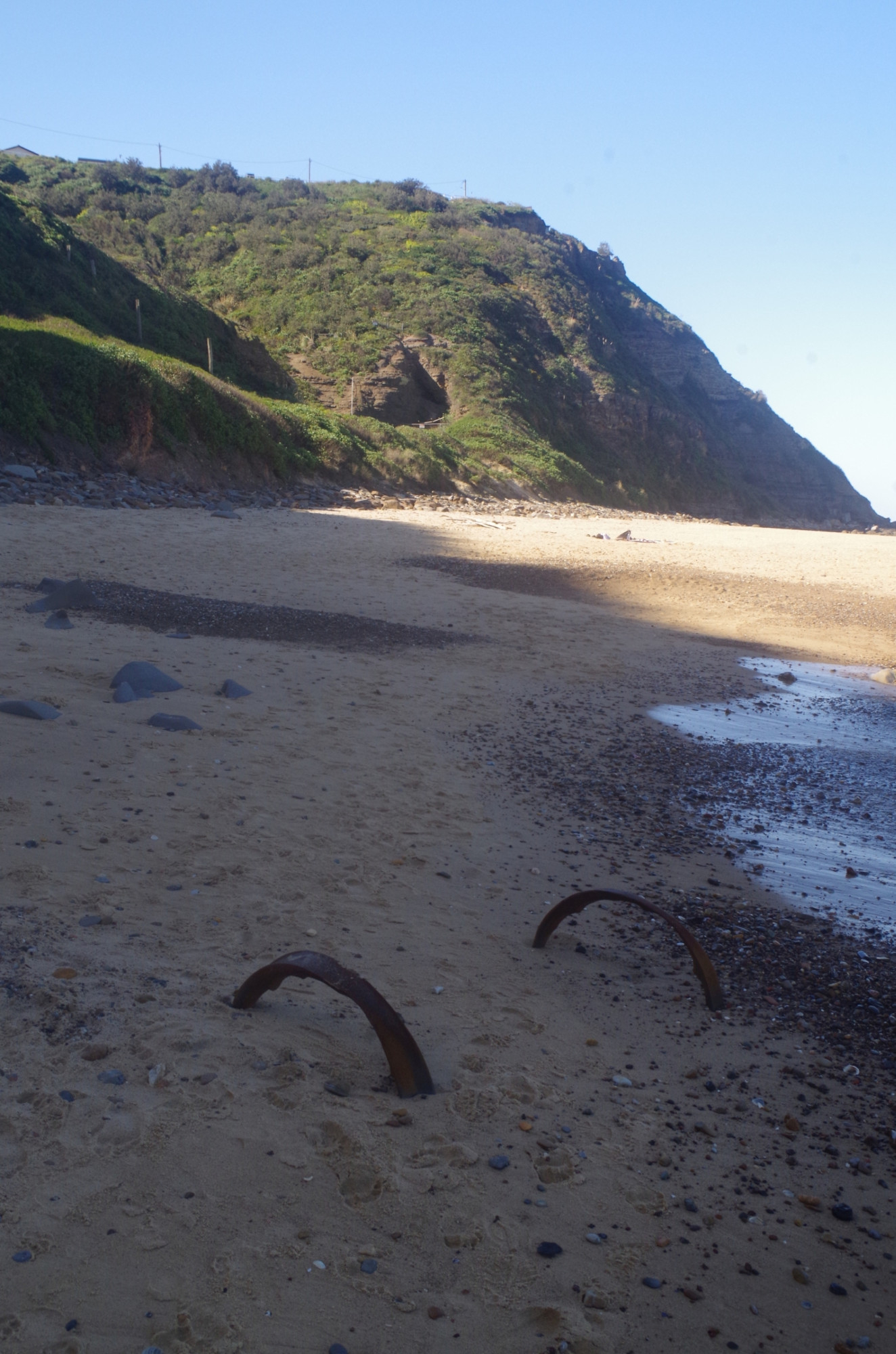
At this south end of the beach the coal seam usually seen there (see title photo) was exposed more than usual and you can see how thick it is. Further along there are more coal seams in the cliff face as well as the remains of the old colliery light railway which once ran along the cliff top. As we approached the north end of Burwood Beach, under Merewether Headland, the remains of the old colliery railway tunnel can be seen (it is blown down now and can’t be entered). Also we noticed a pair of old rail wagon wheels sticking out of the sand, probably exposed for the first time in decades by the recent heavy seas. From here on the Yuelarbah “track” just crosses the wide rock platform under Merewether Headland before reaching Merewether Beach. I deliberately picked a date when it would be low tide and a slight sea swell here, because on a high tide and/or heavy swell, this “track” is under water and can’t be used; the alternative is a steep walk uphill to the top of the headland, then a meandering suburban road bash down to Merewether.
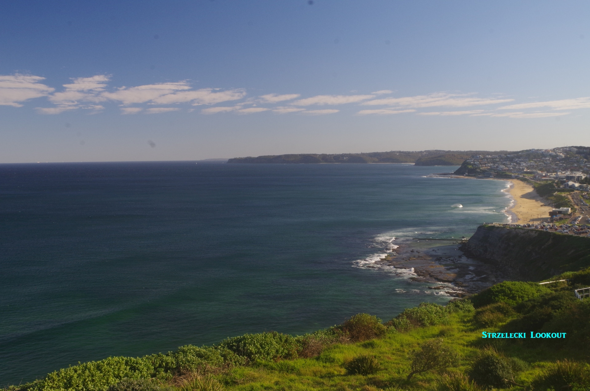
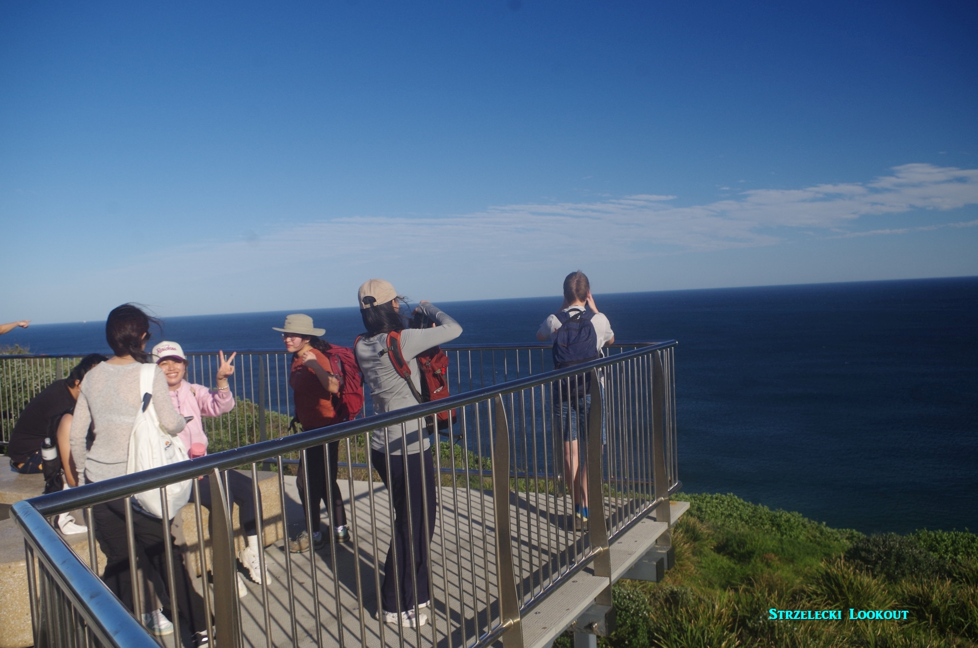
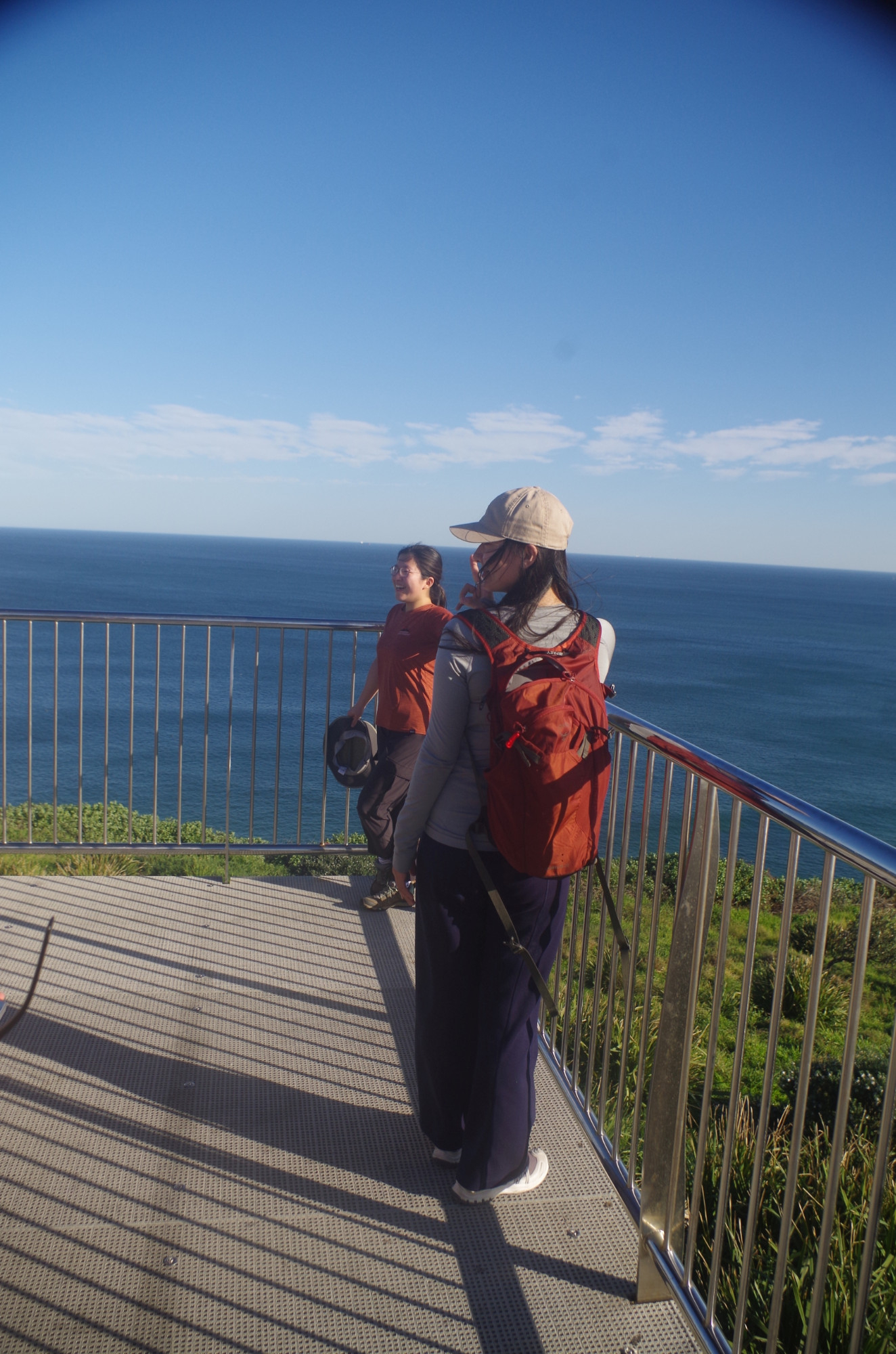
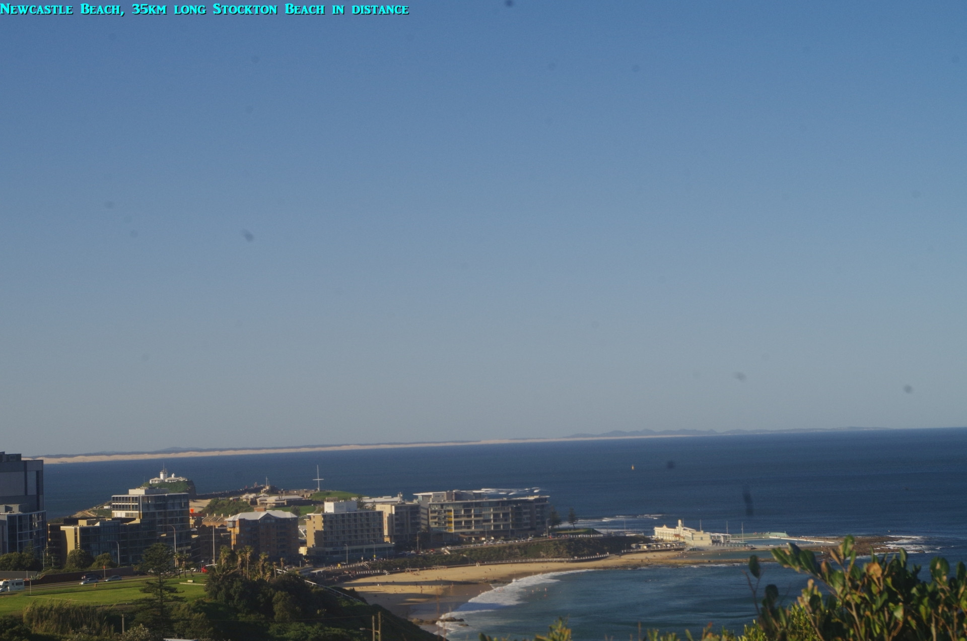
On reaching Merewether Beach, we settled down for a long break, and five of us went in for a swim in the large Merewether Ocean baths, the largest in Australia and as long as an Olympic pool (no photos of that as I was one of the swimmers). The water was cold, really cold, and we didn’t stay in for too long. The warm sunny air was more inviting. Still, it was a welcome break after the walk. By 3pm it was time to move off and resume our walk, this time along the footpath at the edge of Dixon and Bar beaches. Ahead of us was the climb up to Strzelecki Lookout, the steepest part of the whole walk. On top the views were well worth it; the coast down to past Swansea Heads can be seen, and west to Mt Sugarloaf. To the north can be seen the 35km long Stockton Beach. There are more bubblers (water fountains) between Bar Beach and here as well.

After a lot of selfies were taken at the Lookout, we continued on over the Gallipoli Memorial Bridge which lists battle sites of World War 1, and then past the old Shepherds Hill Fort to reach the new Shortland Esplanade Walk, opened only a few weeks ago after many years of delays in construction. This walk is right above the water’s edge just south of Newcastle Beach, and in rough seas walkers here would probably get sea spray on them. We couldn’t spend any time at either Newcastle Beach, and too late to look at Fort Scrathcley due to us running short of time; it was almost 4.30pm by now and time to get the tram to Newcastle Interchange Railway Station. Indeed if it were not for the time saved by walking the new Shortland Esplanade, we probably would have missed the tram if we had had to go via the former detour through King Edward Park as we had done on the past walks here.
On arrival at Newcastle Railway, I found that I had left my trekking pole behing at the Newcastle Beach tram stop; I decided that I couldn’t go back to get it as I would miss the next train and it would be a quite late return arrival home for me. The pole was the only casualty of this walk.
Once on the train we settled in for the long trip home, and we got into many varied conversations. Theo mentioned that “tramping” is the word for bushwalking in his native New Zealand, and Cornelia said that in German it is “wandern”, which as you might guess is related to the English words “wander” and “wandering”, which we can use in the same sense, like “we can go for a wander around South head”. (Speaking of which, maybe I will do another Halloween walk there this year on 31/10). I also recall my family having an old vinyl 78rpm record laying around titled “I like to go a-wandering” but sung in German. We also discussed how “trail” is the only term in the U.S. for what we call both a “trail” and a “track”; if you have a look at our maps, both official ones and Google’s, the word “trail” refers to a route that is wide enough for a 4 wheel vehicle such as a fire truck; hence “Hacking River Fire Trail”. When a route is marked as a “track” on the maps, it means a single file narrow path, e.g. “The Burgh Track”.
We discussed my background: “Stafford” is actually Irish; it’s a common surname around Wexford. And that led on to a discussion about how the Irish Diaspora in Australia defeated a conscription referendum in 1917 as people here of Irish descent had no desire to “fight for King and Country” given that Britain had put down an insurrection against British rule in Ireland just the previous year (the 1916 Uprising). Such are the things we get to talk about on long train trips.
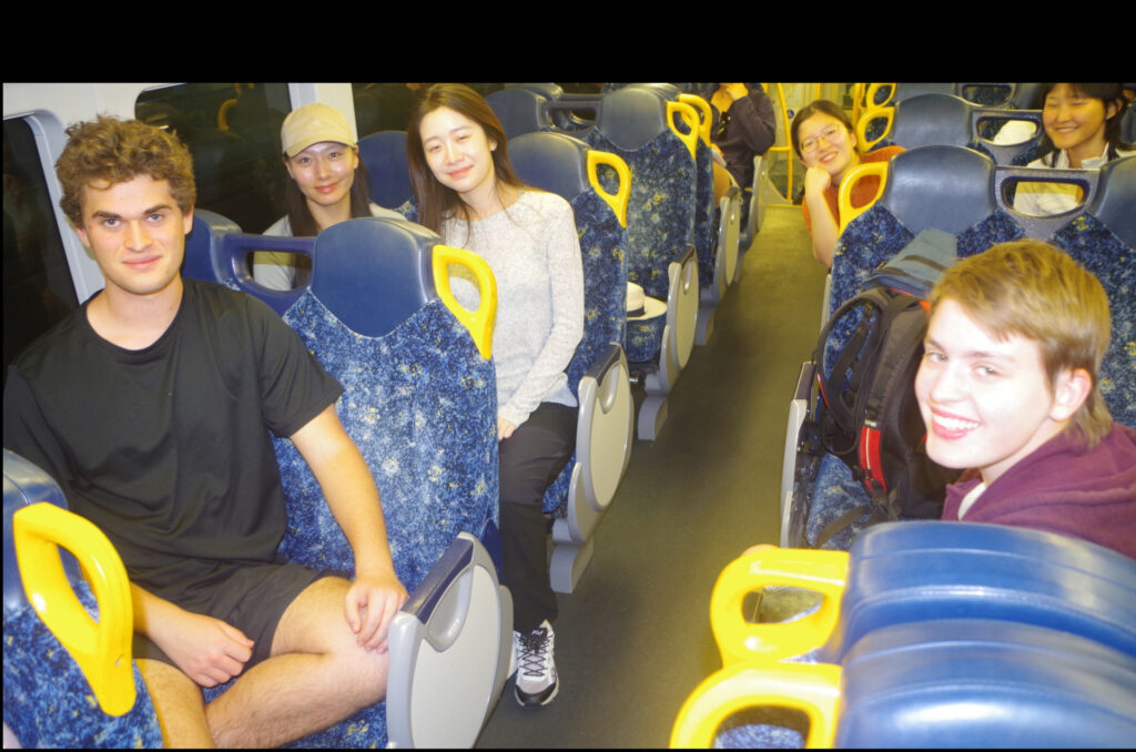
I left the train at Gosford to change to my all-stops train, and everyone waved me goodbye. The smiling happy faces in the last pics of us on the train back says it all!
Two people called in sick on the morning, but there were two who simply did not show up at all, and have made no contact with me since.
There were Oh, but I can’t leave out our discussion we had of the looming introduction of the new “modern dynamic” D set Intercity trains that are supposed to be coming into service “sometime soon”. They are supposed to replace the silver V sets (Blue Mountains trains) and OSCARS such as the train we were on. For some unclear reason they have still not entered service despite some being built 4 years ago. So at present they are being run around the rail system as you can’t just have trains sitting in sidings for 3-4 years doing nothing; vital parts could start to deteriorate. The train drivers doing this think it is great fun to go round all the rail lines in trains carrying no passengers. The D sets’ introduction has been a massive public relations disaster for NSW Transport, especially the non-reversible seats in these trains which are greatly disliked by local passengers and put in despite known disapproval of them. NSW adopted North American practices in train carriages from the late 1870’s onward for a good reason, it suited our long distances and our climate, and that included reversible seats. I mentioned above that their seats seem to be identical to those in some London suburban trains, and this can’t be a co-incidence. These London trains are, however, for outer suburban trips, not like our longer distance intercity trips to the Blue Mountains, and Kiama and Newcastle.
Lastly (bravo if you have got this far), those in the group asking when’s the next time I will bring more small bananas on a walk, it will probably be by the end of this month. The fourth last photo (and here) shows a bunch of Red “Dacca” bananas which are close to being ripe; hopefully we can try these unusual bananas soon.

I promised some links to important sites helpful when going on walks (and one site I think can be unhelpful). here they are:
“Fires near me”: https://www.rfs.nsw.gov.au/fire-information/fires-near-me
Distriict fire danger ratings and total fire bans: https://www.rfs.nsw.gov.au/fire-information/fdr-and-tobans
Tides and sea swell information (insert the name of any beach you want): https://tides.willyweather.com.au/nsw/illawarra/stanwell-park-beach.html
And “Wildwalks” and NSW National Parks sites are easy to find via Google. And they are FREE!
The one site I don’t like is Alltrails. When checking out their track listings around Helensburgh, I found that several people had entered reports stating they had walked along the Palm Jungle loop track (from Burning Palms to Otford) in the last few months. That puzzled me as I thought that the Palm Jungle Track was still closed until December because of construction work on the track by NPWS. Was I wrong? So I phoned the NPWS Office at Audley and they said that indeed that track was still closed, and there are fines for using it while it is closed. And it could be a big fine, too, up to $3,300! (It could also adversely affect students on student visas if they got fined). Clearly, some people either don’t check the NPWS site for closures, or just use the track anyway. “Alltrails” should have advice on its site about that track being closed, but it doesn’t. That is one example of why I don’t like “Alltrails”.
Bruce Stafford.