Date: 6-12/11/2024
Trip leader: Terry
Party: Lily-Rose, Yanjee, my friend from Melbourne (non-club member)
With just one boring exam at the end of semester it’s the perfect time for interstate trips. A bit of research, finding best prices for flights and rentals, and off we went. Car rental prices have been pricey, pushing for the need for more participants to lower costs (the cost was ~$600 at the end, including flights and all expenses). A trip was posted on the club and I got the exact number of people I needed, with the dates clashing with most people’s exam schedules. New tripmates, one I’ve known before and one I haven’t, were great to travel with. The intention was just so someone could pay- as long as they pay I’m happy, and it’s great that they’ve exceeded my little expectation of making prompt payments. French girl claims to be The French girl signing up, but with France having a population of 68 million as of 2023, and half of the population identifying as a female, surely there’s plenty of people claiming to be the French girl.
Doing this trip came with a bit of extensive planning. Flinders Ranges had a massive storm while I was planning roughly a month before, and it looked serious from what I saw on 7 news. Fortunately there weren’t extensive road closures or national park closures except for a few warnings. Most of the trip involves sealed roads giving more certainty- sealed roads are weatherproof, with only tiny sections of unsealed roads as an optional itinerary to add on. This also allows the choice of the cheapest rental car which can go everywhere, even hundreds of kilometres of dirt roads when in good weather.
Flights were booked separately and everyone booked the YHA in Adelaide city as a meetup point. Organising interstate trips it’s always good to have people book flights as a fair commitment to the trip. A few trips to the gear locker and everything was sorted, ready to go. Leaving Princes Hwy Rockdale in the evening, and arriving into Princes Hwy Adelaide at night. Flight lands close to midnight and I was the only one waiting for the bus out of the airport, along with an airport staff. Empty bus travels down deserted Sir Donald Bradman Drive towards the city, meeting up in YHA with my friend who flew in from Melbourne.
A bit of dumb scrolling at the kitchen I got into my YHA bunks at 1am, making my bed while trying my best to not wake up anyone. My 2-week youth hostel trip in Europe has brushed up my bed making skills, having made more beds than the rest of my life. Next day everyone woke up in various states, some enduring a full night of snoring. This renders my theory true: the only way to have a satisfied stay in YHA is to be the most annoying person in the room. A quick run to Franklin St IGA, TV party of trump winning the election then finally everyone got up to leave Adelaide.
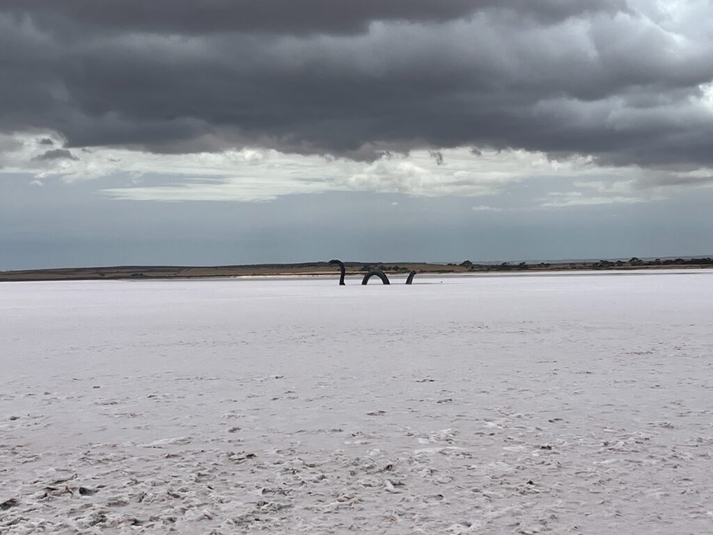
Picking up the car we drove straight out of Adelaide, heading north away from the city. Modern looking motorway has a few art installations resembling M2 in Melbourne, the motorway that heads to the airport. The road up to Pt Wakefield is all boring dual carriageway, as cities become treeless fields with strong wind blasting on the sides. We stopped briefly at a salt lake just so the two club members, barely been out of Sydney, knows what a salt lake is. Loch Ness monster rises from the lake in the form of a metal sculpture. The pink lake appearance seen on tourist brochures and social media only shows under specific weather conditions. Often it’s not worthwhile to drive hours just for a pink lake, like tours to Sea Lake in northwestern Victoria made popular by Chinese social media and Chinese-speaking tours in Melbourne’s Chinatown (well they have $60 Chinese-speaking great ocean road tours- been recommending all the European backpackers in New Zealand and Bundaberg to try that). There’s probably the most developed part of town with other buildings looking like timber sheds, spanning just a few blocks away from the highway.
Cloudy weather clears up as Augusta Hwy heads north, running parallel to Mt Remarkable. Short detour to Pt Pirie it took us a while to find a decent lunch spot. The group had a tough time debating between yummy noodles and chinese food, showcasing life in average regional towns. At least the pasta with excessive cream and overcooked noodles didn’t give diarrhea. Quick Woolworths trip stocks us with everything we need- lots of pasta, lots of pesto, lots of mi goreng, random cheap coffee, along with a few communal items. Group was consulted with what they wanted to cook and with no answer, planning meals for everyone is the way to go. A little bit of variety in what we bought as they complained about lacking variation, yet all meals are essentially the same.
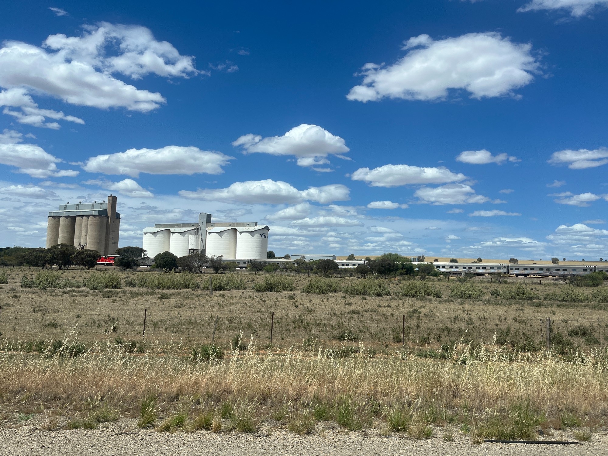
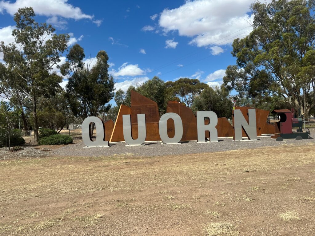
Shoreline emerges closer to Pt Augusta with windmills lining up giving Dutch vibes. Just before Pt Augusta city we turned onto Flinders Ranges Way winding towards the ranges. The road runs along the Pichi Richi heritage railway, cutting along the slopes with historic wooden bridges. Steam trains from Pt Augusta to Quorn are a tourist attraction by itself, but sadly don’t run in summer due to bushfire risks.
Tight slopes open up as distant hills cruising down towards Quorn, a railway town housing a museum-cum-tourist info centre. There’s an interesting booklet on gardening in arid terrain, but otherwise there isn’t much to see. Every railway museum houses a railway map showing the extent of railway lines before falling into abandonment. The narrow gauge line from Pt Augusta up to Quorn and Hawker is just a small part of the network, serving towns like Whyalla, Pt Lincoln and more. South Australia does not run any regional rail services- there has been talks to revive regional rail but its small population renders these route barely viable. SA also doesn’t have a state-owned regional transport operator and relies on privately run coaches to connect its regional destinations. The best regional public transport operator in SA is probably V/line, the Victorian state transport agency (and probably NSW Trainlink with its twice per week service from Broken Hill to Adelaide).
Landscape opens up again after Quorn with occasional mountains scattering towards the sides. Ruins of farmsheds still stand as historical sites as the road heads towards the outback. Patches of red earth emerge as a sign of outback Australia. We stopped by an eagle sculpture as I thought it’d be a cool scenic spot. I took a few pictures of the mountains just as the club members took pictures with the eagle. Soon the road leads to Wilpena Pound where we set our base camp. A well-established campground inside a caldera with the tourist information centre also housing an IGA. Prices in the IGA were not too inflated, fairly similar to my local IGA in Homebush. All the birds and wildlife feel very different to the east, with outback NSW near Broken Hill serving as a natural break for special spread. Eastern grey kangaroo becomes western grey kangaroo, amongst a list of newly encountered wildlife I can’t recognise.
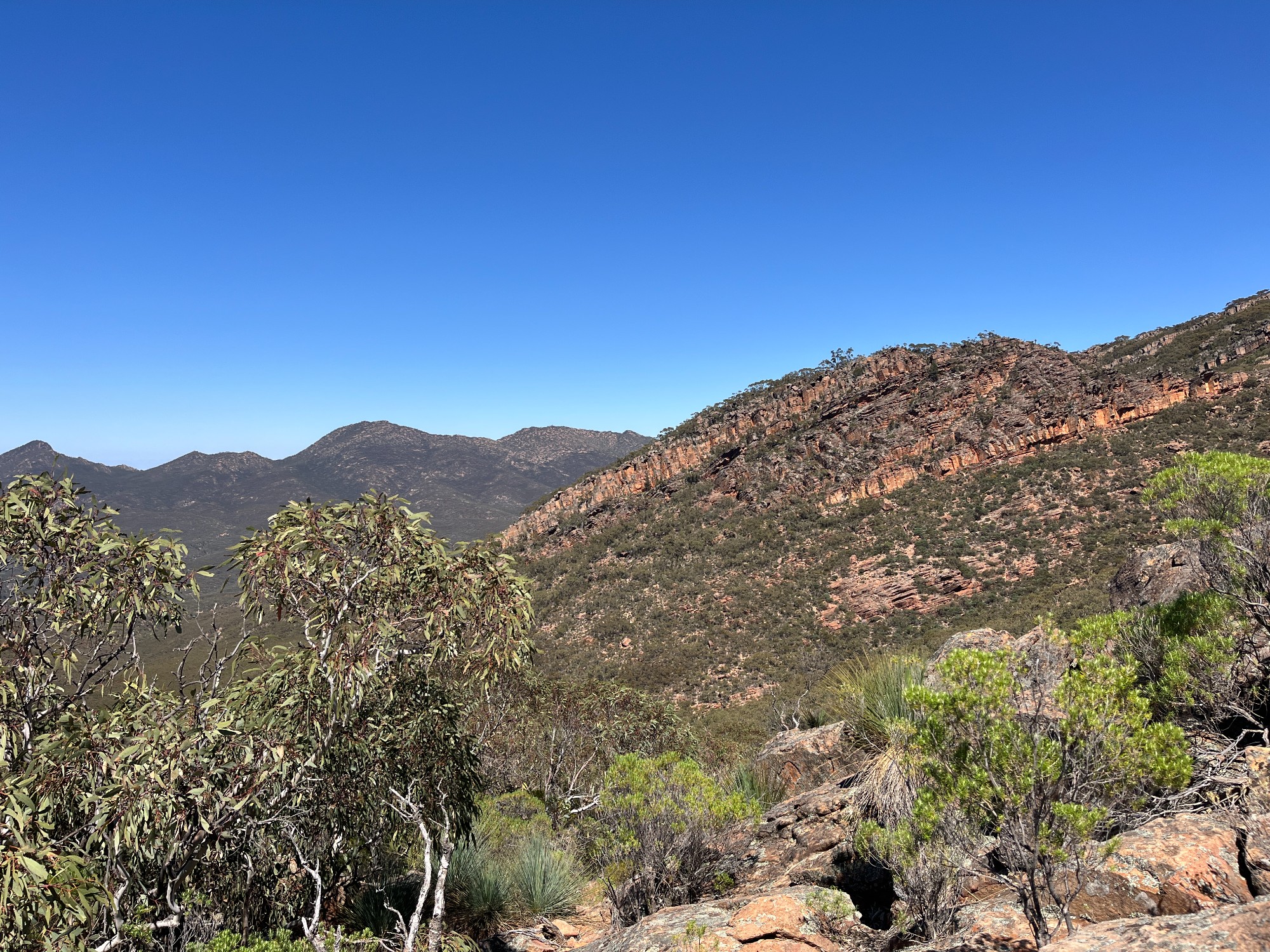
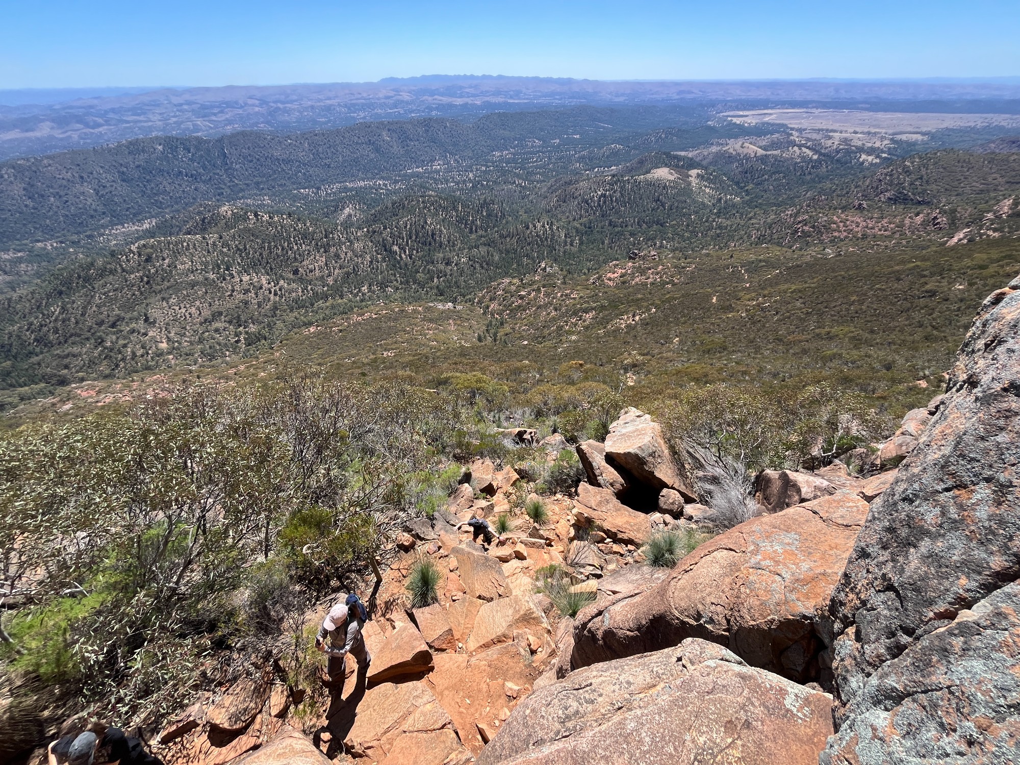
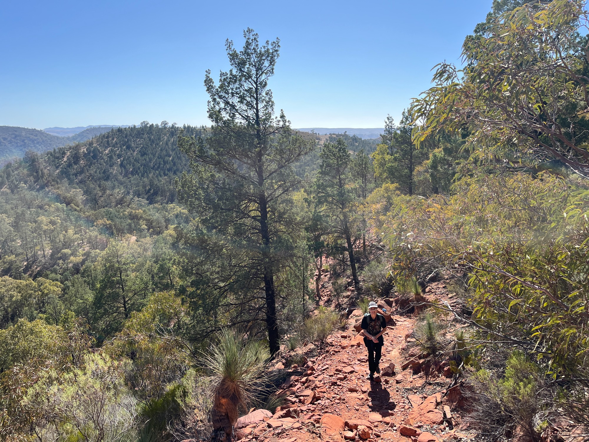
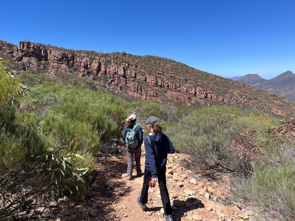
Next day we started the walk to St Mary’s Peak, a prominent peak nearby at an elevation of 1168m. The weather was decently cool with gentle breeze from the east, something fortunate enough to have in November. I was in contact with a SUBW member doing a placement in Broken Hill, rotating around Robinvale in the far west/riverina region. The weather seemed to allow him for a walk into late November, which from what I heard is quite lucky. The official advice is to not go on a walk when temperature exceeds 30 degrees, which sat far below this level on that day. Outback at this time of the year can get boiling hot, reminding me of my Aboriginal lecturer complaining about his Broken Hill train running into temporary speed restrictions in summer.
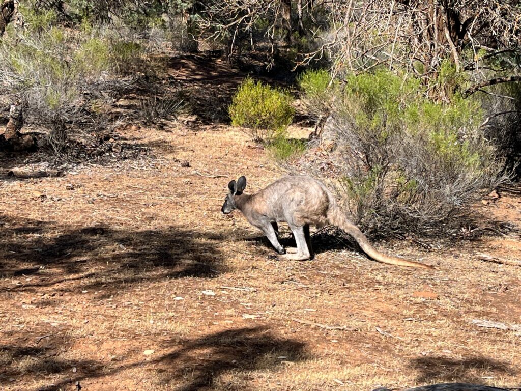
Numerous wallaroos were seen along the track at the base of the peak (or caldera). Hopping around the bush, feeding on the leaves and enjoying a pleasant day out. Over the entire day we’ve counted over 20 of them, perhaps a lot more hidden behind the bush. The eastern side of the range comes with denser bush probably with more rainfall on that side. Lush green slopes with tall trees, resembling summer in Switzerland.
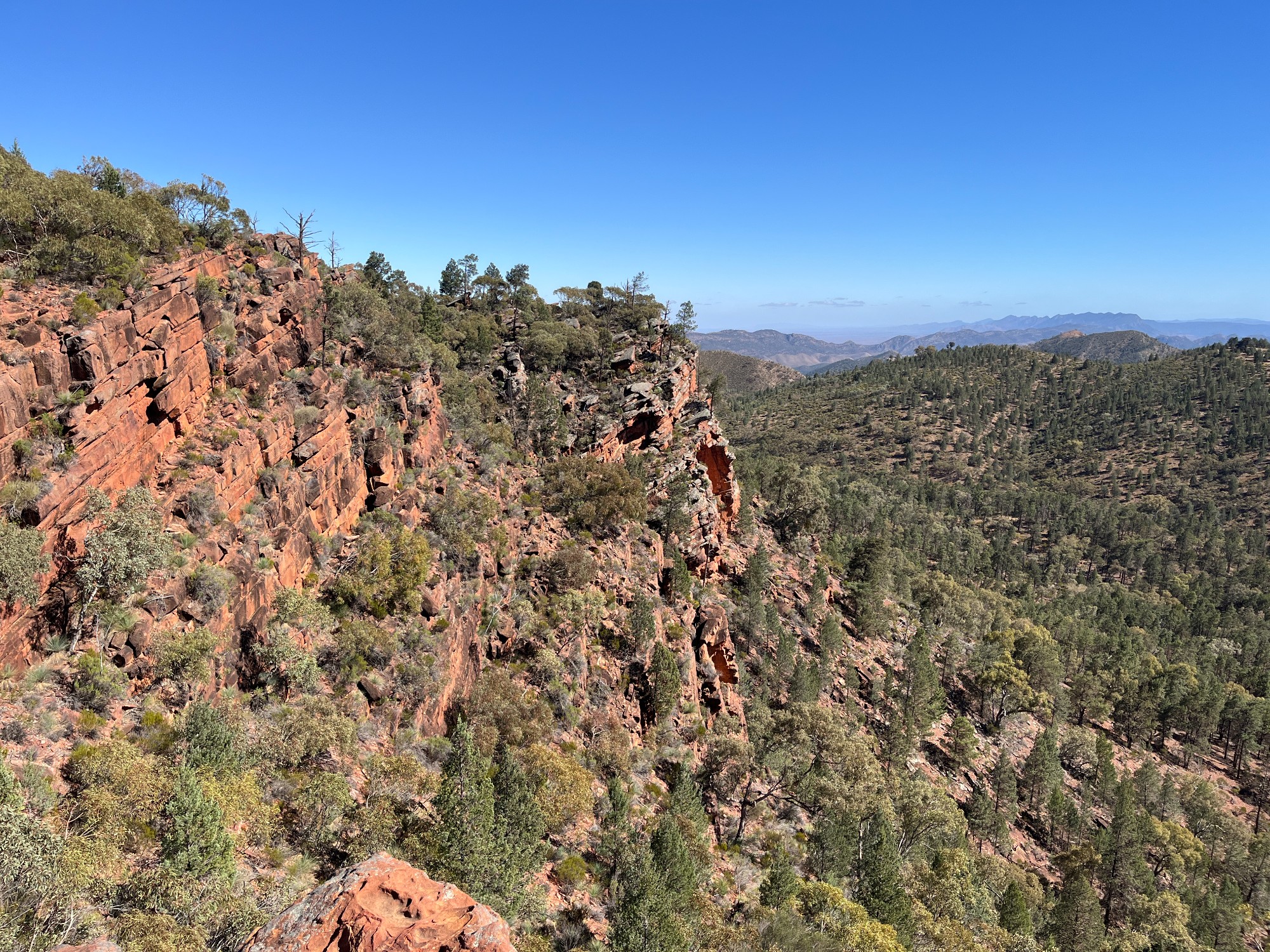
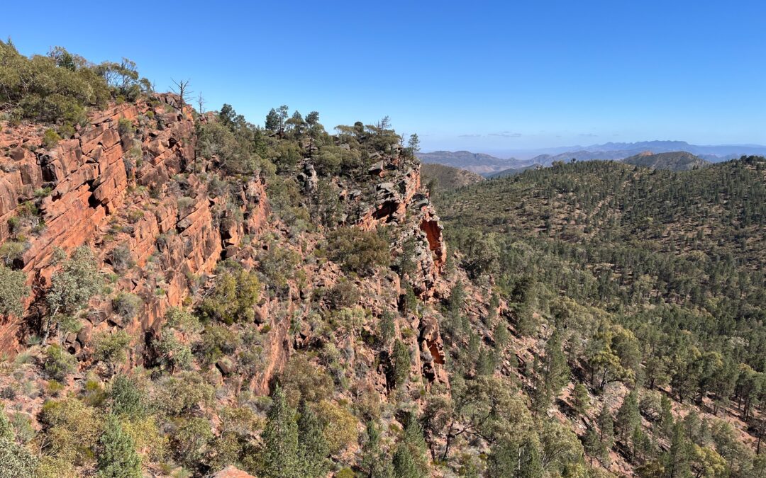
Scenic spot emerges with a bit of scramble off track. Forests to the south, a bit of the symbolic reddish rock, plus the ranges to the north all come to one picture. Soon we reach a saddle where the summit branches off towards the north. My friend from Melbourne, living in a fairly flat city, hasn’t done many bushwalks and was really exhausted at this point. We gave the summit a miss and opted for some pictures at the saddle instead.

Descending off the saddle was easy with the other side being dryer, dominated by scrubs rather than trees. Semi-arid landscape continues with bush in loose density and all adapted to dry weather. We tried to look for a shady spot for lunch and settled somewhere within the scrubs, stuffing all the mi goreng into one pot. The Woolworths in Pt Pirie had no Japanese instant noodles and the next down the list is our legendary mi goreng- our high school favourite. Hong Kong has a large Indonesian migrant population, which contributed to the popularity of mi goreng in school tuck shops and food stalls.
Dry bushlands down at the valley floor continued for the next hour. An abandoned farmshed shows the failed attempt of a cattle station with the dry climate around the area. We finished our walk and went to IGA for souvenirs. The Aboriginal-run cooperative has some T-shirts designed by the community, great to wear in uni lectures demonstrating cultural safety. The range of items sold is impressive- one could literally drive in with nothing and get a full sleeping and cooking system set up.
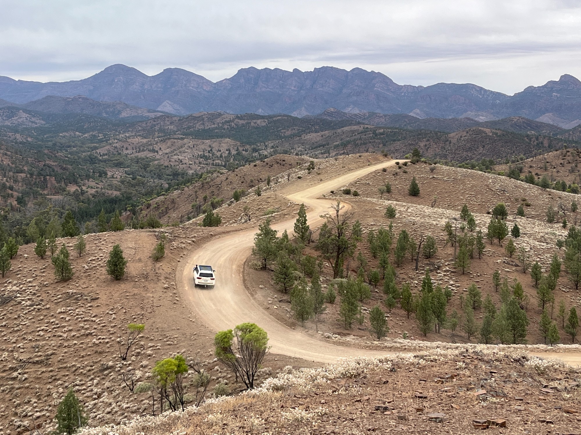
A conversation with a fellow camper in the campground followed, discussing our plans. Geographic formation of the ranges confuses us all, with a bit of sedimentary rock features while looking volcanic with my experience. Wilpena Pound, the campground, sits in a caldera and nearby lookouts show a perfect round-shaped ring, which is a typical volcanic feature. A quoll was spotted roaming around at night, with a dotted appearance over its skin. Next day we consulted the visitor centre before heading off, enquiring on road conditions. The gravel roads have been repaved, giving decent road conditions. We headed north towards Razorback lookout and drove through Bunyeroo Gorge. With a cheap MG5 we drove much faster than landcruisers at the back, overtaking groups of old people on organised tours. A cheap rental car with a full cover is all you need for any trips and be the fastest car on the road.

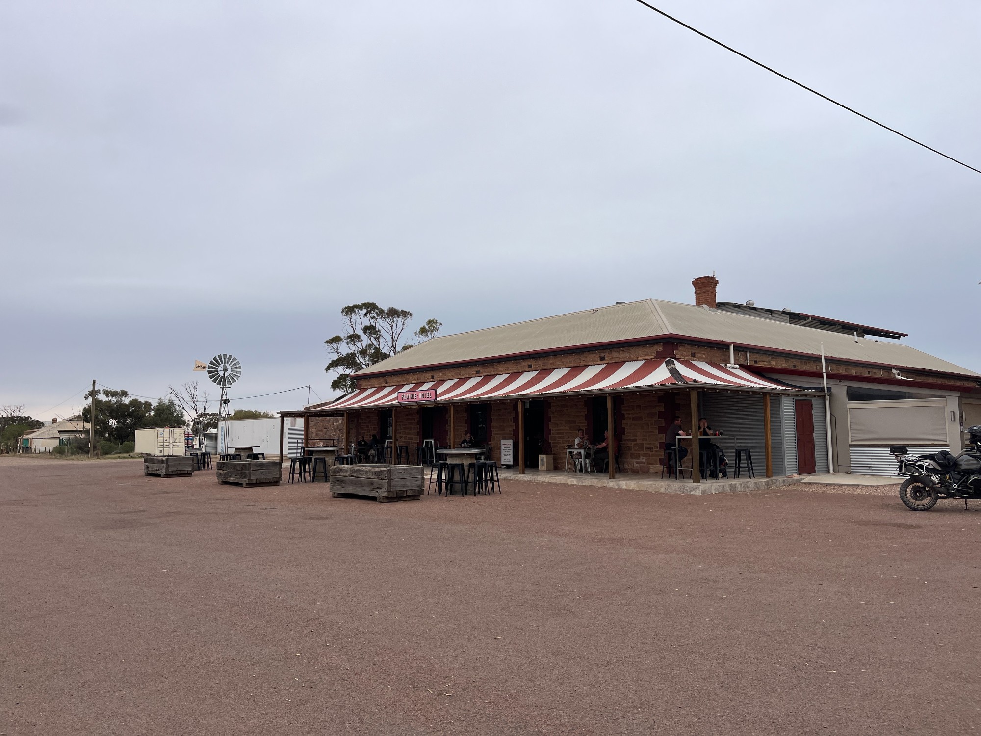
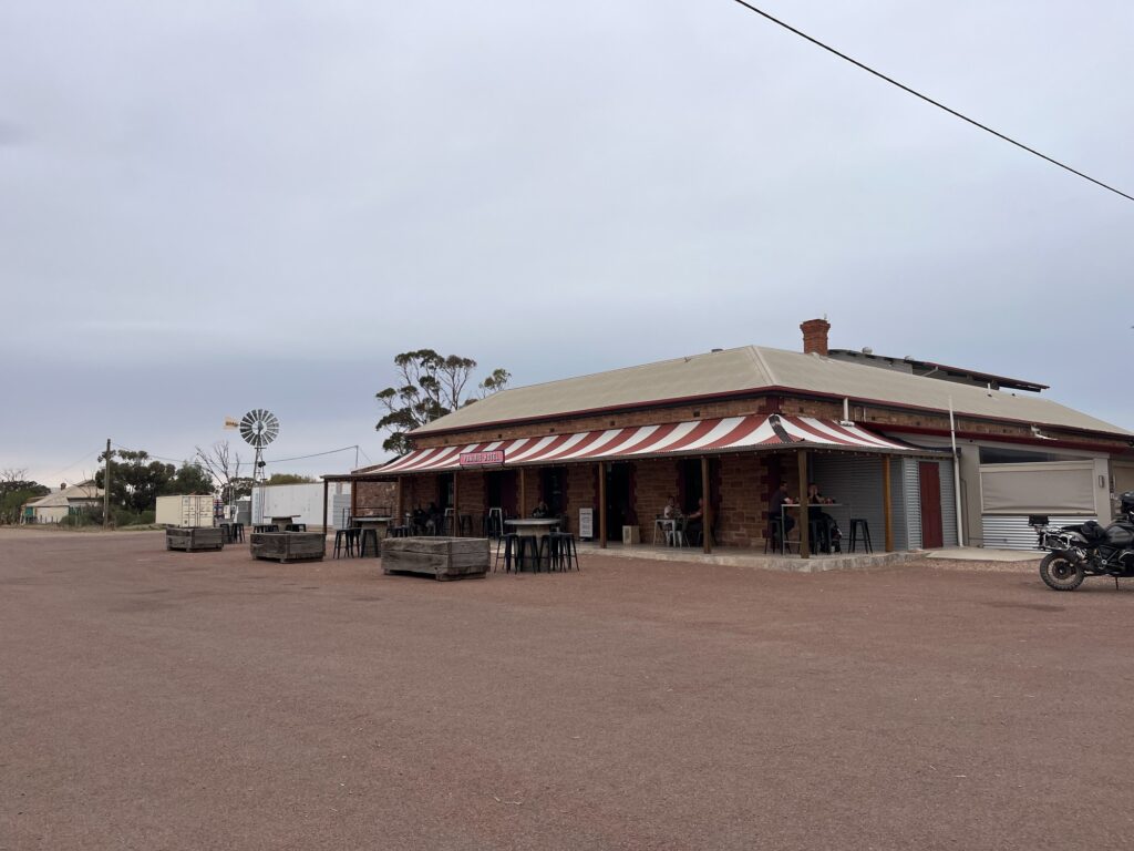
Weaving through the gorge we stopped at a few spots for pictures. Yellow-footed rock-wallabies wandering around with a few emu sightings. Exiting the gorge the road straightens up before joining the main highway. Cattle roam and graze feasting on the few remaining bushes in this dry barren landscape. Heading up The Outback Hwy reaching Parachilna for lunch, where the pub ranks as one of the best bush pubs.
There’s only a handful of buildings in this place- a pub from the old station building, a petro pump and a few containers. The pub specialises in cuisine using native Australian animals. We had a kangaroo schnitzel with very tender meat. The food is very well seasoned, unlike the impression game meat usually gives. The pub also brews its own beer which tastes fairly average. Next to it is an abandoned rail line, where trains to Darwin once ran on it before the railway was rerouted to a much straighter alignment. Travellers make pit stops before continuing north, either to Birdsville or Oodnadatta track (unsealed but sections are being sealed to weatherproof the road).
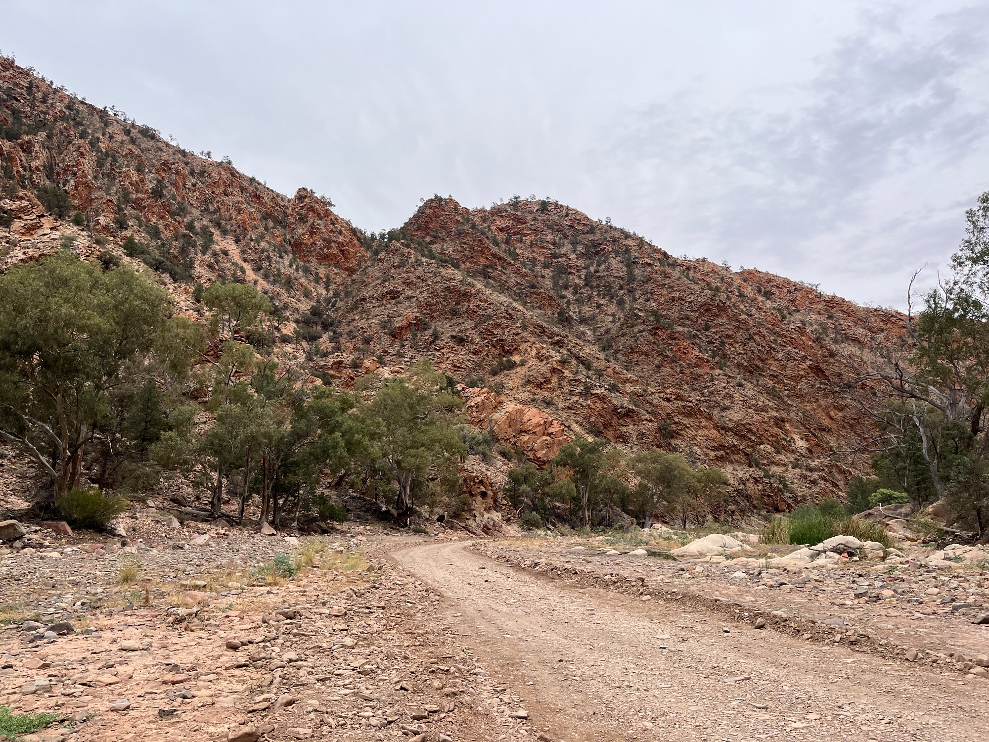
Driving back south we headed to Quorn for a petrol stop before Horrocks Hwy to Mt Remarkable. A bit of mucking around with the petrol pump, wondering why no petrol is coming out, we saw the payment machine requiring a payment to activate the pump. Dodging a few kangaroos on the road led to Mt Remarkable, where a short walk led us to a bush campground. Topo maps denoted a creek running beside the campground but it was dried out when we reached, requiring another trip back to the car bringing our box of water down.
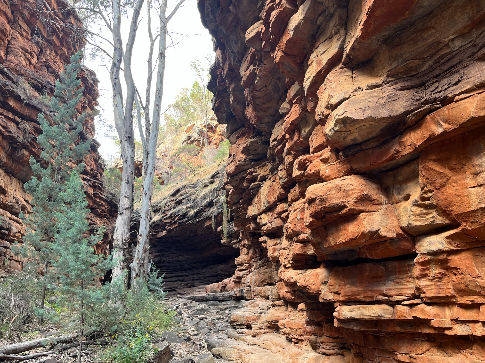
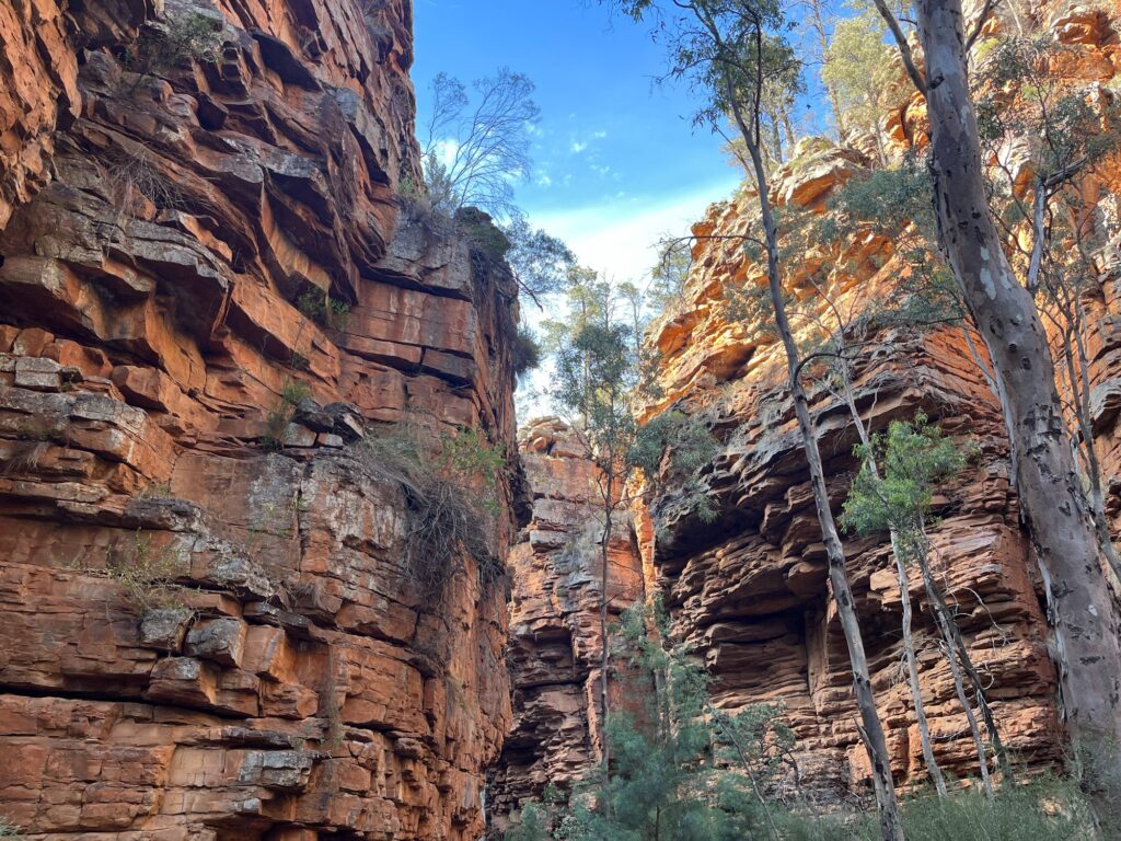
Waking up the next day, we did a walk to Alligator Gorge, the scenic orange gorge showcased on our tourist brochures. Just like any other long-distance trips, I took a few brochures so passengers at the back can do some reading. Down south, the climate is wetter bringing eucalyptus forests all across. Dry gorge remains fairly open throughout the entire walk giving lots of photo opportunities.
Around this time Vyom, the club’s president, sent me his report on Mt Gambier for his Geography unit of study. Located in SA’s Limestone Coast, Mt Gambier is a town on an old volcano with a caldera lake as its main landmark. Pastoral industries, followed by grains (oats, wheat etc) are the main industries of the region. The report estimated increased temperatures due to climate change and reduced rainfall will impact land uses in the area, loss of natural ecosystems and bring socioeconomic impacts. Vineyards in that area, more susceptible to climate change, will also negatively impact tourism.
Heading out of Mt Remarkable we exited through Horrocks Pass Rd rejoining the main highway on the coast. Scenic hills along Horrocks Pass remind me of New Zealand when the weather is good. A few tight curves lead to a straight exit rejoining Augusta Hwy and its windmills. Exiting the barren landscape is always very exciting, the very reason why not everyone enjoys outback trips. Distances are huge and variation in scenery is minimal.
Pt Augusta approaches as we parked in the town centre for lunch. A leisurely Sunday sees residents hanging out in the park enjoying the sunlight. The town reminds me of my weekends on my rural placement in Bundaberg, spending all my time sunbathing by the river, and visiting very boring art installations in town. Train station of the town houses a decent cafe where we had our lunch. Aboriginal art and drawings of industrial progress line the waiting hall giving communist vibes. The club members also concluded that my favourite words over the trip were scam, cringe and communism. Stopped by Reddy express just by the town for fuel. All coles express in SA are called reddy express, giving a bit of a communist vibe. Back to adelaide sighting a long distance cruise-ship styled train to Darwin, which departs once a week.

Flinders Ranges trip ended with returning the car in Adelaide. Wandered around the city finding a dinner place in Chinatown near Franklin St, visiting the Central Bus Station and joyriding at the lift outside of kmart. Adelaide as the largest country town of Australia is filled with nothingness apart from silly railway museum installations.
A few takeaways after this trip and hearing about the club’s trip to New Zealand. Probably the biggest thing is with camping- organising meals for everyone isn’t a good idea. It’s always tempting to perform a planned economy model trying to minimise luggage load but just like how communist leaders died from overwork, it’s often too much effort. Make everyone plan meals and have a few stoves hanging around.
In Australia it’s always good to travel on land whenever possible. It’s better for the planet and less stressful compared to flying. Having done Adelaide to Sydney on land taking 25 hours, sitting on a coach for hours going across Mallee desert, shows good reason not to do it again. This Speedlink journey involves a V/line coach from Adelaide to Albury connecting to a NSW Trainlink XPT train to Sydney. Operated by different states, V/line coach wouldn’t wait for XPT passengers in an event of a severe delay rendering it unrealistic in times when trains are prone to delays. While surprisingly some do take this route under overpriced flights, it’s not a realistic option for many.
While flying brings massive emissions, the benefits of increasing one’s cultural awareness and knowledge through travelling are immeasurable. Certain cultural awareness comes from living in a multicultural community, such as in Strathfield where perfect communication with all patients would involve speaking more than 10 languages. Others come through travelling, complementing knowledge at home and adding a slice of genuinity to multicultural interactions. A good way to measure success of a trip and whether carbon emissions were justified is whether one’s cultural knowledge and awareness have actually increased, in a way not possible anywhere close to home.
Back in high school my friend proposed a model for interaction with nature- survival, control, appreciation. Art is derived from humans’ interaction with nature, and has transitioned from a survival need to a form of appreciation. Appreciating nature will therefore require loosening our firm grip on natural elements. Often tourist infrastructure brings a swarm of tourists onto easily accessible walking tracks or even cable cars or zip lines. When humans have total control over the elements, there’s no appreciation of nature. Have they been closer to nature, or have they distanced themselves even further from nature? Modern day eco-tourism is more on not killing the golden goose, focusing on high quality remote experiences over low quality, overly accessible ones. Focusing on what keeps the place special, instead of pursuing tourism numbers. If the crowd of international tourists wearing overpowered Arc’teryx jackets on New Zealand’s famously overcrowded Hooker Valley Track can understand this, our world will be a better place.